Dhauliganga
| Author:Laxman Burdak, IFS (R) |


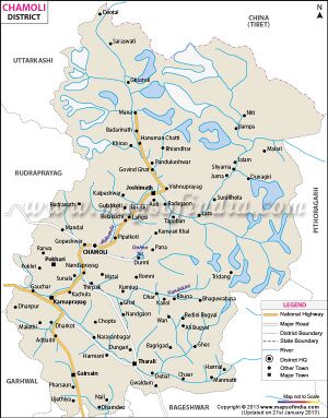
Dhauliganga (धौलीगंगा) is one of the six source streams of the Ganges river. It meets the Alaknanda River at Vishnuprayag at the base of Joshimath mountain in Uttarakhand.
Variants
- Dhauliganga River (धौलीगंगा) (AS, p.469)
- Dhauli Ganga (धौली गंगा)
Course
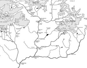
The 82 km long Dhauliganga rises at an altitude of 5,070 m in the Niti Pass in Chamoli District of Uttarakhand. At Raini, 25 km from Joshimath, it is joined by the Rishi Ganga river. The Dhauliganga ends at Vishnuprayag, when it runs into the Alaknanda River. Tapovan, known for its hot sulfur springs, is situated on the banks of the river.[1]
The Darma River starts near Dawe village on the Sino-Indian border and flows southwards. At Tidang it joins the Lassar Yankti and is called Dhauliganga until it joins the Kali River at Tawaghat. Darma valley has rich flora including orchids. A rivulet called Nyuli Yangti that drains Panchachuli east glaciers flows into Dhauli Ganga at Dugtu-Dantu villages. Mandab river joins Dhauli at Sela.
History
धौलीगंगा
विजयेन्द्र कुमार माथुर[2] ने लेख किया है ... 2. धौली = धौलीगंगा (AS, p.469): जिला गढ़वाल (उत्तर प्रदेश): गढ़वाल की एक नदी जो नीतिघाटी में बहती हुई विष्णुप्रयाग में आकर अलकनंदा (गंगा) में मिलती है.

