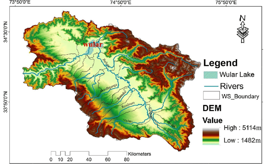
File:Digital-elevation-map-DEM-of-the-Kashmir-Valley-demarcating-various-watershed-and.png
Jump to navigation
Jump to search

Size of this preview: 800 × 494 pixels. Other resolutions: 320 × 198 pixels | 850 × 525 pixels.
Original file (850 × 525 pixels, file size: 159 KB, MIME type: image/png)
File history
Click on a date/time to view the file as it appeared at that time.
| Date/Time | Thumbnail | Dimensions | User | Comment | |
|---|---|---|---|---|---|
| current | 16:25, 14 June 2022 | | 850 × 525 (159 KB) | Lrburdak (talk | contribs) |
You cannot overwrite this file.
File usage
The following 6 pages use this file: