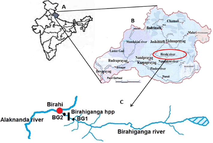
File:Geographical-location-of-the-Birahiganga-River-A-India-map-B-upper-Ganga-River-system.png
Jump to navigation
Jump to search
No higher resolution available.
Geographical-location-of-the-Birahiganga-River-A-India-map-B-upper-Ganga-River-system.png (710 × 477 pixels, file size: 95 KB, MIME type: image/png)
File history
Click on a date/time to view the file as it appeared at that time.
| Date/Time | Thumbnail | Dimensions | User | Comment | |
|---|---|---|---|---|---|
| current | 07:42, 18 February 2022 | | 710 × 477 (95 KB) | Lrburdak (talk | contribs) |
You cannot overwrite this file.
File usage
The following page uses this file: