Pohru
| Author:Laxman Burdak, IFS (Retd.) |


Pohru Pet () is a village in ... tahsil in Kupwara district of the Indian union territory of Jammu and Kashmir.
Pohru is a village in ... tahsil in Badgam district of the Indian union territory of Jammu and Kashmir.
Variants
Location
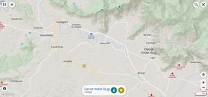
Pohru is a Village in B.k.pora Block in Badgam District of Jammu & Kashmir State, India. It is located 9 KM towards East from District head quarters Budgam. 11 KM from State capital Srinagar, Jammu. Pohru A Pin code is 192121 and postal head office is Pampore. Pohru A is surrounded by Wagoora Block towards South , Pampore Block towards East , Srinagar Block towards North , Nagam Block towards west . Srinagar , Anantnag , Sopore , Bandipore are the near by Cities to Pohru A.[1]
Pohru River
The Pohru River is a stream located near Doabgah village of Jammu and Kashmir, India. Pohru River is one of the tributaries of the river Jhelum.[2]
Doabgah
Doabgah is a small village in Baramulla district of Jammu and Kashmir, India. The nearest town is Sopore (~4 km away). The name "Doabgah" (From Persian and Urdu "Do" meaning "two", "Aab" meaning "water"(Persian) and "Gah" meaning "place" in Persian and Urdu) literally means "a place with two waters". The village has been named so as two prominent rivers of Kashmir meet here, namely Pohru River and Jhelum River.
Jat clans
- Pohar (पोहर)
History
Tourism
References
- ↑ http://www.onefivenine.com/india/villages/Badgam/B.K.Pora/Pohru-A
- ↑ Qazi, S. A. (2005). Systematic Geography of Jammu and Kashmir. APH Publishing. ISBN 978-81-7648-786-3.

