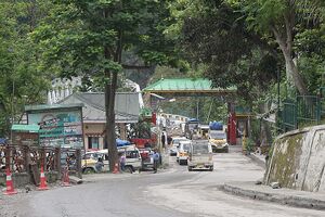
Rangpo
| Author:Laxman Burdak, IFS (R) |

Rangpo (रंगपो) is a town in East Sikkim district in the Indian state of Sikkim.
Variants
Location
Rangpo is located at 27.18°N 88.53°E.[3] It has an average elevation of 333 metres (1093 feet). The town borders West Bengal and is situated along the Teesta river. It is the first town in Sikkim on NH 10 (earlier called NH 31A before renumbering of all national highways) that links Siliguri to Gangtok. It is about 200 m above sea level with a sub-tropical climate.
History
It is the Gateway to Sikkim and all vehicles entering Sikkim have to stop here. Foreign tourists require documents to enter Sikkim state and have to show them at the border police post.
Rangpo River
Rangpo River is in the Indian state of Sikkim. A tributary of the Teesta River,[1] it is fed by the Rangpo chu. The town of Rangpo in Sikkim lies on its north bank. The river forms the border between Sikkim and West Bengal states at Rangpo town. There is no separate name for the town in West Bengal that lies on south bank of the river and therefore it is also called Rangpo.
The river runs through most of East Sikkim and a few parts of the Kalimpong District of North Bengal. This tributary flows mainly from east to west with a variable channel pattern including braided, meandering, straight, gorge and blocked lake. Landslides are very common along the river bank as cliff-like bedrocks are significantly exposed along the river valley wall.
The important towns along the route of this river are Rangpo, Rorathang, Rongli etc in East Sikkim.
Its confluence with Teesta River is immediately downstream of Rangpo town.
रंगपो
रंगपो (Rangpo): रंगपो भारत के सिक्किम राज्य के पूर्व सिक्किम ज़िले में स्थित एक शहर है. यह तीस्ता नदी के किनारे बसा हुआ है. रंगपो पश्चिम बंगाल की सीमा के पास 200 मीटर की ऊँचाई पर है. NH 10 (पूर्व का NH 31A) सिलीगुड़ी से गंगटोक मार्ग पर स्थित सिक्किम का यह पहला शहर है. सिक्किम में प्रवेश के लिए यह गेटवे है. सभी वाहनों की यहाँ जाँच होती है. विदेशी पर्यटकों के अभिलेख बॉर्डर पुलिस द्वारा जाँच किए जाते हैं. गंगटोक से सीधी दूरी 20 किमी है परंतु NH-10 से यह 37 किमी की दूरी पर स्थित है.
External links
References
- ↑ Karan, Pradyumna P. (June 1989). "Environment and Development in Sikkim Himalaya: A Review". Human Ecology. Springer. 17 (2): 261
Back to Rivers

