Trehgam
| Author:Laxman Burdak, IFS (Retd.) |


Trehgam (त्रेहगाम) is a town in Kupwara tahsil in Kupwara district of the Indian union territory of Jammu and Kashmir.
Variants
Location
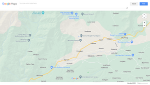
Trehgam is a Town in Trehgam Block in Kupwara District of Jammu & Kashmir State, India. It is located 12 KM towards west from District head quarters Kupwara. It is a Block head quarter. Trehgam Pin code is 193224 and postal head office is Trehgam . Shumnag ( 4 KM ) , Kawari ( 4 KM ) , Kawari ( 4 KM ) , Kawari ( 4 KM ) , Gulgam A ( 4 KM ) are the nearby Villages to Trehgam. Trehgam is surrounded by Ramhal Block towards South , Kupwara Block towards East , Rajwar Block towards South , Kralpora Block towards west. Sopore , Baramula , Bandipore , Srinagar are the nearby Cities to Trehgam.[1]
History
Trehgam:- This historical village is 9 kms to the west of Kupwara. Its beauty & importance is the Shiv Nag located in the village. Sir Walter Lawerance writes about it, “The pond of Trehgam indicates the utmost beauty of Kashmir”. The charming Shive Nag, located in the village, is a symbol of Hindu Muslim unity. Muslim Shrine, Jamia Masjid and a Shiv Temple are located on the same bank of the spring and both the communities treat it sacred. Lime stone has been discovered in the hills on the back side of the village. [2]
In Rajatarangini
- Trigrama (त्रिग्राम): place mentioned in Rajatarangini. [3]
- Trigrāmi (त्रिग्रामी) :place mentioned in Rajatarangini. [4]
- Trigrama (त्रिग्राम)/Trigrāmi (त्रिग्रामी) - place mentioned in Rajatarangini. [5]
Tourism
References
- ↑ http://www.onefivenine.com/india/villages/Kupwara/Trehgam/Trehgam
- ↑ http://kupwara.gov.in/historic.htm
- ↑ Rajatarangini of Kalhana:Kings of Kashmira/Book V (p.113)
- ↑ Rajatarangini of Kalhana:Kings of Kashmira/Book IV (p.78)
- ↑ Rajatarangini of Kalhana:Kings of Kashmira/Book V (p.113); Rajatarangini of Kalhana:Kings of Kashmira/Book IV (p.78); Kings of Kashmira Vol 2 (Rajatarangini of Kalhana)/Book VIII (ii) p.311

