Deo Tal
| Author:Laxman Burdak, IFS (R) |


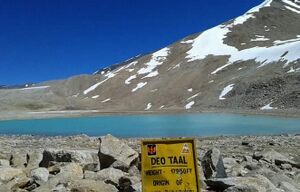
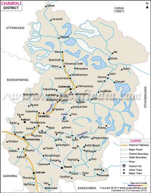
Deo Tal (देवताल) is a lake in the district of Chamoli in the Indian state of Uttarakhand.
Variants
- Devatala (देवताल)
Origin
Deo Tal (देवताल) == 'Lake of The Gods’
Location
Deo Tal is located at an altitude of 5471 metres near border of Chamoli atop Mana Pass.
Jat clans
History
Deo Tal is a sacred lake atop Mana Pass, it is considered very holy since this lake is believed to be the origin of the Mythical Saraswati Ganga. You can also see Rajas Tal and Nag Tal before Deo Tal on either side of the road. Deo Tal is just 3 kms before Mana Pass Zero Point. This lake is surrounded by icy peaks and remains frozen all year round except for the month of September. In Sanskrit, the lake stands as 'Lake of The Gods’.[1]
Population
Mana Pass
Mana Pass is located within the Nanda Devi Biosphere Reserve, 47 km north of the town of Mana, India and 52 km north of the Hindu pilgrimage town of Badrinath in Uttarakhand. It is the source of the Saraswati Ganga, the longest stem of one of the longest Ganges tributaries, the Alaknanda River.[2] That river trickles through several scenic small ponds between the pass and Lake Deo Tal three km southwest of the pass. Mana pass is also the key col for climbing Chaukhamba peak.
Mana as a name derives from "Manibhadra Ashram", the ancient name of the town of Mana.[3]
History: Mana Pass was an ancient trade route between Uttarakhand and Tibet. Mana Pass led from Badrinath to the kingdom, now province, of Guge in Tibet. The Portuguese Jesuits António de Andrade and Manuel Marques became the first known Europeans to enter Tibet across Mana Pass in 1624. The pass continued as a minor trade route until its closure in 1951 by the Chinese. On April 29, 1954, China and India signed an agreement granting pilgrims and indigenous travelers the right to travel between the two countries through Mana Pass.
Access: The pass is reached from the south by an extension of India National Highway 7 (NH-7, old number NH-58) that connects Fazilka with Badrinath, though beyond Badrinath the graded road is subject to landslides.
Tourist places
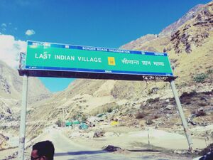
- The villagers of this village are culturally associated with activities of Badrinath temple and annual fair of Matha murthi. They used to trade with Tibet in earlier days.
- There is a small cave in Mana, named Vyas Gufa and it is believed that Maharshi Vyas composed Mahabharatha in this cave.[4]
- One more cave is called Ganesh Gufa and tourists visit both caves regularly.
- Nearby places include Vasudhara Falls, Satopanth Lake, Bhim Pul, Saraswati Temple etc.
Notable persons
External links
References
- ↑ https://www.euttaranchal.com/tourism/deotal.php
- ↑ http://www.tourism-of-india.com/mana.html
- ↑ http://www.tourism-of-india.com/mana.html
- ↑ Bisht, Harshwanti (1994). Tourism in Garhwal Himalaya : with special reference to mountaineering and trekking in Uttarkashi and Chamoli Districts. New Delhi: Indus Pub. Co. pp. 90–92. ISBN 9788173870064.
Back to Lakes

