Dhauladhar
| Author:Laxman Burdak, IFS (R) |

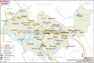
Dhauladhar (धौलाधार) is a mountain range which is part of a lesser Himalayan chain of mountains. It rises from the Shivalik hills, to the north of Kangra and Mandi. Dharamsala, the headquarters of Kangra district and the winter capital of Himachal Pradesh, lies on its southern spur in the Kangra Valley, which divides it from Chamba.[1]
Variants
Location
History
he elevation of the Dhauladhars ranges widely from 3,500 m to nearly 6,000 m. From the banks of the Beas river in Kulu, the range curves towards the town of Mandi, Himachal Pradesh, India. Then, running north, it passes through Barabhangal, joins the Pir Panjal range and moves into Chamba, Himachal Pradesh.
Among the numerous other serpent deities found in Chamba we wish to mention only Mul Naga and Stūhr Naga. The shrine of Mul Naga is immediately above a very fine fountain at the village of Brehi.
The Stuhr or Satuhr Naga is worshipped at the village of Tur on the road to the Baleni pass by which the Dhaolā Dhār is crossed[2].

