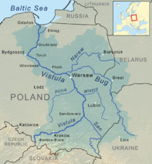
File:Vistula river map.png
Jump to navigation
Jump to search


Size of this preview: 555 × 599 pixels. Other resolutions: 222 × 240 pixels | 800 × 864 pixels.
Original file (800 × 864 pixels, file size: 969 KB, MIME type: image/png)
By Kmusser - Own work, Elevation data from SRTM, drainage basin boundary from USGS, all other features from Natural Earth., CC BY-SA 3.0, https://commons.wikimedia.org/w/index.php?curid=24543621
File history
Click on a date/time to view the file as it appeared at that time.
| Date/Time | Thumbnail | Dimensions | User | Comment | |
|---|---|---|---|---|---|
| current | 22:11, 31 July 2018 | | 800 × 864 (969 KB) | Lrburdak (talk | contribs) |
You cannot overwrite this file.
File usage
The following page uses this file: