
Category:Maps
Subcategories
This category has the following 24 subcategories, out of 24 total.
Pages in category "Maps"
The following 2 pages are in this category, out of 2 total.
Media in category "Maps"
The following 200 files are in this category, out of 430 total.
(previous page) (next page)-
 12. Tigate.jpg 3,264 × 2,448; 2.12 MB
-
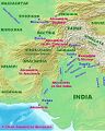
 180px-taxila.jpg 180 × 225; 16 KB
-
 19. Location map Kensington.png 829 × 905; 831 KB
-
 7a. Saint James Park-5.JPG 5,184 × 3,888; 4.46 MB
-
 Achaemenid empire en.png 1,280 × 664; 414 KB
-
 Adilabad-road-map.jpg 780 × 499; 96 KB
-
 Afghanistan Map.gif 506 × 493; 34 KB
-
 Afghanistan provinces numbered.png 335 × 257; 57 KB
-
 Ahmadnagar.jpg 640 × 480; 103 KB
-
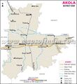 Akola-district-map.jpg 600 × 655; 82 KB
-
 Alans.jpg 1,176 × 507; 591 KB
-
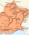 Alexander The Great campaign India 326 BC.jpg 590 × 721; 63 KB
-
 AlexanderIndiaMap.jpg 220 × 276; 23 KB
-
 Ancestral Scythian migration of Jat people.gif 918 × 686; 647 KB
-
 Ancient Haryana.jpg 500 × 386; 51 KB
-
 Ancient india.png 500 × 409; 34 KB
-
 Ancient Indian Kingdoms.png 732 × 599; 82 KB
-
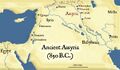 Ancient-assyria 850 bc.jpg 600 × 351; 70 KB
-
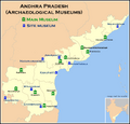 Andhra Pradesh.png 923 × 881; 167 KB
-
 Angles saxons jutes.png 320 × 578; 97 KB
-
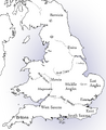 Anglo-Saxon England.png 736 × 900; 266 KB
-
 Arabian Sea map.jpg 797 × 753; 103 KB
-
 Arabian-peninsula-with-capitals.jpg 1,300 × 1,098; 149 KB
-
 Aral map.png 279 × 281; 19 KB
-
 Aral sea map.png 288 × 288; 52 KB
-
 Archaemenian Empire 500 BC.jpg 941 × 1,183; 264 KB
-
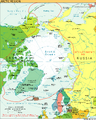 Arctic Ocean.png 800 × 1,003; 540 KB
-
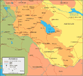 Armenia-map.gif 749 × 689; 47 KB
-
 Arshakuni Armenia 150.png 1,024 × 601; 871 KB
-
 Arunachal-pradesh-map.jpg 800 × 487; 366 KB
-
 Ashok-nagar-district.jpg 800 × 887; 414 KB
-
 Asia 323bc.jpg 2,040 × 1,169; 733 KB
-
 Asia Map.JPG 755 × 538; 89 KB
-
 Asia Minor ca 842 AD.svg.png 1,024 × 534; 821 KB
-
 Assam- State Map.jpg 800 × 600; 327 KB
-
 Assyria-map-arround-1000BC.jpg 800 × 595; 138 KB
-
 Aurangabad Bihar district map.jpg 600 × 553; 73 KB
-
 Azad-kashmir-map.gif 512 × 400; 27 KB
-
 Azarbaijan Map.gif 508 × 421; 32 KB
-
 BactriaMap.jpg 1,905 × 1,440; 334 KB
-
 Bahrain Map.jpg 737 × 900; 176 KB
-
 Baleshwar district map.jpg 600 × 553; 75 KB
-
 Balod-road-map.jpg 800 × 640; 86 KB
-
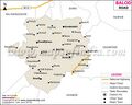
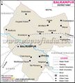 Balrampur District Map.jpg 600 × 666; 73 KB
-
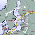 Baltic sea map with pipeline.jpg 578 × 590; 140 KB
-
 Bandipore-tehsil-map.jpg 800 × 700; 188 KB
-
 Bangalore-rural district map.jpg 800 × 657; 311 KB
-
 Bankura-district-map.jpg 600 × 560; 95 KB
-
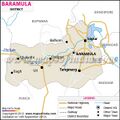 Baramula-district-map.jpg 600 × 600; 77 KB
-
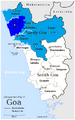 Bardez taluka in North Goa district.png 808 × 1,298; 174 KB
-
 Bardhaman-district-map.jpg 780 × 566; 131 KB
-
 Bastar-Kanker-Imperial Gazetteer.jpg 491 × 635; 148 KB
-
 Bastar.jpg 640 × 480; 101 KB
-
 Bavaria Germany map.gif 1,205 × 1,240; 667 KB
-
 Begusarai-district-map.jpg 600 × 489; 89 KB
-
 Belgium Map.gif 511 × 556; 31 KB
-
 Bemetara-district-map.jpg 800 × 680; 105 KB
-
 Bhadrak.jpg 640 × 480; 68 KB
-
 Bharatavarsha.jpg 1,280 × 958; 167 KB
-
 Bhojpur-district-map.jpg 600 × 676; 114 KB
-
 Bijapur district Karnataka Map.jpg 800 × 971; 495 KB
-
 Bilaspur-district-Chhattisgarh map.jpg 600 × 988; 102 KB
-
 Bilaspur-district-map.jpg 599 × 491; 79 KB
-
 Bilaspur-Masturi-Banar-Kotgarh Map.jpg 1,920 × 1,080; 505 KB
-
 Bilaspur.jpg 640 × 480; 91 KB
-
 Birbhum Rivers.jpg 800 × 1,002; 137 KB
-
 Birbhum-district-map.jpg 600 × 768; 115 KB
-
 Bombayand Sindh 1909.jpg 1,000 × 819; 250 KB
-
 Braj Region Map.jpeg 1,080 × 924; 51 KB
-
 Britain.circa.540.jpg 2,046 × 2,814; 675 KB
-
-
 Burma-map.gif 415 × 750; 68 KB
-
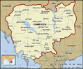 Cambodia-map-boundaries-cities-locator.gif 1,600 × 1,327; 410 KB
-
 Caspianseamap.png 598 × 600; 253 KB
-
 Central Asia borders4.png 326 × 240; 4 KB
-
 Central Asia.jpg 1,024 × 768; 435 KB
-
 Central Provinces India 1903.gif 640 × 480; 336 KB
-
 Cesare prima Gallia 58 a.C. jpg.jpg 1,704 × 1,181; 395 KB
-
 Chabahar Map.jpg 715 × 915; 752 KB
-
 Chabahar-Delaram-Herat-Kabul Road Map.jpg 715 × 915; 750 KB
-
 Chamba-district-map.jpg 600 × 674; 86 KB
-
 Champawat District Map.jpg 600 × 719; 94 KB
-
 Chanderi-Sanchi-Bhimbetka-Jabalpur-Damoh-Satna-Khajuraho.jpg 2,550 × 1,690; 1.32 MB
-
 Chandrabhaga Map.jpg 558 × 349; 29 KB
-
 Chhattisgarh Map Hindi.jpg 951 × 1,214; 646 KB
-
 Chhattisgarh-Orissa-1.jpg 1,859 × 1,736; 978 KB
-
 Chitrakoot-district-map.jpg 800 × 647; 314 KB
-
 Coastline-of-India-–-Indian-Coastline.jpg 814 × 596; 139 KB
-
 Confederaţia.Dahae.jpg 268 × 206; 26 KB
-
 Conquests of Clovis.png 1,220 × 1,079; 1.68 MB
-
 Cornwall Map-1.jpg 466 × 350; 33 KB
-
 Cornwall map-2.gif 787 × 538; 38 KB
-
 Cornwall Map.jpg 1,300 × 1,273; 105 KB
-
 Crimea-peninsula-in-eastern-europe-political-map.jpg 1,300 × 956; 172 KB
-
 Czech Rep. - Bohemia, Moravia and Silesia III (en).png 3,852 × 2,188; 1.11 MB
-
 Dacia 125.png 390 × 332; 264 KB
-
 Damodar Map.jpg 800 × 623; 110 KB
-
 Damoh-district map.jpg 800 × 1,100; 415 KB
-
 Dehradun-Map.jpg 946 × 1,215; 505 KB
-
 Denmark map.png 330 × 355; 15 KB
-
 Devon Map-1.gif 600 × 554; 85 KB
-
 Devon Map-2.jpg 238 × 212; 16 KB
-
 Dhamtari-district-map.jpg 600 × 824; 99 KB
-
 Dhanbad.jpg 600 × 478; 74 KB
-
 Dioecesis Thraciae 400 AD.png 461 × 352; 139 KB
-
 Doda-district-map.jpg 600 × 401; 50 KB
-
 Don River Map.png 800 × 806; 196 KB
-
 Dorset Map.jpg 450 × 304; 28 KB
-
 Edicts Of Ashoka.jpg 1,092 × 1,440; 280 KB
-
 Egypt Map-1.gif 512 × 622; 35 KB
-
 Egypt Map.jpg 3,443 × 3,776; 797 KB
-
 Elam Map.svg.png 555 × 480; 269 KB
-
 England Neighbours.jpg 3,126 × 2,370; 1.59 MB
-
 England-5.jpg 1,573 × 1,036; 830 KB
-
 EpicIndia.jpg 511 × 600; 95 KB
-
 Ethiopia-Map.jpg 2,420 × 1,846; 589 KB
-
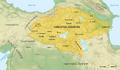
 Ethnic Caucasia-en.png 1,200 × 1,519; 382 KB
-
 Europe in 526.jpg 1,024 × 639; 264 KB
-
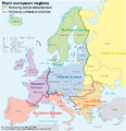
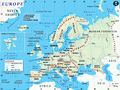 Europe-map.gif 1,000 × 750; 242 KB
-
 Far east1.png 1,920 × 974; 478 KB
-
 Fatehpur-district-map.jpg 600 × 457; 79 KB
-
 Fazilka-district-map.jpg 800 × 1,153; 144 KB
-
 Ferriter's Cove-1.png 986 × 311; 170 KB
-
 France Map-1.gif 900 × 951; 161 KB
-
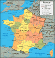
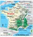 France Map.jpg 3,392 × 3,833; 1.04 MB
-
 Gadag district map.jpg 800 × 1,000; 437 KB
-
 Gajapati.jpg 600 × 847; 100 KB
-
 Ganderbal-district-map.jpg 600 × 443; 50 KB
-
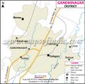 Gandhinagar district map.jpg 500 × 494; 152 KB
-
 Ganges-Brahmaputra-Meghna basins.jpg 1,024 × 567; 247 KB
-
 Ganjam district map.jpg 600 × 731; 107 KB
-
 Gariaband-district-map.jpg 800 × 809; 103 KB
-
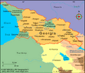 Georgia Map-1.gif 510 × 441; 26 KB
-
 Germania tribes.png 640 × 860; 294 KB
-
 Germany Map.gif 506 × 586; 64 KB
-
 Ghor districts.png 776 × 600; 105 KB
-
 Gondia-district-map.jpg 800 × 1,081; 390 KB
-
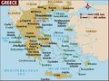 Greece Map.jpg 1,500 × 1,125; 146 KB
-
 Grossgliederung Europas-en.svg.png 800 × 830; 262 KB
-
 Gujranwala Sialkot Map.gif 700 × 410; 42 KB
-
 Guntur-district-map.jpg 780 × 531; 138 KB
-
 Gupta Empire.jpg 712 × 900; 39 KB
-
 Gutian Map.jpg 259 × 194; 20 KB
-
 Hamirpur-district-map.jpg 600 × 719; 95 KB
-
 Hammurabi's Babylonia 1.svg.png 661 × 580; 196 KB
-
 Haora-district-map.jpg 600 × 651; 99 KB
-
 Harappa-Mohanjodaro Map.png 582 × 672; 70 KB
-
 Hardoi-district-map.jpg 600 × 524; 91 KB
-
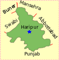 Haripur Pakistan.svg.png 155 × 159; 12 KB
-
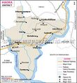
 Hazaribagh district map.jpg 600 × 792; 121 KB
-
 Heinrich Kiepert. Asia citerior.Lycaonia.jpg 1,055 × 1,024; 238 KB
-
 Helmandrivermap.png 795 × 599; 983 KB
-
 Herodotus world map-en.svg.png 788 × 476; 164 KB
-
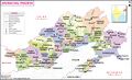
 Himachal Pradesh.jpg 1,329 × 1,772; 1.68 MB
-
 Hindu Shahi dynasty.jpg 250 × 408; 12 KB
-
 Holland.jpg 338 × 400; 31 KB
-
 Hugli-district-map.jpg 600 × 428; 83 KB
-
 Hunza Valley.jpg 245 × 258; 81 KB
-
 Hurrians2300aC.png 800 × 471; 194 KB
-
 Ilam Prov Counties.png 1,600 × 1,333; 191 KB
-
 India in Gupta age.jpg 590 × 694; 126 KB
-
 Indiahills.png 609 × 700; 54 KB
-
 Indian tribes between the Indus and the Ganges.jpg 532 × 638; 85 KB
-
 Indo-ScythiansMap.jpg 501 × 600; 81 KB
-
 Indonesia Map.png 800 × 890; 165 KB
-
 Indus Sites.gif 533 × 374; 69 KB
-
 Indus Valley Civilization Sites.jpg 640 × 772; 164 KB
-
 Iran Map.jpg 1,200 × 1,082; 524 KB
-
 Iraq Map.jpg 3,449 × 3,769; 736 KB
-
 Iraq Places.png 990 × 720; 681 KB
-
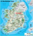 Ireland Map.jpg 3,448 × 3,771; 1.1 MB
-
 Isle of Wight Map.png 1,336 × 765; 311 KB
-
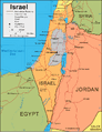 Israel-map.gif 578 × 750; 60 KB
-
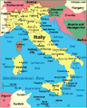 Italy map.gif 503 × 629; 59 KB
-
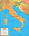 Italy-map.gif 900 × 1,118; 147 KB
-
 Jagatsinghpur district map.jpg 600 × 390; 62 KB
-
 Jajpur district map.jpg 600 × 399; 68 KB
-
 Jammu and Kashmir1.jpg 734 × 645; 167 KB
-
 Jammu-district-map.jpg 600 × 421; 67 KB
-
 Jammuandkashmir-district-map.jpg 800 × 631; 79 KB
-
 Jamtland.png 503 × 436; 531 KB
-
 Janjgir-champa-district-map.jpg 600 × 360; 56 KB
-
 Jat distribution.gif 428 × 321; 37 KB
-
 Java Transportation Network.svg.png 842 × 288; 124 KB
-
 Jharkhand-4.jpg 807 × 706; 422 KB
-
 Jharkhand-map-district.jpg 800 × 700; 260 KB
-
 Jordon Map.gif 510 × 564; 29 KB
-
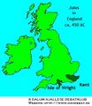 JUTES in ENGLAND.jpg 303 × 350; 65 KB
-
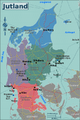 Jutland Peninsula.png 400 × 600; 300 KB
-
 Jyotibaphulenagar.jpg 400 × 451; 54 KB
-
 Kabeerdham-district-map.jpg 600 × 702; 93 KB
-
 Kaimur-district-map.jpg 600 × 767; 90 KB
-
 Kalahandi District Map.jpg 600 × 693; 104 KB
-
 Kanchipuram-district-map.jpg 600 × 718; 139 KB
-
 Kanniyakumari-district-map.jpg 600 × 615; 89 KB
-
 Kanpurnagar-district-map.jpg 600 × 991; 145 KB
-
 Karachi-Map.jpg 350 × 235; 31 KB
-
 Karkota Empire, India.jpg 1,000 × 737; 109 KB
-
 Karnataka Topograph.png 637 × 765; 893 KB
-
 Karte Haus Burgund 4 EN.png 1,200 × 1,690; 652 KB


.jpg)


.png)


