Ladki
| Author:Laxman Burdak, IFS (R) |


Ladki (लाड़की) is a village in Morshi tahsil of Amravati district in Maharashtra. Its ancient name was Mahalla-Lata (महल्ल लाट) or Mahallama-Lata (महल्लम लाट) which seems to mean the larger Lata may be represented by Ladki (लाड़की) or Ghat Ladki (घाट लाड़की) mentioned in Belora Plates (Sets A and B) of 11th year of Pravarasena II.[1]
Variants
- Ladki Bk/Ladki Bujurg
- Mahalla-Lata (महल्ल लाट) or Mahallama-Lata (महल्लम लाट) which seems to mean the larger Lata may be represented by Ladki (लाड़की) or Ghat Ladki (घाट लाड़की) mentioned in Belora Plates (Sets A and B) of 11th year of Pravarasena II
Location
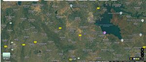
Ladki is a small Village/hamlet in Morshi Taluka in Amravati District of Maharashtra State, India. It comes under Ladki Panchayath. It belongs to Vidarbha region . It belongs to Amravati Division . It is located 48 KM towards North from District head quarters Amravati. 5 KM from Morshi. Shirkhed ( 4 KM ) , Warha ( 5 KM ) , Porgavhan ( 6 KM ) , Dhamangaon ( 6 KM ) , Katpur ( 6 KM ) are the nearby Villages to Ladki. Ladki is surrounded by Chandur Bz Taluka towards west , Tiwsa Taluka towards South , Ashti Taluka towards East , Amravati Taluka towards South.[2]
Origin
Jat Gotras Namesake
- Mahala (महला) (Jat clan) → Mahalla-Lata (महल्ल लाट) or Mahallama-Lata (महल्लम लाट) which seems to mean the larger Lata may be represented by Ladki (लाड़की) or Ghat Ladki (घाट लाड़की) mentioned in Belora Plates (Sets A and B) of 11th year of Pravarasena II.[3]Ladki (लाड़की) is a village in Morshi tahsil of Amravati district in Maharashtra.
History
Belora Plates (Sets A and B) of 11th year of Pravarasena II[4]were issued by Pravarasena II of the Vakataka dynasty. The former record the grant of the village Mahalla-Lata in the Asi bhukti, which was situated in the mārga (subdivision) of Shailapura (शैलपुर), while the latter register the donation of two villages, viz.., Dīrghadraha (दीर्घद्रह) in the Pākkana (पाकण) rāshtra and Mahallama-Laṭa (महल्लम लाट). Of these latter villages, the second is plainly identical with the village Mahalla-Lata of Set A as it is specified exactly like it. The grant recorded in Set B is, therefore, later than that of Set A. (p.17)
Mahalla-Lata (महल्ल लाट) or Mahallama-Lata (महल्लम लाट) which seems to mean the larger Lata may be represented by Ladki (लाड़की) or Ghat Ladki (घाट लाड़की) in the Morshi taluka of the Amaravati District, about 18 miles north by west of Belora1 Mahalla-Lata lay in the mārga of Shailapura (शैलपुर) which may be identical with Salbardi (सालबर्ड़ी)2 situated in the midst of hills about 15 miles east of Ladki.
Asi (असि), the chief town of the bhukti (subdivision) in which Mahalla-Lata was situated, may be identical with Ashti which lies only 10 miles south of Belora.
Dirghadraha (दीर्घद्रह) is probably Dighi (दीघी) on the left bank of the Wardha, about 30 miles south of Ashti. The name of Pravareshvara-shaḍvimsativāṭa which is mentioned in both the grants as the home of the donee seems to indicate that it was the chief village in a group of twenty-six villages. Perhaps it received this name from a shrine of Shiva called Pravareshvara installed by Pravarasena I and named after himself3. This place as well as Pakkana (पाकण), the headquarters of the rāshtra (division) in which Dirghadraha, one of the donated villages, was situated, cannot be traced now.(p.18)
1 There is another small village called Ladgaon (लाड़गांव) on the left bank of the Wardha, about 20 miles south of Belora.
2 Salbardi is an ancient place containing some old caves and hot springs.
3 Compare the name Vanko-Tummana of the first capital of the Kalachuris in Chhattisgadh (Ind. Hist. Quart., Vol. IV, p. 34). It was so called because of the shrine of Vankeshvara which it contained. It may be noted in this connection that the temple of Pravareshvara is mentioned in line 1 of No. 14, below.
Location
Population
Notable Persons
Gallery
External Links
References
- ↑ Corpus Inscriptionum Indicarum Vol.5 (inscriptions Of The Vakatakas), Edited by Vasudev Vishnu Mirashi, 1963, Archaeological Survey of India, p.16-21
- ↑ https://www.onefivenine.com/india/villages/Amravati/Morshi/Ladki
- ↑ Corpus Inscriptionum Indicarum Vol.5 (inscriptions Of The Vakatakas), Edited by Vasudev Vishnu Mirashi, 1963, Archaeological Survey of India, p.16-21
- ↑ Corpus Inscriptionum Indicarum Vol.5 (inscriptions Of The Vakatakas), Edited by Vasudev Vishnu Mirashi, 1963, Archaeological Survey of India, p.16-21

