
Margao
| Author:Laxman Burdak, IFS (R) |

Margao (मड़गांव) is the commercial capital of the Indian state of Goa. It stands on banks of the Sal river and is the administrative headquarters of Salcete sub-district and South Goa district. It is Goa's second largest city by population after Vasco. Author (Laxman Burdak) visited the place on 19.12.2007 - 21.12.2007 and has provided images and other information.
Various
- Mathagrama (मठग्राम)
- Matha Grama (मठग्राम)
- Maṭhagrāma (मठग्राम)
- Margão (मरगाओ) (Portuguese spelling),
- Madgao (मड़गांव) (Konkani)
Location
Margao is located at 15°16′25″N 73°57′29″E. It has an average elevation of 10 m (33 ft). By road, Margao is located approximately 33 km from the capital Panjim, and 25 km from Goa international airport , 560 km South of Mumbai. Nestled on the banks of the Sal River, Portuguese style mansions dot its landscape. One of the fastest growing cities in Goa, its fast growing suburbs include Aquem, Fatorda, Gogol, Borda, Comba, Navelim and Davorlim.
Etymology
- Margão is the Portuguese spelling, with Madgao being used in Konkani. It was called Madgaon in Marathi. One theory holds that the name is derived from the Sanskrit मठग्राम (Maṭhagrāma) which means a village of monasteries.
- Another theory drawing from popular history suggests that is that the name in fact derives from its being the settlement of the caste of Mahars, hence Mahar gão (village of Mahars).[1]
History

In Ravanphond, now a suburb of Margao, there are shrines of Natha sect of Shaivism - Matsyendranath and Gorakhnath.[2] The abode of Nath medicants was called a Matha (Monastery). Madagao was called Mathagrama on account of Vaishnavite Math belonging to Dvaita sect which was founded in the latter 15th century and shifted to Partagal after the establishment of the Portuguese power.[3]
Margao in pre-Portuguese times was one of the important settlements in Salcete and known as Matha Grama (the village of Mathas) as it was a temple town with nine Mathas in temple schools. Its replacement in 1579 was destroyed by raiders. The present church was built in 1675.[4][5]
While the western side of the Holy Spirit Church developed as a market place, the settlement grew on the eastern side, that is, the Borda region.
Margao's importance as an administrative and commercial area grew with the increasing dependence of the surrounding towns and villages; leading to the administrative center with the town hall at its center being built in the south.
In 1961, Annexation of Goa led to its incorporation into the Republic of India, and Margao was declared as the administrative center of the district of South Goa.
Places of tourism importance
The town has many sights and destinations. These include the Mercado de Afonso de Albuquerque which roughly translates to closed market and colloquially known as "Pimplapedd" or "Pimpalakatta", the municipal building (Câmara Municipal), the municipal garden named after benefactor Prince Aga Khan, Anna Fonte (natural springs), Old Market or Mercado Velho, Holy Spirit Church, grand colonial mansions such as the Seven Gables House, the chapel at Monte Hill.
Some of the town suburbs include Pajifond, Aquem, Gogol, Borda, Malbhat, Madel, Kharebandh, Old Market, Navelim and Comba, the last two being the oldest parts of the town.
Pandava Caves Located in Aquem Behind St. Sebestian Church
There are a number of temples and churches in Margao city The famous churches in Margao are the Holy Spirit Church, the Grace Church, The St Sebastian Church in Aquem (The Old St. Sebastian Chapel, popularly known as the Pandava Copel still stands next to the modern St. Sebastian Church) and the Monte Hill Chapel.
The famous temples are the 'Damodar Temple' (Saal), the 'Hari Mandir', the 'Maruti Mandir' at Davorlim the 'Saibaba Temple' at Davorlim, the 'Shiv Temple' (Ling) at Fatorda near Nehru Stadium (which is the original Temple of Damodara).
There are two mosques in Margao, one in the Malbhat area and one on the Monte hill. There is also a Jain temple and a Jama'at Khana for the Khoja faith in Pajifond. There is also a Muslim community of Nizaris living in Margao.
Municipal Garden': In the centre of the town is the Municipal Garden, known as Praça Jorge Barreto, around which most restaurants and office buildings are located. On the park's south side like the colonial style red-washed Municipal building, known as Margao Town Hall which was built in 1905, and the Library. The northern segment of the Municipal garden was developed by the Mavany family and is named after His Highness Prince Shah Karim Al Hussaini, Aga Khan IV/Imam of Nizari Ismaili Muslims who visited Goa just before its liberation. The entire garden is now municipal property and is maintained by the Margao Municipal Council.
The Holy Spirit Church: The Largo de Igreja, or the Church of the Holy Spirit, was built by the Portuguese in 1675 and boasts a pristine white façade and an interior dripping with gilt crystal and stucco. The Municipal Garden square is defined on one side by the church with its baroque architecture and the parochial house, and on the other side by the palatial mansions of affluent elite Catholics, positioned in a row. The Associação das Communidades (Communities Association) building and the school being the odd exceptions which add to its character and sense of scale. They have a maximum height of two stories, and balcões balconies and varandas (verandas) facing the square. Parallel to the church square is the commercial street (old market). There is also a landscaped area next to the church called Praça da Alegria (Joy Square). The church feast is celebrated before the monsoons, it is a time when many residents make pre-monsoon purchases to stock up for a prolonged rainy season.
House of Seven Gables: Just within walking distance of the Holy Spirit Church, is the famous "House of Seven Gables" or "Sat Burzam Ghor". This magnificent mansion was built by Inacio Sebastiao da Silva, emissary and private secretary of the Portuguese Viceroy, in 1790. Today, only three of the seven gables remain. The family church with its Baroque and Rococo workmanship, exhibits the loftiness of the Portuguese time. Narcinva D. Naik residence and Damodar Sal
The Narcinva D. Naik residence houses Margao's well-known temple-hall known as Damodar Sal or Dambaba Saal. The house played host to Swami Vivekananda during his visit to Goa in October 1892 before proceeding to Chicago to address the Parliament of Religions.
Sal River
The Sal River is a small river in Salcete, Goa in India. The river opens near Verna and passes through the villages of Nuvem, Mongul, Seraulim, Colva, Margao, Benaulim, Navelim, Varca, Orlim, Carmona, Dramapur, Chinchinim, Assolna, Cavelossim, Mobor and drains itself into the Arabian Sea at Betul.
Cabo de Rama Beach & Fort

Cabo de Rama is a fort in Goa, India. Portuguese claimed the Cabo de Rama Fort after defeating the Raja (King) of Soonda and subsequently renovated it. In the past, the fort has switched hands between Hindu, Muslim monarchs and the Portuguese and had witnessed many battles in history. The present rickety structure with turrets and rusty cannons is a leftover of the Portuguese. The Portuguese equipped it with 21 guns and military barracks, as well as commandant quarters and a chapel. It was abandoned when the Portuguese left this place. Later, this fort housed a government prison till 1955 and was abandoned again. Today, this fort is in ruins, but is a popular tourist attraction of Goa.
Inside the Cabo de Rama Fort, there is the church of Santo Antonio which is in excellent condition and is still used by devotees. The white church and the black fort provide a photographic picture of stark contrast. People come here to pray and just enjoy the mystical atmosphere of the fort. Cliffs drop steeply to the sea provide a panoramic outlook of the surrounding areas, at the western side of the fortress. The fort provides majestic views of the entire length of Colva beach and the Canacona stretch.
मडगाँव परिचय
मडगाँव भारत के गोवा राज्य के दक्षिण गोवा ज़िले में स्थित एक नगर है। यह उस ज़िले का मुख्यालय भी है। पणजी के बाद यह राज्य का दूसरा सबसे बड़ा कस्बा है। यह गोवा की व्यापारिक राजधानी एवं सर्वाधिक व्यस्त कस्बा है। एक छोटी सी बस्ती है, जो एक किलोमीटर के दायरे में होते हुए बहुत ही आकर्षक जगह है। इस जगह से दक्षिण गोवा के कई महत्त्वपूर्ण समुद्र तट निकट हैं जिस वजह से यहाँ पर्यटकों की भारी आमद देखी जा सकती है।
प्रसिद्ध चर्चों और मंदिरों के अलावा एक बात और है जो इस जगह को विशेष दर्जा देती है। ये जगह कई सारी संस्कृतियों को अपने में समेटे हुए है, यहाँ जहाँ एक तरफ चर्च और मंदिर हैं तो वहीँ दूसरी तरफ इस स्थान पर मुस्लिम समुदाय के लिए भी बहुत कुछ है। यहाँ पर कई सारी मस्जिदें हैं जिन्हें हर साल लाखों पर्यटक देखने आते हैं। यहाँ की मस्जिदों में शिया इमाम इस्माइली खोजा जमातखाना और अकुएम प्रमुख हैं । ये वो स्थान है जहाँ मुस्लिम समुदाय के लोग भारी संख्या में आते हैं।
मडगांव,बेनौलिम, कोल्वा, वर्का, बैतूल और मजोरदा जैसे मनमोहक बीचों से ज्यादा दूर नहीं है इस कारण, इन स्थानों से यहाँ आसानी से पहुंचा जा सकता है। यहाँ आकर पर्यटक बीच के आस पास से सस्ती दरों में बेहतरीन खरीदारी भी कर सकते हैं। अगर आप अच्छे खाने के शौक़ीन है तो यह जगह गोवा का दक्षिणी हिस्सा होने के कारण आपको एक उम्दा कुजीन प्रदान करती है। यहाँ आने वाले पर्यटक कई प्रमुख पांच सितारा होटलों जैसे ताज, लीला, हयात, और हॉलिडे इन जैसे होटलों में रुक सकते हैं जो प्रमुख स्थान से एक मील की दूरी पर हैं। अगर आपको एक छोटी सी राइड का मजा लेना है तो आप फिशरमैन व्हार्फ़ जरूर जाएं ये जगह बेतुल बीच के पास है । अगर आप गोवा आये हैं और आपको ताजा और प्रामाणिक सी फ़ूड खाना है तो आप मडगाव की यात्रा जरूर करें। [6]
मड़गाँव का प्राचीन नाम मठग्राम था जो अपभ्रंश होकर मठगाम और मड़गाँव हो गया। मड़गाँव को गोवा का व्यावसायिक और सांस्कृतिक राजधानी माना जाता है। इसे पुर्तगाली में मरगाओ और 'कोंकणी में मडगांव नाम से पुकारते हैं। वैसे कहा जाता है कि संस्कृत में इसका नाम मठग्राम था। कहा जाता है कि कभी यहां नौ मठ और मंदिर हुआ करते थे। मंदिर के साथ लगे हुए मठ धार्मिक स्कूल की तरह कार्य करते थे। पुर्तगाली आक्रमण के बाद इन सभी मठों को नष्ट कर दिया गया। यहां चर्च का निर्माण होने लगा। [7]
साल 1675 में मडगांव का पहला चर्च बना। आज होली स्पिरिट चर्च शहर का मुख्य चर्च है और शहर की पहचान बन चुका है। मडगांव शहर में आप आज भी पुर्तगाली स्टाइल में बनी तमाम बिल्डिंग देख सकते हैं। इनमें ज्यादातर बिल्डिंग दो मंजिलों वाली हैं। पर अब यहां नई बहुमंजिली इमारतें भी बनने लगी हैं। चर्च स्ट्रीट के आसपास शहर का शापिंग इलाका है। टाउन हाल, म्युनिसपल गार्डन शहर के बीचों बीच है। आज आप मडगांव शहर में निकलें तो गांधी मार्केट मुख्य बाजार है जहां से आप शापिंग कर सकते हैं। इसके अलावा मडगांव से लगा इलाका फटोडा है जो स्थानीय लोगों का लोकप्रिय बाजार है।[8]
एयरपोर्ट से मडगांव 27 किलोमीटर की दूरी पर है। मडगांव कोंकण रेलवे का लोकप्रिय रेलवे स्टेशन है। दक्षिण जाने वाली सभी ट्रेनें यहां रुकती हैं। इसलिए रेल कनेक्टविटी के लिहाज से यह गोवा का सबसे मुफीद शहर है। उत्तर दक्षिण कहीं से भी यहां पहुंचना आसान है।
काबो डी राम
काबो डी राम (Cabo De Rama Beach) गोवा के खूबसूरत बीचों में शुमार एक अद्भुत बीच है, जिसे स्थानीय लोगों द्वारा कैबो डी राम नाम से भी जाना जाता है। कैबो डी राम बीच गोवा के दक्षिण में स्थित एक आकर्षक समुद्र तट है। इस समुद्र तट के उत्तरी दिशा में एक छोटी और उथली नदी भी है। कैबो डी राम बीच से 28 किलोमीटर की दूरी पर मर्गोस ग्रोव्स हैं और बीच से 2 किलोमीटर की दूरी पर कैबो डी राम किला भी है। यहां पर ताड के पेड़ों की संख्या बहुत अधिक है और पर्यटक पेड़ों की छाया में बैठकर पिकनिक मानते हैं और अपने परिवार के साथ समय बिताना भी पसंद करते हैं। [9]
कैबो डी राम किला: काबो दे रामा में एक किला है। पुर्तगालियों ने दावा किया कि सून्डा राजा को हराने के बाद काबो डी राम किला और बाद में इसका जीर्णोद्धार हुआ। अतीत में, किले ने हिंदू, मुस्लिम सम्राटों और पुर्तगालियों के बीच हाथ मिलाया है और इतिहास में कई लड़ाइयों को देखा है। बुर्ज और जंग खाए हुए तोपों के साथ वर्तमान दुर्लभ संरचना पुर्तगालियों का एक बचा हुआ इलाका है। पुर्तगालियों ने इसे 21 तोपों और सैन्य बैरकों के साथ-साथ कमांडेंट क्वार्टर और एक चैपल से सुसज्जित किया। पुर्तगालियों के इस जगह से चले जाने पर इसे छोड़ दिया गया था। बाद में, इस किले ने 1955 तक एक सरकारी जेल में रखा और फिर से छोड़ दिया गया। आज, यह किला खंडहर में है, लेकिन गोवा का एक लोकप्रिय पर्यटक आकर्षण है। काबो डी राम किले के अंदर, सेंटो एंटोनियो का चर्च है जो उत्कृष्ट स्थिति में है और अभी भी भक्तों द्वारा उपयोग किया जाता है। सफेद चर्च और काला किला स्टार्क कंट्रास्ट की एक फोटोग्राफिक तस्वीर प्रदान करते हैं। लोग यहां प्रार्थना करने और किले के रहस्यमय वातावरण का आनंद लेने आते हैं। किले के पश्चिमी भाग में चट्टानें समुद्र के आसपास के क्षेत्रों को मनोरम दृश्य प्रदान करती हैं। किले Colva समुद्र तट की पूरी लंबाई और Canacona खिंचाव के राजसी दृश्य प्रदान करता है।[10]
कोलवा और बेनौलिम बीच
कोलवा बीच (Colva Beach): दक्षिणी गोवा के साल्सेट क्षेत्र में स्थित कोलवा बीच, गोवा के कुछ बेहद खूबसूरत समुद्र तटों में गिना जाता है। इसकी खूबी यह है कि उत्तरी गोवा के समुद्र तटों की तरह यहां भीड़-भाड़ नहीं होती और यह तट अपेक्षाकृत शांत रहता है। वैसे यह बीच गोवा के सबसे प्राचीनतम तटों में से एक होने के साथ-साथ यहां का सबसे लंबा समुद्री तट (25 कि.मी.) भी है। कुछ समय एकांत में बिताने के शौकीनों को यहां का शांत और खूबसूरत माहौल खासा लुभाता है। सफेद रेत के किनारे लगे नारियल के ऊंचे-ऊंचे पेड़ इस जगह की खूबसूरती में इजाफा कर देते हैं और सूर्यास्त के समय समुद्र किनारे टहलने के शानदार अनुभव को तो कभी भूला ही नहीं जा सकता। कोलवा से पर्यटक, काबो डि रामा (Cabo de Rama) किले तक आसानी से जा सकते हैं जो कि पूर्व पुर्तगाली समय का किला है और साथ ही गोवा का सबसे पुराना किला भी है।
कोलवा बीच का इतिहास: किसी जमाने में कोलवा एक विशाल बंजर इलाका हुआ करता था, जहां से अरब सागर का खूबसूरत नजारा दिखाई देता था। फिर मुग़ल और आदिल शाही राजवंश के शासकों को गोवा का उत्तरी और पहाड़ी हिस्सा इतना पसंद आया कि उन्होंने वहां के साथ-साथ यहां भी किलों और गढ़ों का निर्माण करवाया। लेकिन 1510 से 1961 के बीच यह इलाका पुर्तगालियों के कब्जे में रहा। तब इसे डॉक्टर डीओगो रोड्रिग्स की वंशज कहे जाने वाले रोईज़ नामक पुर्तगाली परिवार का गांव माना जाता था। उसे लोग कोलवा का भगवान मानते थे। कहा जाता है कि वह पहला शख्स था जिसने 1551 में यहां पहले पुर्तगाली वास्तुशैली से बने घरों का निर्माण कराया था। तब यह पूरा समुद्र तट भी उसी का हुआ करता तह और इसे प्राईआ दा कोलवा का नाम से जाना जाता था।
वाटर स्पोर्ट्स: यहां बनाना बोट और मोटर बोट की सवारी जैसे कुछ बेहद रोमांचकारी पानी के खेलों का लुत्फ़ तो उठाया जा ही सकता है, साथ ही समुद्र का यह हिस्सा तैराकी के लिए भी पूरी तरह सुरक्षित है। इसलिए यहां आने पर आपको तैरने के लिए सुरक्षित हिस्सों में लाल झंडे लगे दिख जायेंगे।
पाउडर जैसी सफेद रेत: यहां चारों ओर फैली सफेद रंग की पाउडर जैसी रेत विशेष रूप से लोगों को आकर्षित करती है और साथ में लगे नारियल के ऊंचे-ऊंचे पेड़ इस पूरे इलाके की सुंदरता को बढ़ा देते हैं। इस सबके अलावा यहां बने आकर्षक घर भी सैलानियों को अपनी साज-सज्जा की वजह से खासे प्रभावित करते हैं।
बेनौलिम समुद्र तट (Benaulim Beach): कोलवा से दक्षिण की तरफ करीब दो किमी आगे चलने पर स्थित बेनौलिम समुद्र तट पर बड़ी संख्या में स्थानीय लोग और पर्यटक घूमने आते हैं। पौराणिक कथाओं के अनुसार भगवान परशुराम द्वारा चलाया गया तीर इस जगह के समीप कोंकण क्षेत्र में आकर गिरा था, जिसके फलस्वरूप गोवा का निर्माण हुआ।। यह बीच दक्षिणी कोलवा से लगभग 2 किमी की दूरी पर है। बेनौलिम बीच गोवा के स्थिर और शांत समुद्री तटों में से एक है। यह राज्य के उन स्थानों में से एक है, जहां आप स्थानीय हस्तशिल्प की झलक देख सकते हैं। 'सेंट जॉन द बैपटिस्ट' का चर्च यहां की यात्रा के लायक है। मानसून के दौरान यहां 'सेंट जॉन द बैपटिस्ट' नामक फेस्टिवल बहुत धूमधाम से मनाया जाता है।
संदर्भ: https://www.adotrip.com/hi/destination-detail/colva-beach
Gallery
-
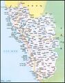
गोआ का मानचित्र

External links
References
- ↑ Gracias, Radharao F. (23 February 2021). "Mahargao or Mathagram?". OHeraldo.
- ↑ Satoskar, B.D (1979). Gomantak: prakṛitī āṇi saṃskṛitī. Śubhdā-Sārasvat. p. 113.
- ↑ Mitragotri, Vithal Raghavendra (1999). A socio-cultural history of Goa from the Bhojas to the Vijayanagara. Institute Menezes Braganza. pp. 151–152.
- ↑ "Hindu temples and deities" by Rui Gomes Pereira
- ↑ "Gomantak Prakruti ani Sanskruti" by B.D.Satoskar
- ↑ https://hindi.nativeplanet.com/margao/#overview
- ↑ https://www.daanapaani.net/2017/12/blog-post_1.html
- ↑ https://www.daanapaani.net/2017/12/blog-post_1.html
- ↑ https://hindi.holidayrider.com/cabo-de-rama-beach-in-hindi/
- ↑ https://hi.vvikipedla.com/wiki/Cabo_de_Rama