Rawatpur
| Author:Laxman Burdak, IFS (R) |

Rawatpur (रावतपुर) is a historical village in tehsil Kulpahar, district Mahoba in Uttar Pradesh, India.[1]
Variants
- Ravatpur रावतपुर, जिला हमीरपुर (वर्तमान महोबा), उ.प्र., (AS, p.796)
- Rawatpur Kalan (रावतपुर कलां)
Location
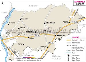
Rawatpur Kalan is a small Village in Panwari Block in Mahoba District of Uttar Pradesh State, India. It comes under Rawatpur Kalan Panchayath. It belongs to Chitrakoot Division . It is located 50 KM towards west from District head quarters Mahoba. 258 KM from State capital Lucknow. Rawatpur Kalan is surrounded by Jaitpur Block towards South , Rath Block towards North , Gursarai Block towards west , Mauranipur Block towards west. Niwari , Rath , Charkhari , Nowgong are the near by Cities to Rawatpur Kalan. [2]
History
27 Large Chandel tank on the embankment of which stands a large ruined temple of the earliest Chandel type. Rawatpur, Tehsil – Kulpahar, district Mahoba. [3]
रावतपुर
रावतपुर (AS, p.796): जिला महोबा), उ.प्र., में स्थित है. मध्य काल के चंदेल नरेशों के समय के ध्वंसावशेष इस स्थान पर पाए गए हैं. [4]

