Sonadai
| Author:Laxman Burdak, IFS (R) |

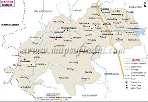
Sonadai (सोनादेई) is a village Bhanupratappur (noe in Durgkondal) tahsil of Kanker district in Chhattisgarh. Author (Laxman Burdak) visited it on 25.11.1985, 10.11.1986, 25.12.1986, 24.11.1987, 06.01.1988.
Variants
Location
According to Census 2011 information the location code or village code of Sonadai village is 447664. Sonadai village is located in Durgkondal tehsil of Uttar Bastar Kanker district in Chhattisgarh, India. It is situated 27km away from sub-district headquarter Durgkondal (tehsildar office) and 75km away from district headquarter Kanker. As per 2009 stats, Lohattar is the gram panchayat of Sonadai village. The total geographical area of village is 496.3 hectares. [1]
Sonadai is a small Village/hamlet in Durgukondal Tehsil in Kanker District of Chattisgarh State, India. It comes under Sonadai Panchayath. It is located 74 KM towards west from District head quarters Kanker. 12 KM from Durgukondal. 151 KM from State capital Raipur. Sonadai Pin code is 494635 and postal head office is Sambalpur. Chihro ( 9 KM ) , Gudum ( 10 KM ) , Raurwahi ( 13 KM ) , Karaki ( 14 KM ) , Bhandardigi ( 15 KM ) are the nearby Villages to Sonadai. Sonadai is surrounded by Manpur (Td) Tehsil towards west , Bhanupratappur Tehsil towards East , Mohala (Td) Tehsil towards North , Dondi Tehsil towards East.[2]
Jat Gotras Namesake
- Sonania = Sonadai is a village Bhanupratappur (noe in Durgkondal) tahsil of Kanker district in Chhattisgarh.
Origin
History
Notable persons
Population
Sonadai has a total population of 214 peoples, out of which male population is 105 while female population is 109. Literacy rate of sonadai village is 67.76% out of which 80.95% males and 55.05% females are literate. There are about 42 houses in sonadai village. Pincode of sonadai village locality is 494635.[3]

