Wiltshire

Wiltshire (Hindi:विल्टसायर, /ˈwɪlt.ʃɪər/) is a county in South West England.
Location
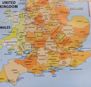
It is landlocked and borders the counties of Dorset, Somerset, Hampshire, Gloucestershire, Oxfordshire and Berkshire. The county town was originally Wilton, after which the county is named, but Wiltshire Council is now based in the county town of Trowbridge.
Origin of name
The county, in the 9th century written as Wiltunscir, later Wiltonshire, is named after the former county town of Wilton.[1]
History
Wiltshire is characterised by its high downland and wide valleys. Salisbury Plain is noted for being the location of the Stonehenge and Avebury stone circles and other ancient landmarks, and as a training area for the British Army. The city of Salisbury is notable for its mediaeval cathedral. Important country houses open to the public include Longleat, near Warminster, and the National Trust's Stourhead, near Mere.
Wiltshire is notable for its pre-Roman archaeology. The Mesolithic, Neolithic and Bronze Age people that occupied southern Britain built settlements on the hills and downland that cover Wiltshire. Stonehenge and Avebury are perhaps the most famous Neolithic sites in the UK.
In the 6th and 7th centuries Wiltshire was at the western edge of Saxon Britain, as Cranborne Chase and the Somerset Levels prevented the advance to the west. The Battle of Bedwyn was fought in 675 between Escuin, a West Saxon nobleman who had seized the throne of Queen Saxburga, and King Wulfhere of Mercia.[2] In 878 the Danes invaded the county. Following the Norman Conquest, large areas of the country came into the possession of the crown and the church.
At the time of the Domesday Survey the industry of Wiltshire was largely agricultural; 390 mills are mentioned, and vineyards at Tollard and Lacock. In the succeeding centuries sheep-farming was vigorously pursued, and the Cistercian monastery of Stanley exported wool to the Florentine and Flemish markets in the 13th and 14th centuries.
In the 17th century English Civil War Wiltshire was largely Parliamentarian. The Battle of Roundway Down, a Royalist victory, was fought near Devizes.
In 1794 it was decided at a meeting at the Bear Inn in Devizes to raise a body of ten independent troops of Yeomanry for the county of Wiltshire, which formed the basis for what would become the Royal Wiltshire Yeomanry, who served with distinction both at home and abroad, during the Boer War, World War I and World War II. The Royal Wiltshire Yeomanry currently lives on as Y (RWY) Squadron, based in Swindon, and B (RWY) Squadron, based in Salisbury, of the Royal Wessex Yeomanry.[3]
Around 1800 the Kennet and Avon Canal was built through Wiltshire, providing a route for transporting cargoes from Bristol to London until the development of the Great Western Railway.
Geology, landscape and ecology
Two-thirds of Wiltshire, a mostly rural county, lies on chalk, a kind of soft, white, porous limestone that is resistant to erosion, giving it a high chalk downland landscape. This chalk is part of a system of chalk downlands throughout eastern and southern England formed by the rocks of the Chalk Group and stretching from the Dorset Downs in the west to Dover in the east. The largest area of chalk in Wiltshire is Salisbury Plain, which is used mainly for arable agriculture and by the British Army as training ranges. The highest point in the county is the Tan Hill–Milk Hill ridge in the Pewsey Vale, just to the north of Salisbury Plain, at 295 m (968 ft) above sea level.
The chalk uplands run northeast into West Berkshire in the Marlborough Downs ridge, and southwest into Dorset as Cranborne Chase. Cranborne Chase, which straddles the border, has, like Salisbury Plain, yielded much Stone Age and Bronze Age archaeology. The Marlborough Downs are part of the North Wessex Downs AONB (Area of Outstanding Natural Beauty), a 1,730 km2 (670-square-mile) conservation area.
In the northwest of the county, on the border with South Gloucestershire and Bath and North East Somerset, the underlying rock is the resistant oolite limestone of the Cotswolds. Part of the Cotswolds AONB is also in Wiltshire, in the county's northwestern corner.
Between the areas of chalk and limestone downland are clay valleys and vales. The largest of these vales is the Avon Vale. The Avon cuts diagonally through the north of the county, flowing through Bradford-on-Avon and into Bath and Bristol. The Vale of Pewsey has been cut through the chalk into Greensand and Oxford Clay in the centre of the county. In the south west of the county is the Vale of Wardour. The southeast of the county lies on the sandy soils of the northernmost area of the New Forest.
Chalk is a porous rock, so the chalk hills have little surface water. The main settlements in the county are therefore situated at wet points. Notably, Salisbury is situated between the chalk of Salisbury Plain and marshy flood plains.
External links
References
- ↑ "Wiltshire Community History: Wilton". Wiltshire Council.
- ↑ Pearson, Michael (2003). Kennet & Avon Middle Thames: Pearson's Canal Companion. Rugby: Central Waterways Supplies. ISBN 0-907864-97-X.
- ↑ British Army Website. "Royal Wessex Yeomanry". Regimental Page. British Army.

