Aral Sea
| Author:Laxman Burdak, IFS (R) |


The Aral Sea Tajik/Persian "Daryocha-i Khorazm" (Lake Khwarazm) is a landlocked endorheic basin in Central Asia.
Variants
- Aral Sea (Anabasis by Arrian, p. 198, 199, 202, 234, 274, 401.)
- Lake Oxus (Pliny.vi.18)
Location
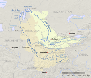
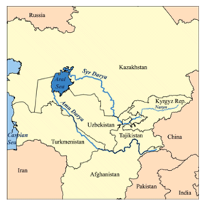
It lies between Kazakhstan in the north and Karakalpakstan, an autonomous region of Uzbekistan, in the south. The name roughly translates as "Sea of Islands", referring to more than 1,500 islands of one hectare or more that dotted its waters.
Jat clans
Origin
In Old Turkic 'aral' means an "island" and also a "thicket".
Mention by Pliny
Pliny[1] mentions 'Nations situated around the Hyrcanian Sea.'....the Derbices also,18 through the middle of whose territory the river Oxus19 runs, after rising in Lake Oxus,20....
18 This was a tribe, apparently of Scythian origin, settled in Margiana, on the left bank of the Oxus. Strabo says that they worshipped the earth, and forbore to sacrifice or slay any female; but that they put to death their fellow-creatures as soon as they had passed their seventieth year, it being the privilege of the next of kin to eat the flesh of the deceased person. The aged women, however, they used to strangle, and then consign them to the earth.
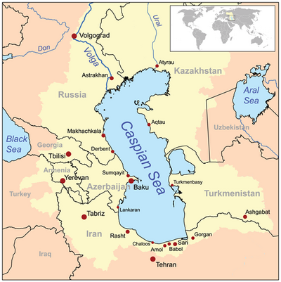
19 The modern Jihoun or Amou. It now flows into the Sea of Aral, but the ancients universally speak of it as running into the Caspian; and there are still existing distinct traces of a channel extending in a southwesterly direction from the sea of Aral to the Caspian, by which at least a portion, and probably the whole of the waters of the Oxus found their way. into the Caspian; and not improbably the Sea of Aral itself was connected with the Caspian by this channel.
20 Most probably under this name he means the Sea of Aral.
Formation

The Aral Sea, like the Caspian Sea and Black Sea, is a remnant of the ancient Paratethys Sea. It became landlocked about 5.5 million years ago due to a fall in sea level and the uplift of the Elburz and Caucasus Mountains. It is generally believed that the Amu Darya did not flow into the shallow depression that now forms the Aral Sea until the beginning of the Holocene, and it is known that the Amu Darya flowed into the Caspian via the Uzboy channel until the Holocene. The Syr Darya formed a large lake in the Kyzyl Kum duirng the Pliocene known as the Mynbulak depression.
हिन्दी में
अरल सागर या अराल सागर मध्य एशिया में स्थित एक झील है जिसके बड़े आकार के कारण इसे सागर कहा जाता है, पर अब दिनोदिन इसका आकार घटता जा रहा है। स्थानीय भाषाओं में इसका शाब्दिक अर्थ है 'द्वीपों की झील', जो इस झील में एक समय पर दिखने वाले लगभग १५०० टापुओं के आधार पर नामांकित थी। सन् १९६० में सोवियत प्रशासन ने इसमें विसर्जित होने वाली दो नदियों - आमू दरिया और सिर दरिया को मरुभूमि सिंचाई के लिए विमार्गित करने का निर्णय लिया, जिसके बाद से अरल सागर घटा और तीन अलग-अलग भागों में बंट गया। इसके फलस्वरूप आने वाले ४० सालों में अराल सागर का ९० प्रतिशत जल खत्म हो गया तथा ७४ प्रतिशत से अधिक सतह सिकुड़ गई और इसका आकार १९६० के इसके आकार का सिर्फ १० प्रतिशत ही रह गया है।
एक समय इसका क्षेत्रफल लगभग ६८,००० वर्ग किलोमीटर था। इसके बाद सन् २००७ तक यह अपने मूल आकार के १० प्रतिशत पर आ गया है। पानी की लवणता में वृद्धि हो रही है और मछलियों का जीवन असंभव हो गया है। १९६० के बाद के दशकों में सूखे के कारण और पानी मोड़ने के लिए बनाई गई नहरों के कुप्रबंधन के चलते अराल सागर की तट रेखा में भी काफी कमी देखी गई, जहाँ बड़ी नौकाएँ चलती थीं, वहाँ रेगिस्तान नजर आने लगा था। लेकिन इस सबके एवज़ में उज़बेकिस्तान दुनिया के प्रमुख कपास निर्यातकों में गिना जाने लगा है, जो एक समय सोवियत संघ की योजना थी।

