Mundala
| Author:Laxman Burdak, IFS (R) |

Mundala(मुंडला) is a small Village in Jatani Tehsil in Khordha District of Odisha State, India. Mundala is also a Village in Chilika Tehsil in Khordha District of Odisha State.
Location
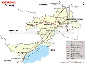
Mundala is a small Village/hamlet in Jatni Tehsil in Khordha District of Odisha State, India. It is located 16 KM towards South from District head quarters Khurda. 11 KM from Jatni. 15 KM from State capital Bhubaneswar. I-bhk, Kalyani Appts. ( 5 KM ) , Nanput ( 5 KM ) , Railway Coaching Yard ( 7 KM ) , Itipur ( 7 KM ) , Patrapada ( 7 KM ) are the nearby Villages to Mundala. Mundala is surrounded by Pipili Tehsil towards South , Bhubaneswar Tehsil towards North , Delanga Tehsil towards South , Balianta Tehsil towards East . Jatani, Bhubaneswar , Khordha , Cuttack are the near by Cities to Mundala. This Place is in the border of the Khordha District and Puri District. Puri District Delanga is South towards this place .

