Rajanpur


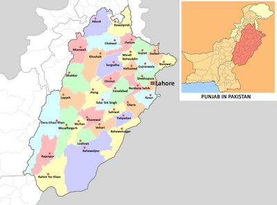
Rajanpur (Hindi: राजनपुर, Urdu: راجن پور) is a city and district in the Punjab province of Pakistan.
Tahsils in the District
Jat Gotras
Click to see Jat Gotras in Rajanpur
History
Rajanpur was named by a warlord Makhdoom Shaikh Rajan in 1772-73. The district lies entirely West of the Indus River (Sind River); it is a narrow, 20 to 40 miles (64 km) wide strip of land sandwiched between the Indus River on the East and the Sulaiman Mountains on the West.
Rajanpur District was carved out from Dera Ghazi Khan District in 1982. Rajanpur is situated on the right bank of River Indus which is bounded on the North by Dera Ghazi Khan, in the East by Muzaffargarh and Rahim Yar Khan Districts, in the South lies District Jacobabad of Sindh Province while on the West are the Districts of Dera Bugti and Barkhan of Balochistan Province. The de-excluded area of Rajanpur is connected with Sulaiman Mountains in the Western side.
Umer Kot is the most cultured town in the district Rajan Pur. Its geological location is very attractive in its south Indus River located, in west koh-e –Suleman and also its boundary meet with Dera bugti Balochistan. Communities are belonging from dissimilar races in this township for the most part Solangi and Mazari are in greater part. Solangi are the major ethnic group in Umer Kot and enjoying dominant power.
Notable persons
References
Back to Pakistan

