Herat
| Author:Laxman Burdak, IFS (R) |


Herāt (Hindi:हेरात, Persian: هرات) is a city in western Afghanistan, in the province also known as Herāt.
Variants of name
- Haroyu (हरोयु): or Haraiva [old Persian} or Areia {Greek} is the region comprising the valley of the river Harirud. Haroyu corresponds to Indian Sarayu (सरयू). The famous province and city Herat. This is famous for its fruits production with principal town Heart, a town of antiquity. [1]
- Aria
- Ariana
- Artacauan (This site was evidently very near to or almost identical with the modern Herat)[2]
- Herāt
- Haraiva (in Old Persian)
- Haroiva (Avesta)
- Harayu ("with velocity": from Hari River)
- Artacoana (by Alexander the Great)
- Harev
- Hariy
- Hairat (=Aratta) (by Alexander Cunningham)
- Hairat-des (by Alexander Cunningham)
Location
It is situated in the valley of the Hari River, which flows from the mountains of central Afghanistan to the Karakum Desert in Turkmenistan. Situated in a fertile area, Herāt was traditionally known for its wine. It is the third largest city in Afghanistan, with a population of 349,000 (2006 official estimate). Persian-speaking Tājiks (or Fārsīwān) are the main inhabitants of the city and are roughly the same as the Persians of Eastern Iran.

Herat is an ancient city with many historic buildings, although these have suffered damage in various military conflicts during the last few decades. The city is dominated by the remains of a citadel constructed by Alexander the Great. During the Middle Ages Herat became one of the important cities of Greater Khorasan, and it was known as the Pearl of Khorasan.
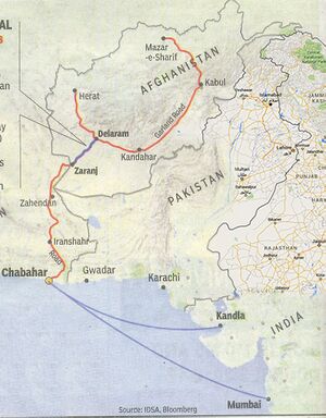
Herāt is situated favorably on the ancient and historic trade routes of the Middle East, India, China, and Europe. The roads from Herāt to Iran, Turkmenistan, Mazar-e Sharif and Kandahar are still strategically important.
History
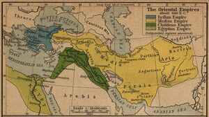
Herat dates back to ancient times, but its exact age remains unknown. In Achaemenid times (ca. 550 BC- 330 BC), the surrounding district was known as Haraiva (in Old Persian), and in classical sources the region was correspondingly known as Aria (Areia). In the Zoroastrian Avesta, the district is mentioned as Haroiva. The name of the district and its main town is derived from that of the chief river of the region, the Hari River, Afghanistan (Old Iranian Harayu "with velocity"), which traverses the district and passes just south (5 km) of modern Herat. The naming of a region and its principal town after the main river is a common feature in this part of the world. (Compare the adjoining districts/rivers/towns of Arachosia and Bactria.)
The Persian Achaemenid district of Aria is mentioned in the provincial lists that are included in various royal inscriptions, for instance, in the Behistun inscription of Darius I (ca. 520 BC).[5] Representatives from the district are depicted in reliefs, e.g., at the royal Achaemenid tombs of Naqsh-e Rustam and Persepolis.
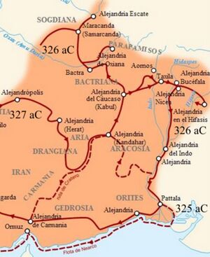
Herodotus called Herat as the bread-basket of Central Asia. At the time of Alexander the Great, Aria was obviously an important district. It was administered by a satrap, called Satibarzanes, who was one of the three main Persian officials in the East of the Empire, together with the satrap Bessus of Bactria and Barsaentes of Arachosia. In late 330 BC Alexander the Great, captured the Arian capital that was called Artacoana. The town was rebuilt and the citadel was constructed. It became part of the Seleucid Empire but was captured by others on various occasions and became part of the Parthian Empire in 167 BC.
In the Sasanian period (226-652), "Harev" is listed in an inscription on the Ka'ba-i Zartosht at Naqsh-e Rustam; and "Hariy" is mentioned in the Pahlavi catalogue of the provincial capitals of the empire. In around 430, the town is also listed as having a Christian community, with a Nestorian bishop.
In the last two centuries of Sasanian rule, Aria (Herat) had great strategic importance in the endless wars between the Sasanians, the Chionites and the Hephthalites who had been settled in modern northern Afghanistan since the late fourth century.
Alexander Cunningham[6] writes that The city of Gujarat Pakistan is situated 9 miles to the west of the Chenab river, on the high-road from Jhelam to Lahor. The city is said to have been first called Hairat, and the district Hairat-des. He takes Hairat to be only an aspirated form of Aratta.
Harut River
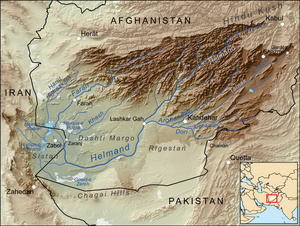
Harut River (or Ardaskan River) is a river of Afghanistan. It is a river which belongs to the Sistan Basin.[7]The source of the river lies in the mountains to the southeast of Herat. The river flows for about 245 miles into the Sistan Lake.[8] Along its course are various canals for irrigation, particularly in the plains of Sabzvar and Anardarah. The Khushkek River enters the Harut.
Jat History in Herat
Afghanistan was part of Bharat Varsh during Mahabharata period. The wife of Dhritrashtra, Gandhari, was from this area. Sometimes there were Indian rulers and sometimes there were Iranian rulers in Afghanistan. During Chandra Gupta’s period Saubhagsen was king in Afghanistan. Jat rulers till the invasion by Mughals ruled Kandahar. After the Mughal invasion some Jats moved to India and others were converted to Muslims. Jats from Afghanistan moved to India during the rule of Shalivahan. According to Henry Eliot, author of the book “Distribution of the races of north western provinces of India”, The Jats settled on the banks of Chenab River in Punjab, call there area as Herat because they believe that they had come from Herat of Iran. According to Thakur Deshraj the present Sistan was ruled by Jats and that area was known as Shivistan (place of Shivi gotra Jats). Cunningham states that Jats mixed with Rajputs and Afghans. Later these people were called Bloch.
According to Jat historian Ram Swarup Joon, "Afghanistan was called Upguanstan, Baluchijostan both of that are Sanskrit words. Both these countries were part of India till, as late as the Mogul period. King Seth of the Ardas branch of Yayati dynasty had a son called Arh, whose son Gandhara founded the town of Gandhar, now known as Kandhar. Gandhari, mother of Duryodhana was from this town. Jats have gotras of this dynasty named Gaina, Gaindhar, Gaindhala and Gaindhu. King Gaj founded Ghazni.
References
- ↑ परोपकारी, अप्रेल प्रथम 2019, s.n. 2, p.6
- ↑ Parthian Stations, S.No.15
- ↑ Center Of Afghanistan Studies, University of Nebraska: "Ethnic composition of Afghanistan" in National Geographic Magazine, 2003
- ↑ H. F. Schurmann, The Mongols of Afghanistan: an Ethnography of the Moghols and Related Peoples of Afghanistan. The Hague: Mouton, 1962: [1]; p. 75: "... the Tajiks of Western Afghanistan [are] roughly the same as the Khûrâsânî Persians on the other side of the line ..."
- ↑ http://mcadams.posc.mu.edu/txt/ah/Persia/Behistun_txt.html |title=The Behistan Inscription of King Darius |author=Translated by Herbert Cushing Tolman |publisher=Vanderbilt University, Nashville, Tennessee
- ↑ The Ancient Geography of India/Taki ,p.179
- ↑ wldelft
- ↑ 1902 encyclopedia
Back to Jat Places in Afghanistan

