
Kapsi
| Author:Laxman Burdak, IFS (R) |

Kapsi (कापसी) is a village Pakhanjur tahsil of Kanker district in Chhattisgarh. Author (Laxman Burdak) visited it on 14.03.1986, 24.10.1986, 25.10.1986, 02.03.1987, 30.06.1987, 23.07.1987, 29-30.08.1987, 22.06.1988.
Variants
- Chhote Kapsi (छोटे कापसी)
- Bade Kapsi (बड़े कापसी)
Location
Devda ravine flowing through Kapsi separates Chhote Kapsi (छोटे कापसी) and Bade Kapsi (बड़े कापसी). Kapsi is located roughly 10 km northeast of the tehsil headquarters Pakhanjur and 100 km southwest of the district headquarters Kanker. It is bordered by the Durgukondal tehsil to its northeast. Due to its location at the northernmost boundary of the erstwhile Paralkot jagir, it is also known as the Gateway of Paralkot.[1] Its proximity to the trijunction of Kanker and Mohla-Manpur-Ambagarh Chowki districts of Chhattisgarh and the Gadchiroli district of Maharashtra, makes it an important transit hub of the area.
Geographically, it lies in the northern lowlands of the Bastar plateau and is a part of the historical Dandakaranya region.[2] The elevation of the village ranges from 310 m (1,020 ft) to 330 m (1,080 ft) above sea level. The Devda ravine, a tributary of Kotri river, meanders through the heart of the village and serves as its lifeline. [3] The region primarily features fertile lateritic soil, which is well-suited to agriculture due to its fine texture and darker hues. With its dense green cover, undulating terrain, hillocks, and stream courses, the region harbours habitats for diverse flora and fauna.
Jat Gotras Namesake
- Devda = Devda ravine, flowing through Kapsi separates Chhote Kapsi and Bade Kapsi.
- Kapahi = Kapsi, a village Pakhanjur tahsil of Kanker district in Chhattisgarh.
Origin
History
Dandakaranya Project
The Dandakaranya Development Authority was created by the union (central) government in 1958 to assist refugees from what was then East Pakistan (now Bangladesh). It constructed the Bhaskel and Pakhanjore irrigation projects in southwestern Odisha and southern Chhattisgarh, respectively; woodworking centers at locations such as Jagdalpur and Umerkote in Chhattisgarh; and roads and railways in the refugee resettlement areas, including an east-west railway project across central Odisha. A factory that mainly produces aircraft engines is located at Sunabeda in southwestern Odisha. Iron-ore deposits are worked at Bailadila in southern Chhattisgarh. Important towns are Jagdalpur, Bhawanipatna in south-central Chhattisgarh, and Koraput in southwestern Odisha.[4]
History
One needs to drive through a belt of sal and mahua forests to reach Pakhanjore in Chhattisgarh’s Bastar region. The road goes through hillocks, rivulets and villages of Halba tribals to a forest habitat bordering Maharashtra’s Gadchiroli district, a hideout of Maoist rebels. Upon entering Pakhanjore town, some 125 km south-west of district headquarters Kanker, one spots symbols that seem unusual in Bastar — a giant statue of Netaji Subhas Chandra Bose, a fishery in almost every home and a and a row of sweet shops selling rasgulla and cham cham. And if you knew just one language – Bangla — you will easily get by in Pakhanjore, since it is the only Bengali-majority sub-division in central India with 133 of the 295 villages home to Hindu refugees from the erstwhile East Pakistan, now Bangladesh. The refugees control the three commercial hubs close by — Kapsi, Bande and Pakhanjore.
But over the years, these settlers have improved their economic fortune by finding newer methods for rice and fish cultivation, and today, they are in total command of local trade and business.“Bengali settlers have established themselves as progressive farmers with their main earnings coming from selling fish. The entire business of the Pakhanjore town is with them. Dandakaranya Project to rehabilitate the refugees from East Pakistan had an in-built provision of doling out land and other essential material along with citizenship. They were given six acres, a cow, two chickens and some material to build houses.
Tourism

Kherkatta Dam, officially known as Paralkot Reservoir (परलकोट जलाशय) is a popular local tourist spot and the largest dam in the district. It is built across the Kotri River near the village of Kherkatta, 10 km northwest of Kapsi. The construction of this medium irrigation project began in 1966 and was completed in 1981 by the Dandakaranya Development Authority, over a period of 15 years.[5]
During the monsoon rains, it sees a large influx of visitors from all over the district as well as from the neighbouring districts, especially when water spills-over from the 12 m (39 ft) high spillway.[6]
Gallery
-
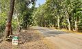
Badgaon-Kapsi section on Chhattisgarh State Highway 25
-
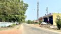
Forest Colony Kapsi


Notable persons
External links
References
- ↑ [1]
- ↑ https://cgclimatechange.com/about-chhattisgar/
- ↑ "छोटेकापसी पुल के पास देवदा नदी में फैली जलकुंभी पानी हो रहा दूषित". Naidunia.com. 13 June 2022.
- ↑ https://www.britannica.com/place/Dandakaranya#ref88411
- ↑ "Significance in Dandakaranya". Encyclopedia Britannica.
- ↑ "लबालब भरा जलाशय देखने उमड़ रही भीड़". 12 August 2022.