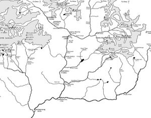
Vasuki Ganga
| Author:Laxman Burdak, IFS (R) |


Vasukiganga (वासुकी गंगा) is a river that flows through Uttarakhand, India. It is a tributary of the Mandakini River. The source of the Vasuki Ganga is the Vasuki Tal, a small glacial lake located in the glacial trough east of Chor Gamak glacier, near Kedarnath.
Variants
- Vasuki Ganga River (वासुकी गंगा नदी)
- Vasukiganga River
- Vasuki Tal (वासुकी ताल)
Origin
Gets name from King Vasuki Naga.
History
Mandakini originates from the Chorabari Glacier near Kedarnath in Uttarakhand, India. Mandakini is fed by Vasukiganga River at Sonprayag. Mandakini joins Alaknanda at Rudraprayag. Alaknanda then proceeds towards Devaprayag where it joins Bhagirathi River to form the Ganges River. Mandakini river flows along NH-107 in Rudraprayag district and turns violent during monsoon, often destroying parts of the highway and adjoining villages.[1]
There is mention of Vasuki river also known as Son river which is a small river and flows in downside of Kedarnath hills. Son is also known as Vasuki Ganga. [2] Confluence of the rivers Vasuki Ganga and Mandakini is known as Sonprayag/Vasukiprayag is situated at 14 kilometer distance from famous Triyuginarayan temple (site where Lord Shiva and Parvati got married together.). Five kilometer pedestrian distance from here.
The place where this Vasukiprayag/Sonprayag is situated is known as Bhilangana region. [3] confluence of two rivers that are called sangam in rest of the India, they are known as prayag in Uttarakhand, India.
वासुकी गंगा
मंदाकनी का स्रोत केदारनाथ के निकट चाराबाड़ी हिमनद है। सोनप्रयाग में यह नदी वासुकिगंगा नदी द्वारा जलपोषित होती है। रुद्रप्रयाग में मन्दाकिनी नदी अलकनन्दा में मिल जाती है। उसके बाद अलकनन्दा वहाँ से बहती हुई देवप्रयाग की ओर बढ़ती है, जहाँ बह भागीरथी से मिलकर गंगा नदी का निर्माण करती है।
वासुकी ताल केदारनाथ से 8 किमी की दूरी पर और समुद्रतल से 4135 मी की ऊँचाई पर स्थित है। यह झील शानदार हिमालय पर्वतश्रृंखलाओं के बीच स्थित है और उत्तराखण्ड का महत्वपूर्ण पर्यटक गंतव्य है।
गौरीकुंड में वासुकी गंगा केदारनाथ से वासुकी ताल होते हुए मंदाकिनी में मिलती है. यहाँ से केदारनाथ की दूरी 14 किलोमीटर है. यहीं से केदारनाथ के लिए पैदल रास्ता प्रारंभ होता है। गौरीकुंड में, केदारनाथ से 13 किलोमीटर नीचे, मंदाकिनी के दाहिने तट पर, गर्म पानी के दो सोते हैं (५३°C और २३°C)। एक दूसरा गर्म सोता ठीक बद्रीनाथ मंदिर के नीचे है जिसका तापमान ४९०°से. है। ऐतिहासिक दृष्टि से गौरीकुंड प्राचीन काल से विद्यमान है। लेकिन एच.जी. वाल्टन ने ब्रिटिश गढ़वाल अ गजटियर में लिखा है कि गौरीकुंड मंदाकिनी के तट पर एक चट्टी थी। यहां गौरा माई – गौरी को समर्पित – का सुंदर एवं प्राचीन मंदिर देखने योग्य है। यहां अत्यधिक समर्पण भाव के साथ संध्याकालीन आरती की जाती है। पावन मंदिरगर्भ में शिव और पार्वती की धात्विक प्रतिमाएं विराजमान हैं। यहां एक पार्वतीशिला भी विद्यमान है जिसके बारे में माना जाता है कि पार्वती ने यहां बैठकर ध्यान लगाया था।
वासुकी ताल
समुद्री तल से 4,150 मीटर की ऊंचाई पर शांत वातावरण में स्थित इस झील से चौखंबा चोटी एवं मंदाकिनी घाटी के आकर्षक परिदृश्य दिखाई देता है। केदारनाथ से वासुकी ताल अथवा वासुकी झील तक की निरंतर चढ़ाई, उसे बेहतरीन ट्रैक बनाती है। पहली बार ट्रैकिंग करने वालों के लिए गौरीकुंड से इस झील तक का ट्रैक बेहद उपयुक्त है। 24 किलोमीटर लंबा रास्ता तय करने के लिए आपके पास अगर समय की कमी है अथवा हिम्मत नहीं है तो टट्टू की सवारी करके आप सबसे पहले गौरीकुंड से केदारनाथ मंदिर तक पहुंच सकते हैं। मंदिर से झील तक पहुंचने के लिए 8 किलोमीटर का रास्ता रह जाता है, जो आसानी से तय किया जा सकता है। केदारनाथ से वासुकी ताल तक का रास्ता दिन के समय में सरलता से तय कर सकते हैं। हिंदुओं की पौराणिक कथाओं के अनुसार, रक्षा बंधन के पावन पर्व पर भगवान विष्णु इस झील में स्नान करते हैं। [4]
External links
References
- ↑ https://en.wikipedia.org/wiki/Mandakini_River
- ↑ Source:- Aitihasik Sthanavali (A book written by Vijayendra Kumar Mathur and published by Rajasthan Hindi Granth Akadami, Jaipur).
- ↑ shloka-23, chapter-44, Kedarakhanda, Skandapurana.
- ↑ https://www.incredibleindia.org/content/incredible-india-v2/hi/destinations/kedarnath/vasuki-tal.html

