
Greenwich
| Author:Laxman Burdak, IFS (R) |

Greenwich (ग्रीनिच) is an area of South East London, England. It is within the Royal Borough of Greenwich, to which it lends its name. Historically it was in the county of Kent for hundreds of years,[1] then the County of London from 1889 to 1965. Author visited Greenwich on 11.08.2018 and provided images and other information.
Variants
- Greenwich (ग्रीनिच) (AS, p.721)
- Greenwich Park
History
The place-name 'Greenwich' is first attested in an Anglo-Saxon charter of 918, where it appears as Gronewic. It is recorded as Grenewic in 964, and as Grenawic in the Anglo-Saxon Chronicle for 1013. It is Grenviz in the Domesday Book of 1086, and Grenewych in the Taxatio Ecclesiastica of 1291. The name means 'green wic', indicating that Greenwich was what is known as a -wich town or emporium, from the Latin 'vicus'.[2]
The settlement later became known as East Greenwich to distinguish it from West Greenwich or Deptford Strond, the part of Deptford adjacent to the River Thames,[3] but the use of East Greenwich to mean the whole of the town of Greenwich died out in the 19th century. However, Greenwich was divided into the registration subdistricts of Greenwich East and Greenwich West from the beginning of civil registration in 1837, the boundary running down what is now Greenwich Church Street and Crooms Hill, although more modern references to "East" and "West" Greenwich probably refer to the areas east and west of the Royal Naval College and National Maritime Museum corresponding with the West Greenwich council ward. An article in The Times of 13 October 1967 stated:[4]
- East Greenwich, gateway to the Blackwall Tunnel, remains solidly working class, the manpower for one eighth of London's heavy industry. West Greenwich is a hybrid: the spirit of Nelson, the Cutty Sark, the Maritime Museum, an industrial waterfront and a number of elegant houses, ripe for development.
Early settlement: Tumuli to the south-west of Flamsteed House,[5] in Greenwich Park, are thought to be early Bronze Age barrows re-used by the Saxons in the 6th century as burial grounds. To the east between the Vanbrugh and Maze Hill Gates is the site of a Roman villa or temple. A small area of red paving tesserae protected by railings marks the spot. It was excavated in 1902 and 300 coins were found dating from the emperors Claudius and Honorius to the 5th century. This was excavated by the Channel 4 television programme Time Team in 1999, broadcast in 2000,[6] and further investigations were made by the same group in 2003.[7]
The Roman road from London to Dover, Watling Street crossed the high ground to the south of Greenwich, through Blackheath. This followed the line of an earlier Celtic route from Canterbury to St Albans.[8]As late as Henry V, Greenwich was only a fishing town, with a safe anchorage in the river.[9]
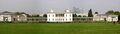
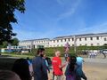
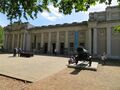
Greenwich is notable for its maritime history and for giving its name to the Greenwich Meridian (0° longitude) and Greenwich Mean Time. The town became the site of a royal palace, the Palace of Placentia from the 15th century, and was the birthplace of many Tudors, including Henry VIII and Elizabeth I. The palace fell into disrepair during the English Civil War and was demolished to be replaced by the Royal Naval Hospital for Sailors, designed by Sir Christopher Wren and his assistant Nicholas Hawksmoor. These buildings became the Royal Naval College in 1873, and they remained a military education establishment until 1998 when they passed into the hands of the Greenwich Foundation. The historic rooms within these buildings remain open to the public; other buildings are used by University of Greenwich and Trinity Laban Conservatoire of Music and Dance.
The town became a popular resort in the 18th century and many grand houses were built there, such as Vanbrugh Castle (1717) established on Maze Hill, next to the park. From the Georgian period estates of houses were constructed above the town centre. The maritime connections of Greenwich were celebrated in the 20th century, with the siting of the Cutty Sark and Gipsy Moth IV next to the river front, and the National Maritime Museum in the former buildings of the Royal Hospital School in 1934.
Sites of interest

Thames River front: The Cutty Sark (a clipper ship) has been preserved in a dry dock by the river. A major fire in May 2007 destroyed a part of the ship, although much had already been removed for restoration. Nearby for many years was also displayed Gipsy Moth IV, the 54 feet yacht sailed by Sir Francis Chichester in his single-handed, 226-day circumnavigation of the globe during 1966–67. In 2004, Gipsy Moth IV was removed from Greenwich, and after restoration work completed a second circumnavigation in May 2007. On the riverside in front of the north-west corner of the hospital is an obelisk erected in memory of Arctic explorer Joseph René Bellot.

The Foot Tunnel entrance: Near the Cutty Sark site, a circular building contains the entrance to the Greenwich foot tunnel, opened on 4 August 1902. This connects Greenwich to the Isle of Dogs on the northern side of the River Thames. The north exit of the tunnel is at Island Gardens, from where the famous view of Greenwich Hospital painted by Canaletto can be seen. The Greenwich Foot Tunnel runs under the River Thames between Cutty Sark Gardens and Island Gardens, on the Isle of Dogs. It is 1,217 feet in length and approximately 50 feet deep. Its original purpose was to allow south London residents to work in the docks on the Isle of Dogs. It was designed by Sir Alexander Binnie and was opened on 4 August 1902 at a cost of £127,000. The tunnel is lined with 200,000 glazed white tiles. The circular entrance buildings are similar both sides of the river and contain a lift and a long spiral flight of stairs. It is open 24 hours a day, although the lifts do not always run the full time.[10]
Rowing has been part of life on the river at Greenwich for hundreds of years and the first Greenwich Regatta was held in 1785. The annual Great River Race along the Thames Tideway finishes at the Cutty Sark. The nearby Trafalgar Rowing Centre in Crane Street is home to Curlew and Globe rowing clubs.

The Old Royal Naval College is Sir Christopher Wren's domed masterpiece at the centre of the heritage site. The site is administered by the Greenwich Foundation and several of the buildings are let to the University of Greenwich and one, the King Charles block, to Trinity College of Music. Within the complex is the former college dining room, the Painted Hall, this was painted by James Thornhill, and the Chapel of St Peter and St Paul, with an interior designed by James 'Athenian' Stuart. The Naval College had a training reactor, the JASON reactor, within the King William building that was operational between 1962 and 1996. The reactor was decommissioned and removed in 1999.
Trinity Hospital, Greenwich:To the east of the Naval College is the Trinity Hospital almshouse, founded in 1613, the oldest surviving building in the town centre.This is next to the massive brick walls and the landing stage of Greenwich Power Station. Built between 1902 and 1910 as a coal-fired station to supply power to London's tram system, and later the London underground, it is now oil- and gas-powered and serves as a backup station for London Underground. East Greenwich also has a small park, East Greenwich Pleasaunce, which was formerly the burial ground of Greenwich Hospital.
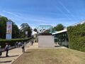
Greenwich Park: South of the former Naval College is the National Maritime Museum housed in buildings forming another symmetrical group and grand arcade incorporating the Queen's House, designed by Inigo Jones. Continuing to the south, Greenwich Park is a Royal Park of 183 acres, laid out in the 17th century and formed from the hunting grounds of the Royal Palace of Placentia.
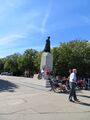
The park rises towards Blackheath and at the top of this hill is a statue of James Wolfe, commander of the British expedition to capture Quebec.[11] Nearby a major group of buildings within the park includes the former Royal Observatory, Greenwich; the Prime Meridian passes through this building.

The Wolfe statue: On top of the same hill as the Old Greenwich Royal Observatory is a statue of General James Wolfe, (1727-59) looking out towards the river. General Wolfe commanded the British forces at Quebec against the French and won a great victory, at the cost of his life. He was a resident of Greenwich and is buried in the parish church, St Alfege's.
The statue was erected in 1930 and bears the inscription "This monument, a gift of the Canadian people, was unveiled by the Marquis de Montcalm". On a personal note, my father formed part of the Honour Guard of Boy Scouts at the unveiling ceremony.
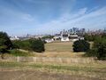
The area around the statue gives the grand view over Greenwich, embracing the Queen's House, the National Maritime Museum and the Old Royal Naval College, with the Isle of Dogs across the river, with the dome of St Pauls and other tall buildings in the City of London and the Canary Wharf area. This is probably the most photographed view in Greenwich.[12]
Royal Observatory, Greenwich

Royal Observatory, Greenwich is an observatory situated on a hill in Greenwich Park in south east London, overlooking the River Thames to the north. It played a major role in the history of astronomy and navigation, and because the Prime Meridian passes through it, it gave its name to Greenwich Mean Time, the precursor to today's Coordinated Universal Time (UTC). ROG, the National Maritime Museum, the Queen's House and the clipper ship Cutty Sark are collectively designated Royal Museums Greenwich.[13]
The observatory was commissioned in 1675 by King Charles II, with the foundation stone being laid on 10 August. The old hilltop site of Greenwich Castle was chosen by Sir Christopher Wren, a former Savilian Professor of Astronomy; as Greenwich Park was a royal estate, no new land needed to be bought.[14] At that time the king also created the position of Astronomer Royal, to serve as the director of the observatory and to "apply himself with the most exact care and diligence to the rectifying of the tables of the motions of the heavens, and the places of the fixed stars, so as to find out the so much desired longitude of places for the perfecting of the art of navigation." He appointed John Flamsteed as the first Astronomer Royal. The building was completed in the summer of 1676.[15] The building was often called "Flamsteed House", in reference to its first occupant.
The scientific work of the observatory was relocated elsewhere in stages in the first half of the 20th century, and the Greenwich site is now maintained almost exclusively as a museum, although the AMAT telescope became operational for astronomical research in 2018.
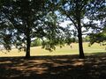
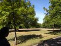
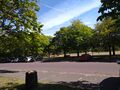
Greenwich Park
Greenwich Park is a former hunting park in Greenwich and one of the largest single green spaces in south-east London. One of the Royal Parks of London, and the first to be enclosed (in 1433), it covers 74 hectares (180 acres),[16] and is part of the Greenwich World Heritage Site. It commands views over the River Thames, the Isle of Dogs and the City of London (Simon Jenkins rated the view of the Royal Hospital with Canary Wharf in the distance as one of the top ten in England).[17]
The park is open year-round. It is listed Grade I on the Register of Historic Parks and Gardens.[18] In 2020, it was awarded a National Lottery grant to restore its historic features, build a learning centre, enhance the park's biodiversity, and provide better access for people with disabilities.[19]
History: The estate of some 200 acres (81 ha) was originally owned by Saint Peter's Abbey, Ghent, but reverted to the Crown in 1427 and was given by Henry VI to his uncle Humphrey, Duke of Gloucester.[20] He built a house by the river, Bella Court, and a small castle, called Greenwich Castle or Duke Humphrey's Tower, on the hill. The former evolved first into the Tudor Palace of Placentia and then into the Queen's House and Greenwich Hospital. Greenwich Castle, by now in disrepair, was chosen for the site of the Royal Observatory by Charles II in 1675, on the advice of Sir Christopher Wren.
As a result of this decision, the Greenwich Prime Meridian crosses Greenwich Park, passing due north and south of the Royal Observatory. Perhaps surprisingly, its route is not marked on the ground.
In the 15th century the park was mostly heathland and probably used for hawking. In the next century, deer were introduced by Henry VIII for hunting, and a small collection of deer is maintained today in an area to the south east. James I enclosed the park with a brick wall, twelve feet high and 3 km long at a cost of £2000, much of which remains and defines the modern boundary. A small section of the boundary wall in the southwest corner of the park was formerly part of Montagu House, one time residence of Caroline of Brunswick, demolished in 1815, though Queen Caroline's bath (c. 1806) is preserved inside the park.
In the 17th century, the park was landscaped, possibly by André Le Nôtre who is known at least to have designed plans for it. The public were first allowed into the park during the 18th century. Samuel Johnson visited the park in 1763 and commented "Is it not fine?". The famous hill upon which the observatory stands was used on public holidays for mass 'tumbling'.[21]
In the 1830s a railway was nearly driven through the middle of the lower park on a viaduct but the scheme was defeated by intense local opposition. However, the London and Greenwich Railway was later extended beneath the ground via a cut-and-cover tunnel link between Greenwich and Maze Hill which opened in 1878 (the tunnel alignment is on the north side of the northern side of the park's boundary wall, running beneath the gardens of the National Maritime Museum and Queen's House).
In 1888 the park got a station of its own when Greenwich Park railway station was opened. The station was not successful, with most passengers preferring the older Greenwich station, and in 1917 Greenwich Park station and the associated line closed.
Greenwich Park was used for outdoor London scenes including representing the street, Constitution Hill in the 2009 film The Young Victoria starring Emily Blunt and Rupert Friend.
-
Greenwich-Park
-
Greenwich-Park
-
Greenwich-Park


Queen's House

Queen's House is a former royal residence built between 1616 and 1635 near Greenwich Palace, a few miles down-river from the City of London and now in the London Borough of Greenwich. It presently forms a central focus of what is now the Old Royal Naval College with a grand vista leading to the River Thames. Its architect was Inigo Jones, for whom it was a crucial early commission, for Anne of Denmark, the queen of King James VI and I. Queen's House is one of the most important buildings in British architectural history, being the first consciously classical building to have been constructed in the country. It was Jones's first major commission after returning from his 1613–1615 grand tour of Roman, Renaissance, and Palladian architecture in Italy.
Some earlier English buildings, such as Longleat and Burghley House, had made borrowings from the classical style, but these were restricted to small details not applied in a systematic way, or the building may be a mix of different styles.[2] Furthermore, the form of these buildings was not informed by an understanding of classical precedents. Queen's House would have appeared revolutionary to English eyes in its day. Jones is credited with the introduction of Palladianism with the construction of Queen's House, although it diverges from the mathematical constraints of Palladio, and it is likely that the immediate precedent for the H-shaped plan straddling a road is the Villa Medici at Poggio a Caiano by Giuliano da Sangallo.
Today the building is both a Grade I listed building and a scheduled monument, a status that includes the 115-foot-wide (35 m), axial vista to the River Thames. The house now forms part of the National Maritime Museum and is used to display parts of its substantial collection of maritime paintings and portraits.
Canary Wharf

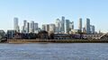
Canary Wharf is an area of London, England, located on the Isle of Dogs in the London Borough of Tower Hamlets. Canary Wharf is defined by the Greater London Authority as being part of London's central business district, alongside Central London.[22] With the City of London, it constitutes one of the main financial centres in the United Kingdom and the world,[23] containing many high-rise buildings including the third-tallest in the UK, One Canada Square,[24] which opened on 26 August 1991.[25]
Developed on the site of the former West India Docks, Canary Wharf contains around 16,000,000 sq ft of office and retail space. It has many open areas, including Canada Square, Cabot Square and Westferry Circus. Together with Heron Quays and Wood Wharf, it forms the Canary Wharf Estate, around 97 acres (39 ha) in area.
Greenwich Tour by Laxman Burdak
Laxman Burdak visited Greenwich on 11.8.2018 and provided images and some notes from tour diary as under:
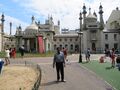
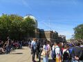
11.8.2018: ब्रजेस हिल (Burgess Hill) से ब्राइटन के लिए 7.30 पर Thameslink ट्रेन से रवाना हुआ. रिटर्न टिकट किराया 5.60 पॉन्ड. ब्राइटन (Brighton) इंग्लैंड के धुर दक्षिण में समुद्र के किनारे स्थित है. ब्राइटन में 1-मालबोरो प्लेस जो सेंट गैलस कालेज के सामने है वहाँ पहुँचा. यहाँ से डिस्कवरी-टूर की बस में ग्रीनविच और केमब्रिज यात्रा की टिकट बुक पहले से करली थी. टिकट 45 पॉन्ड का है. 8.45 बजे बस रवाना होती है और शाम 7.30 पर वापस छोडती है. हमारे साथ बस में गाइड मिस्टर एंड्रयू था. वह एक अच्छा आदमी है. बहुत तरीके से यात्रा में गाइड किया. रास्ते में उसने ब्राइटन का इतिहास भी बताया. ब्राइटन से रवाना होकर हम ब्लेक-हीथ (Blackheath) पहुँचे.
ब्राइटन का इतिहास: ब्राईटन में रॉयल पवेलियन या ब्राईटन पवेलियन सन 1815 में जॉर्ज चतुर्थ के आवास के लिए इंडो-इस्लामिक स्टाईल में बनाया गया था. 1830 में जॉर्ज चतुर्थ की मृत्यु हो गई थी. उनके पश्चातवर्ती विलियम चतुर्थ भी यहाँ रहे परंतु बाद में रानी विक्टोरिया को यह आवास पसंद नहीं आया था. प्रथम विश्व युद्ध में यह पवेलियन मिलिटरी हॉस्पिटल में बदल दिया गया था. घायल भारतीय सैनिकों का यहा ईलाज किया जाने लगा. कोई 720 बेड बनाये गए और कोई 2300 घायल सैनिकों का इलाज किया गया. कहते हैं इनके खाने और रहने के लिए हिंदु, सिख और मुस्लिम धर्म के अनुसार व्यवस्था की गई थी. अगस्त 1915 को किंग जार्ज पंचम यहाँ पधारे थे और भारतीय सैनिकों का सम्मान किया गया था.जनवरी 1916 में भारतीय सैनिकों के लिए यह अस्पताल बंद कर दिया गया था.
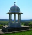
प्रथम विश्व युद्ध में 8 लाख से अधिक भारतीय सैनिकों ने ब्रिटिश सेना की तरफ से युद्ध लड़ा था. रॉयल पवेलियन में उपचार किए गए अधिकांश सैनिक ठीक हो गए थे परंतु 53 हिंदु और सिख सैनिकों का दाह संस्कार भारतीय परंपरा के अनुकूल ब्राईटन के निर्जन इलाक़े साउथ डाउन की पहाड़ी पर किया गया. उनकी अस्थियाँ इंग्लिश चैनल में विसर्जित की गई. इन सैनिकों की यादगार में यहाँ भारतीय स्टाईल की एक छतरी बनी हुई है. इस छतरी का लोकार्पण 1.2.1921 को एडवर्ड प्रिंस वेल्स द्वारा किया गया था. 20.8.1971 को इस छतरी का इंग्लिश हेरिटेज ग्रेड-2 का दर्जा दिया गया. 2018 के जून माह में शताब्दी समारोह का आयोजन छतरी स्थल पर किया गया और भारतीय सैनिकों के योगदान को याद किया. देवेंद्र सिंह ढीलों ने महत्वपूर्ण भूमिका अदा की.
ब्राइटन में स्थित भारतीय सैनिकों की स्मारक छतरी पर अंकित शहीदों की सूची उपलब्ध नहीं हो पाई है. इनमें अधिसंख्य भारत और पाकिस्तान के जाट थे.
ब्लेक-हीथ (Blackheath): हमारी टूरिस्ट बस ग्रीनविच पार्क के दक्षिण के गेट पर रुकी. दक्षिण में ब्लेक-हीथ गाँव पड़ता है. ब्लेक-हीथ ग्रीनविच से 2.5 किमी दक्षिण में स्थित है. अब यह लंदन का हिस्सा है और दक्षिण-पूर्वी लंदन का एक जिला है. पूर्व में यह केंट (Kent) राज्य के अंतर्गत आता था. केंट पर जट (Jute) लोगों का शासन रहा है. इस तथ्य की पुष्टि जाट इतिहासकारों और पश्चिमी इतिहासकारों से होती है. जाटों का इंग्लैंड में इतिहास नीचे संक्षेप में दिया गया है.
जाटों का इंग्लैंड में इतिहास:
दलीप सिंह अहलावत[26] लिखते हैं: जूट्स, सेक्सन्स और एंगल्स लोग जर्मनी की एल्ब नदी के मुहाने और डेन्मार्क के तट पर रहते थे। ये लोग बड़े बहादुर थे। ये क्रिश्चियन धर्म के विरोधी थे। ब्रिटेन से रोमनों के चले जाने के बाद ब्रिटेन के लोग बहुत कमजोर और असहाय थे। इन लोगों पर स्काटलैंड के केल्टिक कबीलों, पिक्ट्स और स्काट्स ने हमला कर दिया। ब्रिटेन निवासियों की इसमें भारी हानि हुई। इनमें इतनी शक्ति न थी कि वे इन हमलों करने वालों को रोक सकें। इसलिए मदद के लिए इन्होंने जट लोगों को बुलाया। जट्स ने उसी समय ब्रिटिश सरदार वरटिगर्न (Vortigern) के निमन्त्रण को स्वीकार कर लिया। जटलैण्ड से जाटों की एक विशाल सेना अपने जाट नेता हेंगिस्ट और होरसा (Hengest and Horsa) के नेतृत्व में सन् 449 ई० में केण्ट (Kent) में उतर गई। इन्होंने पिक्ट्स और स्कॉट्स को हराया और वहां से बाहर निकाल दिया। उन्हें भगाने के बाद जाट ब्रिटेन के लोगों के विरुद्ध हो गये और उन्हें पूरी तरह से अपने वश में कर लिया और 472 ई० तक पूरे केण्ट पर अधिकार कर लिया। यहां पर आबाद हो गये। इसके अतिरिक्त जाटों ने अपना निवास व्हिट द्वीप में किया[27]।
Alistair Moffat[28] writes...Vortigern is a title which is version of Vawr Tigherna, or Overlord, a Celtic description of a man who may have High King of southern Britain. Vortigern invited then Germanic Warriors of Horsa and Hengest, as the Picts of the North had been raiding in Britannia for at least a century - Gildas called them ‘transmarini’ - and the Vortigern or overlord needed mercenaries to contain them. It has been characterized as one of the most spectacular misjudgments in British history. The Anglo-Saxon Chronicle gives a more complete report of events:
449 AD: In this year Mauricius and Valentinian obtained the Kingdom and reigned seven years. In their days, Hengest and Horsa, invited by Vortigern, King of Britain, came to Britain at a place which is called Ypwines fleot (Ebbsfleet) at first to help the Britons, but later they fought against them. They then sent to Anglein, ordered them to send more aid and to be told off the worthlessness of the Britons and of the excellence of the Land. They then sent them more aid. These men came from three nations of Germany: from the Old Saxons, from the Angles, and from the Jutes.
Alistair Moffat[29] writes... The Vortigern wanted the Germanic warriors to go away from Britain. But they did not go. A Barbarians Rebellion flared in the South East, and it seems that three battles fought around London and Kent were lost by the British. The Germanic incomers seized more land and began to settle. Bede is clearest on the territory they took:
From the Jutes are descended the people of Kent and the Isle of Wight and those in the province of the West Saxons opposite the Isle of Wight who are called Jutes to this day.
From the Saxons - that is, the country now known as the land of the Old Saxons - came the East, South and West Saxons.
And from the Angles - that is, the country known as Angulus, which lies between the province of the Jutes and Saxons and is said to remain unpopulated to this day - are descended the east and the Middle Angles, the Mercians, all the Northumbrian stock (that is, those people living north of the River Humber), and other English peoples.
बलेक-हीथ नामकरण: बलेक-हीथ के नाम के बारे में कहते हैं यह नाम यहाँ की काली मिट्टी के खुले मैदान होने के कारण पड़ा है. पुरानी धारणा यह भी है कि 14 वीं शदी की काली-मौत या 1665 के प्लेग में हुई मौतों के नाम पर इसका नाम पड़ा हो. इन महामारियों में मारे गए लोगों को यहीं पर दफ़नाया जाता था. रोमन रोड जिसको बाद में वटलिंग स्ट्रीट नाम से जाना जाने लगा यह ब्लेक-हीथ के उत्तरी छोर से जाती है.
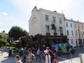
ग्रीनिच पार्क (Greenwich Park): ब्लेक-हीथ गाँव की तरफ के गेट पर बस ने छोड़ा और 12.45 बजे स्टोक्वेल स्ट्रीट पर मिलने का बताया. एक नक्शा भी दिया गया. यहाँ से ग्रीनिच पार्क के अंदर ब्लेक-हीथ एवेन्यू से रॉयल ओब्जरवेटरी ग्रीनिच (Royal Observatory, Greenwich) तक गए जो पहाड़ी की चोटी पर बनी है. ग्रीनविच पार्क, ग्रीनविच वर्ल्ड हेरिटेज साईट का हिस्सा है और 74 हेक्टर क्षेत्र में फैला हुआ है. यह अच्छा गार्डन है यहाँ चेस्ट-नट के बड़े-बड़े पेड़ लगे हुये हैं जो ब्रिटेन के अन्य बगीचों में भी बहुतायत से मिलते हैं.
ग्रीनविच : ग्रीनविच इंग्लैंड में दक्षिण-पूर्वी लंदन का एक भाग है. ऐतिहासिक रूप से सैंकड़ों वर्षों तह यह केंट काउंटी का भाग रहा[30] और 1889 से 1965 तक लंदन काउंटी का हिस्सा रहा.
रॉयल ओब्जर्वेटरी (Royal Observatory, Greenwich): ग्रीनिच पार्क में पहाड़ी के टॉप पर बनी है. जहाँ से टेम्स नदी और अनेक ऐतिहासिक भवन दिखाई देते हैं. रॉयल ओब्जर्वेटरी का ज्योतिष विज्ञान और नौका संचालन के क्षेत्र में महत्वपूर्ण स्थान रहा है. इसी ने ग्रीनविच मीन टाइम (GMT) का नाम दिया है. लन्दन के शाही ग्रीनिच वेधशाला के माध्य सौर समय को ग्रीनिच माध्य समय (Greenwich Mean Time / GMT) माना गया है. यह वहाँ की मध्यरात्रि से आरम्भ होता है (अर्थात मध्यरात्रि को समय = ०) . यह 1675 में किंग चार्ल्स II द्वारा स्थापित की गई थी.
रॉयल ओब्जर्वेटरी के पास पर जनरल जेम्स वोल्फ स्टेच्यु (2.1.1727 – 13. 9.1759) लगी है. General James Wolfe ने 1959 में इंग्लैंड के क्यूबेक (Quebec) अभियान का नेतृत्व किया था. इस युद्ध में उनको बहुत प्रसिद्धि दिलाई थी और उनको मरणोपरांत ‘क्यूबेक का हीरो’ का खिताब मिला. क्यूबेक अभियान की सफलता ने मॉन्ट्रियल कनाडा पर विजय प्राप्त करने में सहायता की.
ग्रीनिच पार्क में रॉयल ओब्जर्वेटरी से नीचे की तरफ ठीक सामने रानी का भवन है और नेशनल मेरीटाइम म्यूजियम है. उनके पीछे ग्रीनविच हॉस्पिटल है. यहीं ग्रीनविच मार्केट है. टेम्स नदी का मुहाना यहाँ बहुत सुंदर है. इसमें काफी नाव चलती हैं.
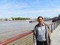
टेम्स या थेम्स इंग्लैंड की एक प्रमुख नदी है. लंदन टेम्स नदी के किनारे बसा है. थेस्म कभी व्यस्त जलमार्ग हुआ करता था. यह चैल्थनम में सेवन स्प्रिंग्स से निकलती है और ऑक्सफ़र्ड, रैडिंग, मेडनहैड, विंड्सर, ईटन, लंदन जैसे शहरों से होती हुई 346 किलोमीटर की यात्रा पूरी करके इंगलिश चैनल में जा गिरती है. अठ्ठारहवीं शताब्दी में यह दुनिया का सबसे व्यस्त जल मार्ग हुआ करता था, यहाँ तक कि इसमें जहाज़ तक चला करते थे. अधिकांश विद्वानों का मानना है कि थेम्स शब्द कैल्टिक भाषा के तमस शब्द से बना जिसका अर्थ है काला या अंधकारमय. संस्कृत में भी तमस का यही अर्थ है.
ग्रीनविच फूट टनल (Greenwich foot tunnel): ग्रीनविच में Cutty Sark के पास एक व्रताकर गोल बिल्डिंग है जो ग्रीनविच फूट टनल का प्रवेश द्वार है. यह जनता के लिए 4 अगस्त 1902 को खोला गया था. यह ग्रीनविच को टेम्स नदी के उस पार उत्तर में स्थित Isle of Dogs को जोड़ता है. यह टनल टेम्स नदी के नीचे से Cutty Sark Garden और Island Gardens रास्ता प्रदान करती है. यह 1,217 फीट लंबी और 50 फीट गहरी है. इसका मूल उद्देश्य लंडन वासियों को Isle of Dogs के डोक्स में काम करने की सुविधा प्रदान करना था.
ग्रीनविच पार्क से टेम्स नदी तक की संरचनाओं को 1997 में मैरीटाइम ग्रीनविच (Maritime Greenwich) नाम से विश्व धरोहर स्थल घोषित किया गया है.
ग्रीनिच (Greenwich) : ग्रीनिच वह जगह है जहाँ 0 डिग्री लोङ्गिट्यूड होता है इसलिए इसको ग्रीनिच मेरीडियन और ग्रीनिच मीन टाइम नाम से जाना जाता है. ग्रीनिच में रॉयल पैलेस बना है. यह कई Tudors, जिसमें प्रसिद्ध Henry VIII and Elizabeth I हैं, का जन्म स्थान है.
ग्रीनिच पूर्व नें केंट काउंटी का भाग था परंतु 1889 में लंडन काउंटी का हिस्सा हो गया था. 18वीं शती में ग्रीनविच का तेजी से विकास हुआ. Vanbrugh Castle का निर्माण 1717 में Maze Hill पर किया गया. रॉयल पैलेस 1443 में टेम्स नदी के किनारे हेनरी IV के समय में Humphrey, Duke of Gloucester ने बनवाया था. इसी स्थान पर बाद में ग्रीनविच हॉस्पिटल बना जो 1873 में रॉयल नवल कालेज बन गया. ओल्ड रॉयल नवल कालेज (Old Royal Naval College) में अब एक मेरी टाइम म्यूजियम (National Maritime Museum) बना है. यहाँ कट्टी शार्क (Cutty Sark) नाव का ढाँचा सुरक्षित किया हुआ है जो 2007 में आग से जलगई थी. अन्य भवन मेरीटाइम ग्रीनविच यूनिवर्सिटी (Greenwich Maritime University) के अधीन हैं.
ग्रीनिच यूनिवर्सिटी (Greenwich University): यह यूनिवर्सिटी आर्किटेचर, व्यापार, गणित , विज्ञान, अभियांत्रिकी, मानवविज्ञान, समाजविज्ञान, समुद्री विज्ञान, कम्प्यूटिंग आदि विषयों का अध्ययन करवाती है. वर्ष 2012 में इंग्लैंड में सबसे हरी-भरी यूनिवर्सिटी घोषित हुई है. यहाँ के पढ़े अनेक विद्यार्थियों ने विभिन्न क्षेत्रों में नाम कमाया है. 2009 का भौतिकी का नोबल प्राइज़ यहाँ के Charles Kao को प्राप्त हुआ है.
ग्रीनिच के पश्चिमी हिस्से का विकास बहुत तेजी से हुआ परंतु पूर्वी हिस्सा विकसित नहीं है. औद्योगीकरण में विकास के लिए यहीं के मजदूर काम करते थे. इन दोनों को अलग करने वाली जमीन के अंदर से टेमस नदी के नीचे से गुजरने वाली ब्लेकवाल टनल (Blackwall Tunnel) है जो इंजीनियरिंग का नायाब उदाहरण है. इसी टनल के अंदर से हम लोग केम्ब्रिज के लिए रवाना हुये. रास्ते में दाईं तरफ लंदन स्टेडियम है जहाँ ऑलिंपिक गेम्स के समय बहुत काम किया गया है.
Jat History: The ancient history of Greenwich is related with the ancient Jats. We give here the relevant part from History of Greenwich
The place-name 'Greenwich' is first attested in an Anglo-Saxon charter of 918, where it appears as Gronewic. It is recorded as Grenewic in 964, and as Grenawic in the Anglo-Saxon Chronicle for 1013. It is Grenviz in the Domesday Book of 1086, and Grenewych in the Taxatio Ecclesiastica of 1291. The name means 'green wic', indicating that Greenwich was what is known as a -wich town or emporium, from the Latin 'vicus'.[31]
Early settlement: Tumuli to the south-west of Flamsteed House,[32] in Greenwich Park, are thought to be early Bronze Age barrows re-used by the Saxons in the 6th century as burial grounds. To the east between the Vanbrugh and Maze Hill Gates is the site of a Roman villa or temple. A small area of red paving tesserae protected by railings marks the spot. It was excavated in 1902 and 300 coins were found dating from the emperors Claudius and Honorius to the 5th century. This was excavated by the Channel 4 television programme Time Team in 1999, broadcast in 2000,[33] and further investigations were made by the same group in 2003.[34]
Dalip Singh Ahlawat[35] writes that Jat Blood flows in the people of England as the Celts, Jutes, Angles, Saxons and Danes were descendants of Scythian Jats. This is evident from Jat Clans surnames still prevalent in England though they follow Christianity. [36]
For more details on Jat history in England see see Saxons
महाकाल
विजयेन्द्र कुमार माथुर[37] ने लेख किया है ...महाकाल (AS, p.721): उज्जैन में स्थित भगवान शिव का अति प्राचीन मंदिर है. इसका वर्णन कालिदास ने मेघदूत, (पूर्वमेघ, 36 तथा अनुवर्ती छंद में किया है--'अप्यन्यस्मिञ्जलधर महाकालमासाद्य काले, स्थातव्यं ते नयनविषयं यावदत्येति भानुः, कुर्वन् सन्ध्याबलिपटहतां शूलिनः श्लाघनीयाम्, आमन्द्राणां फलमविकलं लप्स्यसे गर्जितानाम्'--आदि.
रघुवंश 6,34 में इंदुमती-स्वयंवर के प्रसंग में अवंती नरेश के परिचय के संबंध में भी महाकाल का वर्णन है-- 'असौ महाकालनिकेतनस्य वसन्नदूरे किल चन्द्रमौलेः, तमिस्रपक्षेऽपि सह प्रियाभिर्ज्योत्स्नावतो निर्विशति प्रदोषान्'.
उज्जयिनी को प्राचीन काल में ज्योतिष-विद्या का घर माना जाता था. इस नगरी में प्राचीन काल में भारतीय कालक्रम की गणना का केंद्र होने के कारण भी महाकाल मंदिर का नाम सार्थक जान पड़ता है (प्राचीन भारत में ज्योतिष विद्या विशारदों ने कालक्रम मापने के लिए उज्जयिनी में शून्य ने अक्षांश की स्थिति मानी थी जैसा कि वर्तमान काल में ग्रीनिच में है). जयपुर नरेश जयसिंह द्वितीय ने एक प्रसिद्ध वेधशाला भी यहां बनवाई थी. महाकाल का मंदिर उज्जैन में आज भी है किंतु यह कालिदास द्वारा वर्णित प्राचीन मंदिर से अवश्य भिन्न है. प्राचीन मंदिर को गुलाम वंश के सुल्तान इल्तुतमिश ने 13वीं शती में नष्ट कर दिया था. नवीन मंदिर प्राचीन देवालय के स्थान पर ही बनाया गया जान पड़ता है. यह मंदिर भूमि के नीचे गहरे स्थान में बना हुआ है. पास ही शिप्रा नदी बहती है जिसका वर्णन कालिदास ने महाकाल मंदिर के प्रसंग में किया है.
Gallery of Images of Greenwich
-
-
Royal Pavalion Brighton
-
-
All Saints Church, Blackheath
-
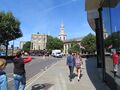
Greenwich-Park
-
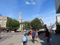
Greenwich-Park
-
Greenwich-Park
-
Royal Observatory, Greenwich
-
General James Wolfe Statue-Greenwich Park
-
View of Greenwich from Royal Observatory
-
The Queen's House viewed from the foot of Observatory Hill, Canary Wharf looms behind.
-
Canary Wharf viewed from the Greenwich riverside, near the Cutty Sark
-
Greenwich town
-
Greenwich town
-
Greenwich Meridian (0° longitude)
-
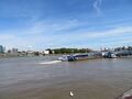
Boats at Greenwich in Thames River
-
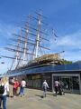
Greenwich Cuty Sark
-
Greenwich University
-
Greenwich University
-
Greenwich town
-
Greenwich-Gipsy Moth IV
-
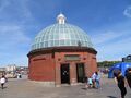
The Foot Tunnel entrance, Greenwich
-
Old Royal Naval College Greenwich
-
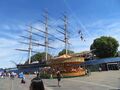
Greenwich-Cutty Sark
-
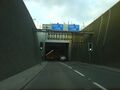
Blackwall tunnel southern portal


.JPG)


External links
Notable Jats
- Virender Choudhary - is the President (Students' Union) of University of Greenwich, London (U.K)
References
- ↑ John Bartholomew's Gazetteer of the British Isles, 1887: "Greenwich, parl. bor. and par., Kent, on river Thames"
- ↑ Eilert Ekwall, The Concise Oxford Dictionary of English Place-names, p. 204.
- ↑ "Parishes: Greenwich". british-history.ac.uk.
- ↑ "Greenwich-the instant village", Brandon Green, The Times, 13 October 1967; p. 11.
- ↑ Flamsteed House – designed and built by Sir Christopher Wren in 1675–76, was the home of the first Astronomer Royal, John Flamsteed, and the heart of Charles II's new Royal Observatory.
- ↑ "Roman remains". Royal Parks.
- ↑ "Greenwich London". Time Team. Channel 4. 2 February 2003.
- ↑ The Roman Watling Street: from London to High Cross O. Roucoux, (Dunstable Museum Trust, 1984) ISBN 0-9508406-2-9.
- ↑ "Parishes: Greenwich". british-history.ac.uk.
- ↑ The Foot Tunnel (Greenwich Guide)
- ↑ [1]
- ↑ General Wolfe Statue (Greenwich Guide)
- ↑ Rebekah Higgitt (6 September 2012). "Royal Observatory Greenwich, London". BSHS Travel Guide - A Travel Guide to Scientific Sites.
- ↑ "Greenwich and the Millennium". 2015.
- ↑ Robert Chambers, Book of Days
- ↑ "Greenwich Park". The Royal Parks.
- ↑ Jenkins, Simon (28 September 2013). "Our glorious land in peril" – via www.telegraph.co.uk.
- ↑ Historic England, "Greenwich Park (1000174)", National Heritage List for England,
- ↑ "Greenwich Park receives National Lottery millions to protect World Heritage Site". The Royal Parks.
- ↑ Barker, Felix (1999). Greenwich and Blackheath Past. Historical Publications. ISBN 0-948667-55-9.
- ↑ Cavendish, Dominic (18 June 2011). "Greenwich Fair: Where Dickens let his hair down". Daily Telegraph.
- ↑ Greater London Authority (January 2008). London's Central Business District: Its global importance (PDF). p. 6. ISBN 978-1-84781-109-7.p.6
- ↑ Greater London Authority (January 2008). London's Central Business District: Its global importance (PDF). ISBN 978-1-84781-109-7.p.4
- ↑ https://skyscraperpage.com/diagrams/?countryID=133
- ↑ A. Beaumont (2015). Contemporary British Fiction and the Cultural Politics of Disenfranchisement: Freedom and the City (illustrated ed.). Springer. p. 40. ISBN 9781137393722.
- ↑ Jat History Dalip Singh Ahlawat/Chapter IV, pp.399
- ↑ आधार लेख - इंगलैण्ड का इतिहास पृ० 16-17, लेखक प्रो० विशनदास; हिस्ट्री ऑफ ब्रिटेन पृ० 21-22, लेखक रामकुमार लूथरा, अनटिक्विटी ऑफ जाट रेस, पृ० 63-66, लेखक: उजागरसिंह माहिल; जाट्स दी ऐन्शन्ट रूलर्ज पृ० 86 लेखक बी० एस० दहिया तथा जाट इतिहास अंग्रेजी पृ० 43, लेखक ले० रामसरूप जून।
- ↑ Alistair Moffat: The British: A Genetic Journey, Birlinn, 2013,ISBN:9781780270753, p.173
- ↑ Alistair Moffat: The British: A Genetic Journey, Birlinn, 2013,ISBN:9781780270753, p.174
- ↑ John Bartholomew's Gazetteer of the British Isles, 1887: "Greenwich, parl. bor. and par., Kent, on river Thames"
- ↑ Eilert Ekwall, The Concise Oxford Dictionary of English Place-names, p. 204.
- ↑ Flamsteed House – designed and built by Sir Christopher Wren in 1675–76, was the home of the first Astronomer Royal, John Flamsteed, and the heart of Charles II's new Royal Observatory.
- ↑ "Roman remains". Royal Parks.
- ↑ "Greenwich London". Time Team. Channel 4. 2 February 2003.
- ↑ Jat History Dalip Singh Ahlawat/Chapter IV, p.401
- ↑ Ujagar Singh Mahil: Antiquity of Jat Race, p.66-70
- ↑ Aitihasik Sthanavali by Vijayendra Kumar Mathur, p.721