Konkanapura
| Author:Laxman Burdak, IFS (Retd.) |

Konkanapura was a Buddhist Kingdom visited by Xuanzang in 640 AD in Maharashtra.
Location
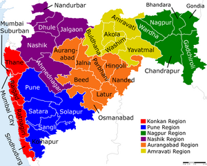
Boundaries - The precise definition of Konkan varies, it is roughly the land between the Western Ghats and the Arabian Sea, and between the Tapi river in the north and the Chandragiri River in the south. It includes the following districts of modern India: Thane, Mumbai, Raigad, Ratnagiri, Sindhudurg, North Goa, South Goa. The towns of Karwar, Ankola, Kumta, Honavar and Bhatkal fall within the Konkan.
Origin of name
Jat clan
History
Konkan or the Konkan Coast or sometimes simply Kokan is a rugged section of the western coastline of India. It is a 720 km long coastline. It consists of the coastal districts of western Indian states of Maharashtra and Goa. The ancient sapta-Konkan is a slightly larger region described in the Sahyadrikhanda which refers to it as "Parashuramakshetra".
The People
The Gabit, Gauda, Kuruba, Aagari and Kunbi tribals of Konkan are among the original settlers in the region. The Konkan region in Maharashtra and Goa constitutes of chitapavan konkanastha Brahmins.
Tribal communities in Konkan include Konkana, Warli and Kolcha in Southern Gujarat, Dadra and Nagarhaveli and Thane district of Maharashtra. Katkaris are found more in Raigad and also some in Ratnagiri district.
Visit by Xuanzang in 640 AD
Alexander Cunningham[1] writes that From Malayakuta the pilgrim returned to Dravida (Conjeveram), and then proceeded to the north-west for 2000 li, or 333 miles, to Kong-kien-na-pu-lo, or Konkanapura.[2] Both the bearing and distance point to Annagundi on the northern bank of the Tungabhadra river, which was the ancient capital of the country before the Muhammadan invasion. M. Vivien de Saint-Martin has suggested the old town of Banawasi, which is mentioned by Ptolemy as Banauasei. But the distance is rather too great, and the subsequent bearing to the capital of Maharashtra would be almost due north instead of north-west as stated by the pilgrim. Annagundi is a remarkable old site, and was the capital of a Yadava dynasty of princes before the foundation of the modern city of Vijayanagar on the southern bank of the river.[3]
According to Hamilton, the name of Konkana amongst the natives includes " much country lying to the east of the western ghats." This extension agrees with Abu Rihan's description of Danaka as the "plains of the Konkan" which can only apply to the table-land above the ghats. Such also may have been its application in the time of Hwen Thsang, as ho describes the kingdom as being 5000 li, or 833
[p.553]: miles, in circuit, which, if limited to the narrow strip of land between the ghats and the sea, would include the whole line of coast from Bombay to Mangalur. But in the seventh century the northern half of this tract belonged to the powerful Chalukya kingdom of Maharashtra ; and consequently, if the pilgrim's estimate of its size is correct, the kingdom of Konkana must have extended inland far beyond the line of the western ghats. Its actual limits are not mentioned, but as it was bounded by Dravida on the south, by Dhanakakata on the east, by Maharashtra on the north, and by the sea on the west, it may be described as extending along the coast from Vingorla to Kundapur, near Bednur, and inland from the neighbourhood of Kulbarga to the ancient fortress of Mad-giri, which would give a circuit of about 800 miles. This was the ancient kingdom of the Kadambas, which for a time rivalled that of the Chalukyas of Maharashtra. Hamilton states that the name of the country is pronounced Kokan by the natives, which suggests its identification with the people called Cocondae by Pliny, who occupied a middle position in the route from the south of India towards the mouth of the Indus.
References
- ↑ The Ancient Geography of India/Southern India, p.552-553
- ↑ Julien's ' Hiouen Thsang,' iii. 146. See Map No. I.
- ↑ Wilks' ' Mysore,' i. 14; note, quoting from the Mackenzie MSS.

