Bannu
| Author:Laxman Burdak, IFS (Retd.) |


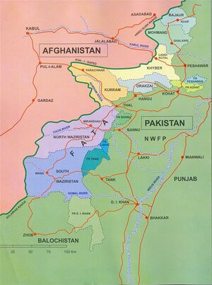
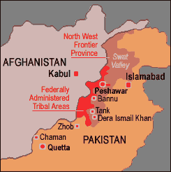
Bannu (बन्नू) is city and District in the Khyber Pakhtunkhwa Province of Pakistan.
Variants
- Bannu बन्नू, पाकिस्तान, (AS, p.607)
- Varnu (वर्णु) = Bannu बन्नू, पाकिस्तान, (AS, p.835)
- Varnava (वार्णव) (AS, p.845)
- Varnu River (वर्णुनदी) (AS, p.845)
Origin of the Name
- Bannu originated from Sanskrit word - Varnu. The ancient Indian name Varnu (वर्णु) is based on Jat clan Pannu. [1]
Mention by Panini
V. S. Agrawala[2] writes that Varnu (वर्णु) is a place name mentioned by Panini under Suvastvadi (सुवास्त्वादि) (4.2.77) group.
V. S. Agrawala[3] writes that Ashtadhyayi of Panini mentions janapada Varnu, under Kachchhadi (कच्छादि) (IV.2.133) (शैषिक अण्। काच्छ:)[4] and Sindhvadi (सिन्ध्वादि) (IV.3.93) (सोअस्याभिजन:,अण्। सैन्धव:)[5].
V. S. Agrawala[6] writes that Panini mentions name of River Varnu.
Varnu (वर्णु) is mentioned by Panini in Ashtadhyayi. [7]
V S Agarwal[8] mentions.... Varnava (वार्णव) (IV.2.77; IV.2.103). It was so called from its situation in the Varnu or Bannu valley.
History
V. S. Agrawala[9] writes that Panini mentions village name in category ending Kanthā (IV.2.142) - Panini gives the interesting information that Kantha ending was in use in Ushinara (II.4.20)
[p.68]: and Varnu (Bannu) (IV.2.103). He names the following places: Chihaṇakantha, Maḍarakantha, Vaitulakantha, Paṭatkakantha, Vaiḍalikarṇakantha, Kukkuṭakantha, Chitakaṇakakantha.
V. S. Agrawala[10] writes that Panini notices kantha-ending place names as being common in Varṇu (Bannu Valley) and the Usinara country between the lower course of the Chenab and Ravi River, and also instances some particular names such as Chihaṇa-kantham and
[p.468]: Maḍura-kantham, which rather appear as loan words (ante,p.67-68). In fact Kantha was a Scythian word for ‘town’, preserved in such names as Samarkand, Khokan, Chimkent etc.
The above data point to somewhat closer contacts between India and Persia during the reigns of Achaemenian emperors Darius (522-486 BC) and Xerxes (485-465 BC) as a result of their Indian conquests. This explains the use in India of such terms as Yavana, Parsu, Vrika, Kantha. To these we may add two others, viz. Jābāla (goat-herd) and hailihila (poison) mentioned by Panini (VI.2.38) which were really Semitic loan words.
This evidence points to Panini’s date somewhere after the time of these Achaemenian emperors.
Bannu is a very old city, founded in ancient times; however, the present location of the downtown Bannu was founded by Sir Herbert Edwardes in 1848, and was formerly called Edwardesabad and Dhulipnagar.

An inhabitant of Bannu is known as a Bannuchi.
At first Bannu was predominantly dwelt by Hindus. However, after the advent of Islam, through the efforts of Muslim saints and conquerors most of the population converted to Islam. Many Afghan tribes also settled here. Two major tribes named “Hanni” and “Mangal” settled here in Bannu. It is said that these two tribes settled here in twelfth or thirteenth century A.D. These two tribes were then kicked out of Bannu by a new invader named “Shah Farid Shithek”Then Shah Farid and his tribe got settled in Bannu . Most of the population of Bannu we see now a days are the descendants of Shah farid Shthak's tribe.
जाटों का विस्तार
डॉ रणजीतसिंह[11] भारत भूमि में जाटों के विस्तार को देखते हुए योगेन्द्रपाल शास्त्री [12] ने लिखा है कि ...."जाट अपने आदि देश भारतवर्ष के कोने-कोने में नहीं वरन उपजाऊ प्रदेशों की ऊंची भूमियों पर बसे हुए हैं। नदियों की अति निकटवर्ती खादर भूमि या पहाड़ों की तलहटी में उनकी सामूहिक विद्यमानता नहीं पाई जाती। डेरा गाजी खां, डेरा इस्माइल खां, डेरा फतेह खाँ, बन्नू, कोहाट, हजारा, नौशेरा, सियालकोट, गुजरात, गुजरान वाला, लायलपुर, मिंटगुमरी, लाहौर की चुनिया तहसील में कुल मिलाकर 25 लाख जाट आज भी बसे हुए हैं। यद्यपि इनका धर्म है इस्लाम है किंतु रक्त की दृष्टि से जाट होने का उन्हें गर्व है। विभाजित भारत में जाटों की संख्या किसी भी प्रकार कम नहीं है। "
बन्नू, पाकिस्तान
बन्नू, पाकिस्तान (AS, p.607) प्राचीन नाम वर्णु या वार्णव है. युवानच्वांग ने इसे फलन कहा है. उसके समय में इस क्षेत्र में बौद्ध धर्म का काफी प्रसार था.[13]
वार्णव
विजयेन्द्र कुमार माथुर[14] ने लेख किया है .....वार्णव (AS, p.845) नाम के नगर का उल्लेख पाणिनि की 'अष्टाध्यायी' 4, 2, 77 में हुआ है, जो वर्णुनद पर स्थित था। वर्तमान में 'बन्नू' (पाकिस्तान) से इस नगर का अभिज्ञान किया गया है। (दे. वर्णु)
वर्णु
विजयेन्द्र कुमार माथुर[15] ने लेख किया है .....वर्णु (AS, p.835) पाकिस्तान के वर्तमान 'बन्नू' शहर का प्राचीन नाम है, जिसे प्रसिद्ध चीनी यात्री युवानच्वांग ने फलन लिखा है।
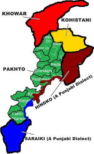
संस्कृत के प्रसिद्ध वैयाकरणाचार्य पाणिनि ने सबसे पहले चौथी शताब्दी ई. पू. में 'बन्नू' का ज़िक्र किया था और उसका प्राचीन नाम 'वरनु' (वर्णु) बताया था। इतिहासकारों को बन्नू के अकरा नामक क्षेत्र में मौजूद टीलों में अति प्राचीन सिन्धु घाटी सभ्यता के अवशेष मिले हैं। मध्य एशिया से आये बहुत से हमलावरों द्वारा छोड़े गए तरह-तरह के चिह्न भी यहाँ से प्राप्त हुए हैं। यहाँ के लोग पठान या पंजाबी हैं और इस पूरे क्षेत्र में 'पश्तो' और 'हिन्दको' (एक पंजाबी उपभाषा) बोली जाती है।[16]
बन्नू
बन्नू ख़ैबर-पख़्तूनख़्वा प्रदेश, पाकिस्तान का एक ज़िला है। प्राचीन समय में इस क्षेत्र को 'वर्णु' कहा जाता था। इस ज़िले के मुख्य शहर का नाम भी 'बन्नू' है। यहाँ बहुत-सी शुष्क पहाड़ियाँ हैं, हालांकि ज़िले में बहुत हरियाली दिखाई देती है और यहाँ की धरती बहुत उपजाऊ है। ब्रिटिश शासन काल में यहाँ के सौंदर्य के कारण बन्नू की तुलना स्वर्ग से की जाती थी।
यहाँ पानी मुख्य तौर पर वज़ीरिस्तान की पहाड़ियों से उत्पन्न होने वाली कुर्रम नदी और गम्बीला ( उर्फ़ टोची नदी) से आता है। बन्नू पहाड़ी इलाक़ा है, जिसके बीच में 100 कि.मी. लम्बी और 60 कि.मी. चौड़ी बन्नू वादी विस्तृत है।
इतिहास: सर्वप्रथम संस्कृत के प्रसिद्ध वैयाकरणाचार्य पाणिनि ने चौथी शताब्दी ईसा पूर्व में बन्नू का ज़िक्र किया था और उसका प्राचीन नाम 'वर्णु' बताया था। सातवीं सदी ईसवी में भारतीय उपमहाद्वीप आये प्रसिद्ध चीनी धर्मयात्री युवानच्वांग ने भी बन्नू का दौरा किया और वर्तमान अफ़ग़ानिस्तान में स्थित ग़ज़नी की नगरी तक गया। इतिहासकारों को बन्नू के 'अकरा' नामक क्षेत्र में मौजूद टीलों में अति प्राचीन सिन्धु घाटी सभ्यता के अवशेष मिले हैं और मध्य एशिया से आये बहुत-से हमलावरों द्वारा छोड़े गए तरह-तरह के चिह्न भी प्राप्त हुए हैं।
ब्रिटिश साम्राज्य के अधीन: जब पंजाब से सिक्ख साम्राज्य फैला तो बन्नू ज़िला भी उसका भाग बन गया, हालांकि यह एक पश्तून इलाक़ा है। जब अंग्रेज़ों ने पंजाब को ब्रिटिश राज का हिस्सा बनाया, तो बन्नू भी उसमें शामिल किया गया। यहाँ के फ़ौजी अड्डों से सेना की टुकड़ियां अक्सर टोची घाटी और वज़ीरिस्तान के क़बाइली क्षेत्रों में समय-समय पर क़ाबू पाने के लिए भेजी जाती थीं। ब्रिटिश ज़माने में ही फ़ौज के प्रयोग के लिए डेरा ग़ाज़ी ख़ान से बन्नू तक एक सड़क तैयार की गई थी।
पारसी ग्रंथ में उल्लेख: पारसी धर्म ग्रन्थ 'अवेस्ता' में भी बन्नू को 'वरन' के नाम से सम्बोधित किया गया और कहा गया है कि 'अहुर मज़्दा' (यानि परमात्मा) द्वारा दुनिया में बनाए गए 16 सर्वोतम जगहों में से यह एक है।
संदर्भ: भारतकोश-बन्नू
Visit by Fahian in 404 AD
James Legge[17] writes - Having stayed there till the third month of winter, Fa-hien and the two others,1 proceeding southwards, crossed the Little Snowy mountains.2 On them the snow lies accumulated both winter and summer. On the north (side) of the mountains, in the shade, they suddenly encountered a cold wind which made them shiver and become unable to speak. Hwuy-king could not go any farther. A white froth came from his mouth, and he said to Fa-hien, “I cannot live any longer. Do you immediately go away, that we do not all die here;” and with these words he died.3 Fa-hien stroked the corpse, and cried out piteously, “Our original plan has failed; — it is fate.4 What can we do?” He then again exerted himself, and they succeeded in crossing to the south of the range, and arrived in the kingdom of Lo-e,5 where there were nearly three thousand monks, students of both the mahayana and hinayana. Here they stayed for the summer retreat,6 and when that was over, they went on to the south, and ten days’ journey brought them to the kingdom of Poh-na,7 where there are also more than three thousand monks, all students of the hinayana. Proceeding from this place for three days, they again crossed the Indus, where the country on each side was low and level.8
1 These must have been Tao-ching and Hwuy-king.
2 Probably the Safeid Koh, and on the way to the Kohat pass.
3 All the texts have Kwuy-king. See chapter xii, note 13.
4 A very natural exclamation, but out of place and inconsistent from the lips of Fa-hien. The Chinese character {.}, which he employed, may be rendered rightly by “fate” or “destiny;” but the fate is not unintelligent. The term implies a factor, or fa-tor, and supposes the ordination of Heaven or God. A Confucian idea for the moment overcame his Buddhism.
5 Lo-e, or Rohi, is a name for Afghanistan; but only a portion of it can be here intended.
6 We are now therefore in 404.
7 No doubt the present district of Bannu, in the Lieutenant-Governorship of the Punjab, between 32d 10s and 33d 15s N. lat., and 70d 26s and 72d E. lon. See Hunter’s Gazetteer of India, i, p. 393.
8 They had then crossed the Indus before. They had done so, indeed, twice; first, from north to south, at Skardo or east of it; and second, as described in chapter vii.
Visit by Xuanzang in 644 AD
Alexander Cunningham[18] writes about 9. Falana or Banu: The name of Fa-la-na is mentioned only by Hwen Thsang, who places the country to the south-east of Ghazni, and at fifteen days' journey to the south of Lamghan.[19] It was 4000 li, or 666 miles, in circuit, and was chiefly composed of mountains and forests. It was subject to Kapisene, and the language of the people had a slight resemblance to that of Central India. Prom the bearing and distance, there is no doubt that Banu was the district visited by Hwen Thsang, from which it may be inferred that its original name was Varana, or Barna. This is confirmed by Fa-Hian, who calls the country by the shorter verrnacular name of Po-na, or Bana, which he reached in thirteen days from Nagarahara in going towards the south. Pona also is said to be three days' journey to the west of the Indus, which completes the proof of its identity with Banu, or the lower half of the
[p.85]: valley of the Kuram river. In the time of Fa-Hian the kingdom of Banu was limited to this small tract, as he makes the upper part of the Kuram valley a separate district, called Lo-i, or Roh.[20] But in the time of Hwen Thsang, when it had a circuit of more than 600 miles, its boundaries must have included the whole of the two large valleys of the Kuram and Gomal rivers, extending from the Safed Koh, or " Little Snowy Mountains " of Fa-Hian, to Sivastan on the south, and from the frontiers of Ghazni and Kandahar on the west to the Indus on the east.
I think it not improbable that the full name of this district, Falana or Barana, may have some connection with that of the great division of the Ghilji tribe named Buran, as the upper valleys of both the Kuram and Gomal rivers, between Ghazni and the Sulimani mountains, are now occupied by the numerous clans of the Sulimani Khel, or eldest branch of the Burgins. Iryub, the elder son of Buran, and the father of Suliman, is said to have given his name to the district of Haryub or Irydb, which is the upper valley of the Kuram river.
M. Vivien de St. Martin[21] identifies Falana with Vaneh, or Wanneh, of Elphinstone.[22] But Vana, or Wana, as the Afghans call it, is only a petty little tract with a small population, whereas Banu is one of the largest, richest, and most populous districts to the west of the Indus. Vana lies to the south-south-east, and Banu to the east-south-east of Ghazni, so that either of them will tally very well with the south-east direction noted by Hwen Thsang ; but Vana is from
[p.86]: 20 to 25 days' journey to the south of Lamghan, while Banu is just 15 days' journey as noted by the pilgrim. As Fa-Hian's notice of Banu dates as high as the beginning of the fifth century, I think that it may he identified with the Banagara of Ptolemy, which he places in the extreme north of Indo-Scythia, and to the south-south-east of Nagara or Jalalabad. A second town in the same direction, which he names Andrapana, is probably Draband or Deraband, near Dera Ismail Khan.
Hwen Thsang mentions a district on the western frontier of Falana, named Ki-kiang-na, the position of which has not yet been fixed. M. Vivien de St. Martin and Sir H. Elliot have identified it with the Kaikanan, or Kikan, of the Arab historians of Sindh ;[23] but unfortunately the position of Kaikanan itself is still undetermined. It is, however, described as lying to the north or north-east of Kachh Gandava, and as Kikiangna was to the west of Falana or Banu, it appears probable that the district intended must be somewhere in the vicinity of Pishin and Kwetta ; and as Hwen Thsang describes it as situated in a valley under a high mountain, I am inclined to identify it with the valley of Pishin itself, which lies between the Khoja Amran hills on the north, and the lofty Mount Takatu on the south. This position agrees with that of Kaikan, <arabic> given by Biladuri,[24] who says that it formed part of Sindh in the direction of Khorasan. This is further confirmed by the statement that Kaikan was on the road from Multan to Kabul, as the usual route between these places lies over the
[p.87]: Sakhi Sarwar Pass in the Sulimani mountains, and across the Pishin valley to Kandahar. A shorter, but more difficult, route is by the valley of the Gomal river to Ghazni. But as the valley of the Gomal belonged to Falana, it follows that the district of Kikiangna must have been somewhere in the neighbourhood of Pishin; and as this valley is now inhabited by the tribe of Khakas, it is not improbable that the name of Kikan, or Kaikan, may have been derived from them.
Jat Gotras in Bannu District
- Awan - The Awans (अवान) are an important tribe, exclusively Muhammadan, chiefly found in the Salt Range, where they possess an Awankari, but also widely spread to the east, south and west of that tract. Extending along the whole length of the Range from Jhelum to the Indus, they are found in great numbers throughout the whole country beyond it up to tho foot, of the Sulemans and the Safed Koh; though in trans-Indus Bannu they partly, and in Dera Ismail Khan wholly, merge in the Jats, a term which in those parts means little more than a nondescript peasant. In Peshawar the Awans are included in the hamsaya or faqir class. In Kohat towards Khushalgarh they resemble the Awans of the Salt Range, but elsewhere in that District are hardly distinguishable from the Bangash and Niazais among whom they live. [25]
- Hindki
- Lachau
- Punia - They are still found in large numbers in Dera Ghazi Khan and Bannu and there all of who are followers of Islam.[26]
- Talokar - The Talokar/Thalokar are a clan of Jat who claim to be the brothers of Sial and Tiwana (Tila.Sila and Taloka). That tribe accepted Islam on the hand of Baba Farid Shukar Gunj, who came from India and first settled near Bhera, village known as Kalara and Kurrar Talokar. Later they came west and settled permanently on the east side of the Indus River, known as Bakharra (Kacha) and Ding/Khola (Thal), now in Mianwali.
References
- ↑ Bhim Singh Dahiya: Jats the Ancient Rulers (A clan study)/Appendices/Appendix II,p.325,s.n.111
- ↑ V. S. Agrawala: India as Known to Panini, 1953, p.508
- ↑ V. S. Agrawala: India as Known to Panini, 1953, p.50
- ↑ V. S. Agrawala: India as Known to Panini, 1953, p.497
- ↑ V. S. Agrawala: India as Known to Panini, 1953, p.498
- ↑ V. S. Agrawala: India as Known to Panini, 1953, p.44
- ↑ V. S. Agrawala: India as Known to Panini, 1953, p. 43, 44, 68
- ↑ V S Agarwal: India as Known to Panini, p.70, sn.4.
- ↑ V. S. Agrawala: India as Known to Panini, 1953, p.68-69
- ↑ V. S. Agrawala: India as Known to Panini, 1953, p.467-468
- ↑ Jat Itihas By Dr Ranjit Singh/1.Jaton Ka Vistar,p. 6
- ↑ योगेद्रपाल, क्षत्रिय जातियों का उत्थान और पतन, पृष्ठ 271-73
- ↑ Aitihasik Sthanavali by Vijayendra Kumar Mathur, p.607
- ↑ Aitihasik Sthanavali by Vijayendra Kumar Mathur, p.845
- ↑ Aitihasik Sthanavali by Vijayendra Kumar Mathur, p.835
- ↑ भारतकोश-वर्णु
- ↑ A Record of Buddhistic Kingdoms/Chapter 14
- ↑ The Ancient Geography of India/Udyana, pp. 84-87
- ↑ H. Th., i. 265.
- ↑ Seal's Translation, c. 14, p. 50.
- ↑ ' Hiouen Thsang,' appendice iii.
- ↑ Elphinstone's ' Kabul,' ii. 156, 158.
- ↑ ' Hiouen Thsang,' iii. 185 ; Dowson's edition of Sir H. Elliot's ' Muhammadan Historians,' i. 381.
- ↑ Reinaud's 'Fragments Arabes, etc.,' p. 184.
- ↑ A glossary of the Tribes and Castes of the Punjab and North-West Frontier Province By H.A. Rose Vol II/A,pp.25-26
- ↑ Ram Sarup Joon: History of the Jats/Chapter V, p.97
Back to Jat Places in Pakistan/Mahabharata People/Mahabharata Places/Rivers in Mahabharata

