
Khandwa
| Author: Laxman Burdak IFS (R) |
- For another village of same name see - Khandwa Niwai

Khandwa (खंडवा) is a city and district in Madhya Pradesh. Formerly it was called East Nimar. Burhanpur District was created on August 15, 2003, from the southern portion of Khandwa District.
Origin
The name of the city is derived from Khandavavana (खांडववन), which literally means Khandav Forests.
Variants
Location
Khandwa is a major railway junction; the Malwa line connecting Indore with the Deccan meets the main east–west line from Mumbai to Kolkata.[5]
Geography
Khandwa District lies in the Nimar region, which includes the lower valley of the Narmada River. The Narmada forms part of the northern boundary of the district, and the Satpura Range form the southern boundary of the district. Burhanpur District, to the south, lies in the basin of the Tapti River. The pass through the Satpuras connecting Khandwa and Burhanpur is one of the main routes connecting northern and southern India, and the fortress of Asirgarh, which commands the pass, is known as the "Key to the Deccan". Betul and Harda districts lie to the east, Dewas District to the north, and Khargone District to the west.
Jat Gotras
Tahsils in Khandwa District
Villages in Khandwa tahsil
History
Ancient history: Recent explorations in the beds/tributaries of Narmada have revealed traces of the Paleolithic men in the East Nimar district. Omkar Mandhata, a rocky island on the bank of the Narmada river, about 47 miles north-west of Khandwa, is said to have been conquered by the Haihaya king Mahishmant, who had named the same as Mahishmati.[1]
During the rise of Buddhism, the East Nimar region was included in the Avanti Kingdom under Chandapradyota Mahesana, which was later added to the growing empire of Magadha by Shishunaga.
From the early 2nd century BCE to late 15th century CE, the Nimar Region (earlier a part of Khandesh) was ruled by many dynasties, which include Mauryas, Shungas, Early Satvahanas, Kardamakas, and Abhiras (Ahir Gavli).[2] Vakatakas, Imperial Guptas, Kalachuris,[3] Vardhanas (of Harsha Vardhana fame), Chalukyas, Rashtrakutas, Paramaras, Faruki Dynasty.[4]
Places of interest
- Ganguli House, the ancestral home of Ashok Kumar and Kishore Kumar. Also named Gauri Kunj, after their mother.[5]
- Samadhi of Kishore Kumar.[6]
- Four Kunds located in four directions of the city, called Padam Kund, Bheem Kund, Suraj Kund and Rameshwar Kund.[7]
- Dada Darbar, popularly known as Shri Dadaji Dhuniwale.
- Shree Vitthal Mandir Khandwa the temple was founded by shree swami sacchidanand swami maharj in 1850, temple is made up of sheesham and sagvan wood. Great example of architecture.
Notable persons
- Late B L Dhaka - Mob:9926013854
- Ajit Singh Patel- Thana Prabhari Mundi, Dist: Khandwa, Mob: 9425086166
- Hisalal Nathu ji jat- 9407455411
- Ramchandra Jat-milk dairy 6266548483
- Ashok Jat , milk dairy -- 9617680051
- Banshi lal Jat, milk dairy - 8959692764
- Moti Lal Jat , milk dairy- 8770509341
Gallery
-
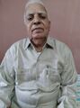
Shri Hisalal Nathu ji jat Khandwa.

External links
Source
- Santosh Kumar Thakur (Khenwar) 9826546968
References
- ↑ Subodh Kapoor (2002). Encyclopaedia of Ancient Indian Geography, Volume 2. Genesis Publishing Pvt Ltd. p. 435. ISBN 9788177552997.
- ↑ B.H. Mehta (1984). Gonds of the Central Indian Highlands Vol II. Concept Publishing Company. p. 569.
- ↑ "Kalachuris of Mahismati". CoinIndia.
- ↑ Charles Eckford Luard, Ram Prasad Dube (1908). Indore State Gazetteer. Superintendent government printing, India, Original from University of Minnesota. p. 221.
- ↑ Santoshi, Neeraj (4 August 2014). "Kishore Da's house lives in neglect in Khandwa". Hindustan Times.
- ↑ "Curfew drowns music riot on Kishore b'day". The Times of India. 3 August 2014.
- ↑ https://www.khandwa.nic.in/tourism.htm
Back to Madhya Pradesh