Kabul
| Author:Laxman Burdak, IFS (Retd.) |
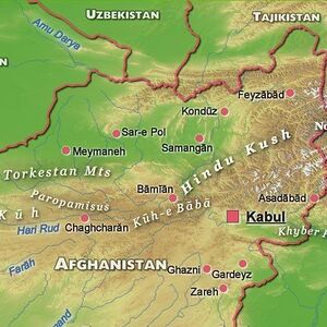
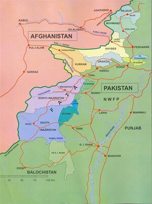
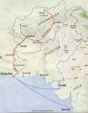
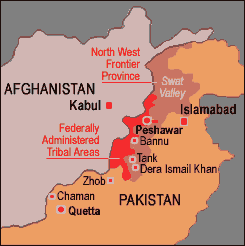
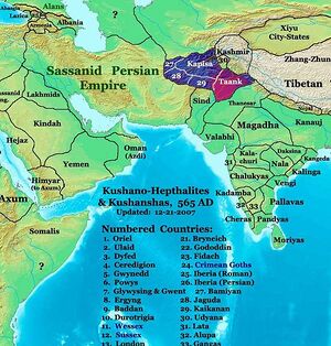
Kābul (Hindi: काबुल, Persian: کابل) is the capital and largest city of Afghanistan, with population of about 3 million people.
Variants of name
- Cophen (Anabasis by Arrian, p. 114, 189, 379.)
- Cophen River (Anabasis by Arrian, p. 247, 265.)
- Cophes (River ) (Pliny.vi.21)
- Cophen (City) (Pliny.vi.25)
- Kabul
- Kabura
- Kophene
- Kophes
- Khoes
- Khoaspes
- Urddhasthana
- Ortostana
- Hu-phi-na (by Hwen Thsang)
- Hu-pi-yan-na
- Fo-li-shi-sa-tang-na
- Kabul (काबुल) दे. Kubha (कुभा) (AS, p.167)
- Kumbha River (कुंभा) = Kubha River (कुभा) (काबुल नदी) (AS, p.198)
- Kubha कुभा (AS, p.202)
- Kubhakula कुभाकूल = Kabul काबुल दे. Kubha कुभा (AS, p.202)
Origin of name
Alexander Cunningham[1] writes that The name of Kophes (Kabul) is as old as the time of the Vedas, in which the Kubha river is mentioned as an affluent of the Indus. The Kunar River, the Kurram River, and the Gomal rivers to the west, and the Kunihar River to the east of the Indus, all of which are derived from the Scythian ku, " water."
Founders
It was founded by Darad gotra Jats. [2]
Location
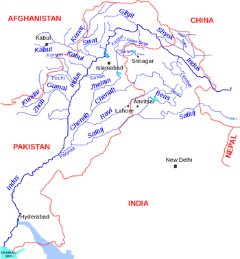
It is an economic and cultural center, situated 5,900 feet (1,800 m) above-sea-level in a narrow valley, wedged between the Hindu Kush mountains along the Kabul River. Kabul is linked with Ghazni, Kandahar, Herat and Mazar-e Sharif via a long beltway (circular highway) that stretches across the country. It is also linked by highways with Pakistan to the southeast and Tajikistan to the north.
Four rivers, Sardaryab River, Khialey River, Jindey River and Shalam River meet in Nisatta becoming a big river which the local Paskhtoon call Landey River (Kabul River) which flows along Nowshehra and at Kund (Attock) joins Abaseen (Indus River).
History
Kabul is over 3,000 years old. Many empires have long fought over the city, due to its strategic location along the trade routes of Southern and Central Asia. In 1504 Babur captured Kabul and used it as his headquarters until 1526, before his conquest of India. In 1776, Timur Shah Durrani made it the capital of modern Afghanistan.[3] The population of the city is multi-cultural and multi-ethnic, reflecting the diversity of the entire country. Kabul is currently in the process of being rebuilt following decades of wars and chaos.
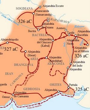
The city of Kabul is thought to have been established between 2000 BCE and 1500 BCE.[4] In the Rig Veda (composed between 1700–1100 BCE) the word "Kubhā" is mentioned, which appears to refer to the Kabul River. There is a reference to a settlement called Kabura by the Persian Achaemenids around 400 BCE which may be the basis for the use of the name Kabura by Ptolemy.[5] Alexander the Great conquered Kabul during his conquest of the Persian Empire. The city later became part of the Seleucid Empire before becoming part of the Mauryan Empire. The Bactrians founded the town of Paropamisadae near Kabul, but it was later ceded to the Mauryans in the 1st century BCE.
According to many noted scholars, the Sanskrit name of Kabul is Kamboj.[6] [7] [8] [9] It is mentioned as Kophes or Kophene in the classical writings. Gazetteer of Bombay Presidency 1904 maintains that the ancient name of Kabul was Kambojapura, which Ptolemy (160 CE) mentions as Kaboura (from Ka(m)bo(j)pura?). Hiuen Tsang refers to the name as Kaofu, which according to Dr. J. W. McCrindle [10], Dr Sylvain Lévi [11], Dr. B. C. Law [12], Dr. R. K. Mukkerji [13], N. L. Dey [14] and many other scholars [15], is equivalent to Sanskrit Kamboja (Kamboj/Kambuj). Kaofu was also the appellation of one of the five tribes of the Yuechi who had migrated from across the Hindukush into Kabul valley around Christian era [16]. According to some scholars, the fifth clan mentioned among the Tochari/Yuechi may have been a clan of the Kambojas [17]
The Greco-Bactrian Kingdom captured Kabul from the Mauryans in the early 2nd century BCE, then lost the city to their subordinates in the Indo-Greek Kingdom in the mid 2nd century BCE. Indo-Scythians expelled the Indo-Greeks by the mid 1st century BCE, but lost the city to the Kushan Empire nearly 100 years later. It was conquered by Kushan Emperor Kujula Kadphises in the early 1st century CE and remained Kushan territory until at least the 3rd century CE.[18][19] Kabul was one of the two capital cities of Kushans.
Around 230 CE the Kushans were defeated by the Sassanid Empire and were replaced by Sassanid vassals known as the Kushanshas or Indo-Sassanids. In 420 CE the Kushanshas were driven out of Afghanistan by the Chionites tribe known as the Kidarites, who were then replaced in the 460s by the Hephthalites. The Hephthalites were defeated in 565 CE by a coalition of Persian and Turkish armies, and most of the realm fell to those Empires. Kabul became part of the surviving Kushano-Hephthalite Kingdom of Kapisa, who were also known as Kabul-Shahan. The rulers of Kabul-Shahan built a huge defensive wall around the city to protect it from invaders. This wall has survived until today and is considered a historical site. Around 670 CE the Kushano-Hephthalites were replaced by the Shahi or Hindu- Shahi dynasty.
कुभा
विजयेन्द्र कुमार माथुर[20] ने लेख किया है ...कुभा (AS, p.202) - अफ़ग़ानिस्तान का वैदिक नाम- 'त्वं सिंधो कुभयागोमतीं क्रमुं मेहत्न्या सरथंयाभिरीयसे।' --ऋग्वेद, 10, 75-76 (नदी-सूक्त)। कुभा में उत्तर की ओर 'सुवास्तु' ( =स्वात) तथा दक्षिण की ओर 'क्रुमु' (=कुरुम) और गोमती (=गोमल) मिलती है। काबुल नगर 'काबुल' या 'कुभा' के तट पर ही बसा है। काबुल का नाम संभवत: 'कुभाकूल' (यथा गोमल=गोमल कूल) से बिगड़ कर बना है। चीनी यात्री सुंगयुन (520 ई. के लगभग) ने भारत की यात्रा के वृत्तांत में काबुल के देश का नाम 'किपिन' लिखा है। यह नाम संभवत: कुभा का ही रूपांतर है। कुभा का पाठांतर 'कुंभा' भी मिलता है। कुभा नदी काबुल नगर से 37 मील दूर सीरे चश्मा के सोते से निकलती है, जो कोहीबाबा पर्वत के नीचे है।
Mention by Pliny
Pliny[21] mentions 'The Nations of India'....From this place to the river Cophes18 and Peucolaitis, a city of India, is two hundred and thirty-seven miles; from thence to the river Indus and the city of Taxilla19 sixty; from thence to the famous river Hydaspes20 one hundred and twenty; and from thence to the Hypasis,21 a river no less famous, two hundred and ninety miles, and three hundred and ninety paces. This last was the extreme limit of the expedition of Alexander, though he crossed the river and dedicated certain altars22 on the opposite side. The dispatches written by order of that king fully agree with the distances above stated.
18 See c. 24 of the present Book.
19 The present Attok, according to D'Anville.
20 One of the principal rivers of that part of India known as the Punjaub. It rises in the north-western Himalayah mountains in Kashmere, and after flowing nearly south, falls into the Acesines or Chenab. Its present most usual name is the Jhelum.
21 The most eastern, and most important of the five rivers which water the country of the Punjaub. Rising in the western Himalaya, it flows in two principal branches, in a course nearly south-west (under the names respectively of Vipasa and Satadru), which it retains till it falls into the Indus at Mittimkote. It is best known, however, by its modern name of Sutlej, probably a corrupt form of the Sanscrit Satadru.
22 See c. 18 of the present Book. The altars there spoken of, as consecrated by Alexander the Great, appear to have been erected in Sogdiana, whereas those here mentioned were dedicated in the Indian territory.
Mention by Pliny
Pliny[22] mentions The Ariani and the adjoining Nations.... Arachosia3 has a river and a city of the same name; the city was built by Semiramis; by some writers it is called Cophen. The river Erymanthus4 flows past Parabeste5 which belongs to the Arachosii. Writers make the Dexendrusi come next, forming the boundary of the Arachotæ on the southern side, and of the Paropanisadæ on the north.
3 See the Notes in p. 50.
4 The principal river of Drangiana, which rises in the lower range of the Paropanisus or Hindoo Koosh, and enters Lake Zarah. Its present name is Ilmend or Helmend. Burnouf has supposed it to be the same as the Arachotus; but Professor Wilson is of opinion that the Arachotus was one of the tributaries of the Erymanthus or Erymandrus, and probably the modern Arkand-Ab.
5 Parisot takes the meaning of this word to be "valley," and is of opinion that it is the modern Chabul; not to be confounded, however, with the country of Cabul, to the east of which it is situate.
Mention by Pliny
Pliny[23] mentions The Ariani and the adjoining Nations..... the towns of Pucolis, Lyphorta, the desert of the Methorgi25, the river Manais26, the nation of the Acutri, the river Eorum, the nation of the Orbi, the Pomanus, a navigable river in the territories of the Pandares, the Apirus in the country of the Suari, with a good harbour at its mouth, the city of Condigramma, and the river Cophes27; into which last flow the navigable streams of the Saddaros28, the Parospus, and the Sodanus.
25 Parisot says that this is the desert region now known as Eremaier, to the east of Mount Maugracot.
26 As Parisot remarks, our author is now approaching the sea-shore; these places, however, do not appear to have been identified.
27 Not the same as the river Cophen or Cophes mentioned in c. 24, the modern Kabul. Hardouin takes it to be the same as the Arbis or Arabius of Ptolemy, the modern Hilmend or Ilmend.
28 Parisot seems to think that the modern names of these rivers are the Sal, the Ghir, and the Ilmentel, which, according to him, flow into the Ilmend.
Visit by Fahian in 402 AD
James Legge writes that When the processions of images in the fourth month were over, Sang-shao, by himself alone, followed a Tartar who was an earnest follower of the Law, and proceeded towards Kophene. Fa-hien and the others went forward to the kingdom of Tsze-hoh, which it took them twenty-five days to reach. Its king was a strenuous follower of our Law, and had (around him) more than a thousand monks, mostly students of the mahayana. Here (the travellers) abode fifteen days, and then went south for four days, when they found themselves among the Ts’ung-ling mountains, and reached the country of Yu-hwuy, where they halted and kept their retreat. When this was over, they went on among the hills for twenty-five days, and got to K’eeh-ch’a, there rejoining Hwuy-king and his two companions. [24]
Visit by Xuanzang 630 AD & 644 AD
Alexander Cunningham[25] writes about Kophene, or Kabul: The district of Kabul is first mentioned by Ptolemy, who calls the people Kubolitaea, and their capital Kabura,
[p.33]: which was also named Ortospana. The latter name alone is found in Strabo and Pliny, with a record of its distance from the capital of Arachosia, as measured by Alexander's surveyors, Diognetes and Baiton. In some copies of Pliny the name is written Orthospanum, which, with a slight alteration to Orthostana, as suggested by H. H. Wilson,[26] is most probably the Sanskrit Urddhasthana, that is, the " high place," or lofty city. The same name is also given to the Kabul district by the Chinese pilgrim Hwen Thsang. But I strongly suspect that there has been some accidental interchange of names between the province and its capital.
On leaving Ghazni, the pilgrim travelled to the north for 600 li, or 83 miles, to Fo-li-shi-sa-tang-na, of which the capital was Hu-phi-na. Now by two different measured routes the distance between Ghazni and Kabul was found to be 81 and 88½ miles.[27] There can be no doubt, therefore, that Kabul must be the place that was visited by the pilgrim. In another place the capital is said to be 700 li, or 116 miles, from Bamian, which agrees very well with the measured distance of 104 miles[28] between Bamian and Kabul, along the shortest route.
The name of the capital, as given by the Chinese pilgrim, has been rendered by M. Vivien de St. Martin as Vardasthana, and identified with the district of the Wardak tribe, while the name of the province has been identified with Hupian or Opian. But the Wardak valley, which receives its name from the "Wardak tribe, lies on the upper course of the
[p.34]: Logarh river, at some distance to the south, of Kabul, and only 40 miles to the north of Ghazni, while Hupian or Opian lies 27 miles to the north of Kabul, or more than 70 miles distant from Wardak. My own researches lead me to conclude that both names refer to the immediate neighbourhood of Kabul itself.
Professor Lassen has already remarked that the name of Kipin, which is so frequently mentioned by other Chinese authors, is not once noticed by Hwen Thsang. Remusat first suggested that Kipin was the country on the Kophes or Kabul river ; and this suggestion has ever since been accepted by the unanimous consent of all writers on ancient India, by whom the district is now generally called Kophene. It is this form of the name of Kipin that I propose to identify with the Hu-phi-na of Hwen Thsang, as it seems to me scarcely possible that this once famous province can have remained altogether unnoticed by him, when we know that he must have passed through it, and that the name was still in use for more than a century after his time.[29] I have already stated my suspicion that there has been some interchange of names between the province and its capital. This suspicion is strengthened when it is found that all difficulties are removed, and the most complete identification obtained, by the simple interchange of the two names. Thus Hu-phi-na will represent Kophene, or Kipin, the country on the Kabul river, and Fo-li-shi-sa-tang-na, or Urddhasthana, will represent Ortostana, which, as we know from several classical authorities, was the actual capital of this province.
[p.35]: I may remark that Huphina is a very exact Chinese transcript of Kophen, whereas it would be a very imperfect transcript of Hupian, as one syllable would be altogether unrepresented, and the simple p would be replaced by an aspirate. The correct transcript of Hupian would be Hu-pi-yan-na.
M. Vivien de St. Martin has objected[30] to the name of Urddhasthana that it is a " conjectural etymology without object." I am, however, quite satisfied that this reading is the correct one, for the following reasons : — 1st. The name of Ortospana is not confined to the Paropamisadae ; but is found also in Karmania and in Persis. It could not, therefore, have had any reference to the Wardak tribe, but must be a generic name descriptive of its situation, a requirement that is most satisfactorily fulfilled by Urddhasthana, which means literally the "high place," and was most probably employed to designate any hill fortress. 2nd. The variation in the reading of the name to Portospana confirms the descriptive meaning which I have given to it, as porta signifies "high " in Pushtu, and was, no doubt, generally adopted by the common people instead of the Sanskrit urddha.
The position of Ortospana I would identify with Kabul itself, with its Bala Hisar, or "high fort," which I take to be only a Persian translation of Ortospana, or Urddhasthana. It was the old capital of the country before the Macedonian conquest, and so late as the tenth century it was still believed " that a king was not properly qualified to govern until he had been inaugurated at Kabul."[31] Hekataeus also describes
[p.36]: a " royal town " amongst the Opiai,[32] but we have no data for determining either its name or its position. It seems most probable, however, that Kabul must he intended, as we know of no other place that could have held this position after the destruction of Kapisa by Cyrus ; but in this case Kabul must have been included within the territories of the Opiai.
It is strange that there is no mention of Kabul in the histories of Alexander, as he must certainly have passed through the town on his way from Arachosia to the site of Alexandria. I think, however, that it is most probably the town of Nikaia, which was Alexander's first march from his new city on his return from Bactria. Nikaia is described by Nonnus as a stone city, situated near a lake. It was also called Astakia, after a nymph whom Bacchus had abused.[33] The lake is a remarkable feature, which is peculiar in Northern India to Kabul and Kashmir. The city is also said to have been called Indophon, or "Indian-killer," on account of the victory which Bacchus had gained over the Indians on this spot. From this name I infer, that Nonnus had most probably heard of the popular meaning which is attributed to the name of Hindu-kush, or "Hindu-killer," and that he adopted it at once as corroborative of the Indian conquests of Dionysius.
[p.37]: The province is described as being 2000 li, or 333 miles, in length, from east to west, and 1000 li, or 166 miles, in breadth from north to south. It is probable that this statement may refer to the former extent of the province, when its king was the paramount ruler of Western Afghanistan, including Ghazni and Kandahar, as the actual dimensions of the Kabul district are not more than one-half of the numbers here stated. Its extreme length, from the sources of the Helmand river to the Jagdalak Pass, is about 150 miles, and its extreme breadth, from Istalif to the sources of the Logarh river, is not more than 70 miles.
The name of Kophes is as old as the time of the Vedas, in which the Kubha river is mentioned as an affluent of the Indus ; and as it is not an Arian word, I infer that the name must have been applied to the Kabul river before the Arian occupation, or, at least, as early as B.C. 2500. In the classical writers we find the Khoes, Kophes, and Khoaspes Rivers, to the west of the Indus, and at the present day we have the Kunar, the Kuram, and the Gomal rivers to the west, and the Kunihar river to the east of the Indus, all of which are derived from the Scythian ku, " water." It is the guttural form of the Assyrian hu in Euphrates and Eulaeus, and of the Turki su and the Tibetan chu, all of which mean water or river. The district of Kophene must, therefore, have received its name from the river which flowed through it, like as Sindh from the Sindhu or Indus, Margiana from the Margus, Aria from the Arius, Arachosia from the Arachotus, and others. It is not mentioned by Alexander's historians, although the river Kophes is noticed by all of them.
[p.38]:In Ptolemy's ' Geography ' the city of Kabura and the Kabolitae, with the towns of Arguda, or Argandi, and Locharna, or Logarh, are all located in the territories of the Paropamisadae along the Kabul river. Higher up the stream he places the town of Bagarda, which corresponds exactly in position, and very closely in name with the valley of Wardak. All the letters of the two names are the same; and as the mere transposition of the guttural to the end of the Greek name will make it absolutely identical with the modern name, there is strong evidence in favour of the reading of Bardaga instead of Bagarda. According to Elphinstone,[34] the Wardak tribe of Afghans occupy the greater part of the Logarh valley. This is confirmed by Masson,[35] who twice visited the district of "Wardak ; and by Vigne,[36] who crossed it on his way from Ghazni to Kabul. The only objection to this identification that occurs to me is, the possibility that Bagarda may be the Greek form of Vackereta, which is the name given in the ' Zend Avesta ' to the seventh country that was successively occupied by the Arian race. From its position between Bactria, Aria, and Arachosia, on one side, and India on the other, Vackereta has usually been identified with the province of Kabul. This, also, is the opinion of the Parsis themselves. Vackereta is further said to be the seat or home of Duzhak, which further tends to confirm its identification with Kabul, as the acknowledged country of Zohak. If the Wardaks had ever been a ruling tribe, I should be disposed to infer that the name of Vackereta might, probably, have been derived from them. But in our present total ignorance
[p.39]: of their history, I think that it is sufficient to note the very great similarity of the two names.
In the seventh century the king of Kophene was a Turk, and the language of the country was different from that of the people of Ghazni. Hwen Thsang mentions that the alphabet of Kapisene was that of the Turks, hut that the language was not Turki. As the king, however, was an Indian, it may reasonably be inferred that the language was Indian. For a similar reason it may be conjectured that the language of Kophene was some dialect of Turki, because the king of the district was a Turk.
Freedom movement
Raja Mahendra Pratap was a rare prince who voluntarily chose the path of a wandering pilgrim in quest of freedom of his motherland. Spurred by the conviction that freedom was not possible without revolutionary struggle and revolutionary struggle was not possible from within the country, he left India in 1914. He tried sincerely to liberate his motherland from British Raj. On 20th December 1914, at the age of 28, Raja Mahendra Pratap left India for European countries to liberate India from the clutches of the British colonial rule with outside support.
For the next three decades he relentlessly srtrived to arose the conscience of world community to help India free herself from the foreign yoke. In 1915, through Germany and Turkey, he made his way to Afghanistan. That year in Kabul, along with other Indian revolutionaries he established Provisional Government of Free India. He was the President and Maulana Barkatullah was the Prime Minister. On 1st December 1915, his 28th birthday, he established the first Provisional Government of India at Kabul in Afghanistan, during First World War. Anti-British forces supported his movement. Due to his revolutionary ideas he had good relation with Lenin. Lenin invited Raja Mahendra Pratap to Russia on its liberation and welcomed him. It was, however, an exercise tinged with disappointment and had a brief life. He had become a big menace for the foreign rule in India. The British Government of India declared a reward on his head, attached his entire estate and declared him a fugitive.
External Links
Website of Embassy of India, Kabul
References
- ↑ Alexander Cunningham: The Ancient Geography of India/Kabul,pp. 37
- ↑ Ram Swarup Joon:History of the Jats
- ↑ Britannica Concise Encyclopedia - Kabul.
- ↑ The history of Afghanistan, Ghandara.com website
- ↑ "Kabul" Chambers's Encyclopaedia: A Dictionary of Universal Knowledge (1901 edition) J.B. Lippincott Company, New York, page 385
- ↑ Ethnologische Forschungen und Sammlung von Material für dieselben, 1871, p 244, Adolf Bastian - Ethnology.
- ↑ The People of India: A Series of Photographic Illustrations, with ..., 1868, p 155, John William Kaye, Meadows Taylor, Great Britain India Office - Ethnology.
- ↑ Supplementary Glossary, p. 304, H. M. Elliot.
- ↑ Various Census of India, 1867, p 34.
- ↑ Alexander’s Invasion, p 38, J. W. McCrindle; Megasthenes and Arrian, p 180, J. W. McCrindle.
- ↑ Pre-Aryan and Pre-Dravidian in India, 1993 edition, p 100, Dr Sylvain Lévi, Jules Bloch, Jean Przyluski, Asian Educational Services - Indo-Aryan philology.
- ↑ Some Kṣatriya Tribes of Ancient India, 1924, p 235, Dr B. C. Law - Kshatriyas; Indological Studies, 1950, p 36; Tribes in Ancient India, 1943, p 3.
- ↑ Chandragupta Maurya and His Times, 1966, p 173, Dr Radhakumud Mookerji - History; Studies in Ancient Hindu Polity: Based on the Arthaṡâstra of Kautilya, 1914, p 40, Narendra Nath Law, Kauṭalya, Radhakumud Mookerji; The Fundamental Unity of India, 2004, p 86; The Fundamental Unity of India (from Hindu Sources), 1914, p 57, Dr Radhakumud Mookerji.
- ↑ Geographical Dictionary of ancient and Medieval India, Dr Nundo Lal Dey.
- ↑ The Modern Review, 1907, p 135, Ramananda Chatterjee - India; Literary History of Ancient India in Relation to Its Racial and Linguistic ..., p 165, Chandra Chakraberty; Prācīna Kamboja, jana aura janapada =: Ancient Kamboja, people and country, 1981, Dr Jiyālāla Kāmboja, Dr Satyavrat Śāstrī - Kamboja (Pakistan) etc.
- ↑ The Ancient Geography of India, p 15, A Cunningham.
- ↑ Ancient Kamboja, People and the Country, 1981, p 43, Dr J. L. Kamboj.
- ↑ Hill, John E. 2004. The Western Regions according to the Hou Hanshu. Draft annotated English translation...link
- ↑ Hill, John E. 2004. The Peoples of the West from the Weilue 魏略 by Yu Huan 魚豢: A Third Century Chinese Account Composed between 239 and 265 CE. Draft annotated English translation... Link
- ↑ Aitihasik Sthanavali by Vijayendra Kumar Mathur, p.202
- ↑ Natural History by Pliny Book VI/Chapter 21
- ↑ Natural History by Pliny Book VI/Chapter 25
- ↑ Natural History by Pliny Book VI/Chapter 25
- ↑ James Legge:A Record of Buddhistic Kingdoms/Chapter 4
- ↑ The Ancient Geography of India/Kabul,pp. 32-39
- ↑ 'Ariana Antiqua,' p. 176.
- ↑ Thornton's ' Gazetteer,' Appendix.
- ↑ Lieutenant Sturt, Engineers, by perambulator.
- ↑ Lassen, ' Points in the History of the Greek Eings of Kabul,' p. 102.
- ↑ 'Hiouen Thsang,' iii. 416.
- ↑ Ouseley, ' Oriental Geography,' p. 226.
- ↑ Steph. Byz. in v. 'Ωπiai.'<greek>
- ↑ 'Dionysiaca,' xvi. <greek> The meaning of which appears to be, that " Bacchus built a stone city, named Nkaia, near a lake, which he also called Astakia, after the nymph, and Indophon, in remembrance of his victory."
- ↑ Kabul; i. 160.
- ↑ ' Travels,' ii. 223.
- ↑ ' Ghazni,' p. 140.

