
Abujhmar
| Author:Laxman Burdak, IFS (R) |

Abujmarh (अबूझमाड़) is a hilly forest area, spread over 4,000 square kilometres (1,500 sq miles) in Chhattisgarh, covering Narayanpur district, Bijapur district and Dantewada district. Author (Laxman Burdak) visited it on 26.02.1986, 19.03.1986, 25.03.1986.
Variants
Etymology
The word abujmarh means "the unknown hills" (abuj means 'unknown' and marh means 'hill') in the Gondi language native to the region.[1][2]
It is mentioned as Dandakaranya, literally meaning "the abode of Dandaka", also finds mention in Ramayana.[3]
Jat Gotras Namesake
- Dandak = Dandakaranya = Abujhmar, a hilly forest area, spread over 4,000 square kilometres (1,500 sq miles) in Chhattisgarh, covering Narayanpur district, Bijapur district and Dantewada district.
Location
A tittle known and comparatively inaccessible tract of Madhya Pradesh (now Chhattisgarh), the Abujhmar or Marh, as it is conveniently referred to, extends over 3 tahsils Narayanpur, Bijapur and Dantewara of Bastar district. Roughly speaking, it comprises all the wild, hilly country bounded on the south by the Indrawati, on the north by the plains of Antagarh and Narayanpur, on the east by the country of Johrias and the valley of the Gudra river and the west by the Kotri river from Pratappur to its junction with the Indrawati. The tract extends in west beyond the borders of Bastar district into Chanda (now renamed as Chandrapur) district of Maharashtra State.[4]
History
It is home to indigenous tribes of India, including Gond, Muria, Abuj Maria, and Halbas. Geographically isolated and largely inaccessible, the area continues to show no physical presence of the civil administration.
In 2007 the area was proposed as a biosphere reserve by Ministry of Environment and Forests, Government of India.
It was only in 2009 that the Government of Chhattisgarh lifted the restriction on the entry of common people in the area imposed in the early 1980s.
The dense forests of Abujmarh have long been isolated from the outside world, inhabited largely the indigenous people, and accessible only via forest pathways starting from Narayanpur, Bijapur and Barsur. Geographically, the Indravati river segregates it from Bastar region, adding to its isolation.[5][6]
Recently the access to area has been further marred by heavy use of landmines by the insurgents at entry points.[7]
During the British rule in India, Abujmarh remained in isolation and constitutionally "excluded",[8] though a land survey was done in 1873.
Part of Bastar district, Abujhmar is inhabited by the primitive Maria tribe. The government has no records about them or the region, including land ownership details. The proposed survey will not only streamline revenue records but also help the government map the Naxalite terrain. [9]
After independence of India, its isolation continued, except when in 1958 the government refugees from East Bengal in the Dandakaranya area in the present Bastar division, and later the hills started getting exploited for its mineral wealth, like the Bailadila Hills excavated for its deposits of high-grade iron ore.[10] The tribals remained backward and exploited by prevalent feudalism in India,[11] majority of them started cultivation only recently, and education was undertaken only at small schools run either by NGOs and missionaries.[12] All these conditions, after 1967 gave rise to the Naxalite movement, which grew and spread over the coming decades.[13]
Abujmarh has been termed as "liberated zone", as due to its inaccessibility it remained untouched by any government presence and civil administration for the past 60 years and has developed a stronghold of Naxal-Maoist insurgents of the banned Communist Party of India (Maoist), which ran a parallel government, known as Janta Sarkar (People's government). Besides running its own military wing, People’s Liberation Guerrilla Army (PLGA) and training camps, Moaoist also runs small irrigation projects, courts known as jan adalat (People’s courts) and schools.[14] The Times of India reported the existence of one such schools, known as "Janta Sarkar Bhoomkaal School" at Metapada, where besides elementary education, the students were also taught Naxal ideologies.[15] After being pushed out of Andhra Pradesh, post 2003, Naxals made these forests their hub, and even established a revenue generation system which includes land sharing, cooperative farming and running foodgrain and seeds banks.[16]
The state government had no records about the Muria tribes living in the region or land ownership or revenue records. Thereafter, nearly 132 years after the previous survey, in 2005, the Government of Chhattisgarh initiated a project to map the area through an aerial survey at the cost of ₹55 million.[17] Prior to 2006 a permit was required to enter the area.[18]
In June 2009, after a nearly 30-year restriction on the entry of outsides into the area, imposed by then Government of Madhya Pradesh, triggered by a controversial documentary made by a foreign channel, the Government of Chhattisgarh, a state carved out of Madhya Pradesh in 2000, eased the restrictions.[19]
On the night of 19 May 2005, Naxals made a coordinated attack on two police outposts adjoining the hills, one at Chhota Dongar in Narayanpur and another at Dhau Dai, 8 km away, subsequently senior police officials managing the response were trapped in Pharasgaon near Narayanpur and 6-hour gun-battle, later an army helicopter had to be called in for their rescue. The attacks revealed use of sophisticated communication instruments, landmines and coordination amongst the Naxals.[20] The next big attack came on 18 March 2007, when the Maoists attacked a police camp at Ranibodli, killing 55 policemen, including Special Police Officers (SPOs). "Operation Green Hunt" was launched in area in April 2010, but on 7 April, in an ambush by People's Liberation Guerilla Army (PLGA), 76 security persons were killed in Chintalnar.
Geography
This area of dense forest, mountains, and several rivers is spread over 4,000 square kilometres (1,500 sq mi), an area larger than the state of Goa. Known for its rich in mineral deposits, it covers the Narayanpur district, Bijapur district and Dantewada district of Chhattisgarh state and is close to the borders of neighbouring Orissa, Andhra Pradesh and Maharashtra. The Indravati river, which originates from Orissa, and is a tributary of the Godavari River, separates the area from Bastar.[21] Even today, most of tribal villages in the area remain inaccessible for six months in a year.[22]
In 2008, Ministry of Environment and Forests, Government of India proposed to designate Abujmarh as a biosphere reserve.[23]
Demographics
The area has population density of less than 4 inhabitants per square kilometre, and is home to nearly 27 per cent entire tribal population of the Chhattisgarh state, dominated by Gond, Muria, Abuj Maria, Maadia and Halbas tribes. A total population of 34,000 tribal inhabits 233 villages.[24] As this area is largely uncharted, in 2009, satellite mapping of region was done by the Indian Space Research Organisation (ISRO) to locate villages.[25]
Economy
Majority of the tribals live under dire poverty, and survive of the traditional shifting cultivation or slash-and-burn—known locally as penda kheti—for six months in a year, they cultivate a small grained rice, korsa, and for the rest of the period survive by selling the rice along with forest products like tendu leaves, and occasionally come out to the weekly markets, hat bazar of near by towns to sell their produce.[26]
Abujhmar in District Census Handbook
Abujhmar by Dr. H. C. Jain, Tabulation Officer, Office of the Director of Census Operations, Madhya Pradesh. District Census Handbook, Bastar, Parts X(A) & X(B), Series-10, 1971, pp.623-626
Geographical Setting: p.623: A tittle known and comparatively inaccessible tract of Madhya Pradesh (now in Chhattisgarh), the Abujhmar or Marh, as it is conveniently referred to, extends over 3 tahsils Narayanpur, Bijapur and Dantewara of Bastar district. Roughly speaking, it comprises all the wild, hilly country bounded on the south by the Indrawati, on the north by the plains of Antagarh and Narayanpur, on the east by the country of Johrias and the valley of the Gudra river and the west by the Kotri river from Pratappur to its junction with the Indrawati. The tract extends in west beyond the borders of Bastar district into Chanda (now renamed as Chandrapur) district of Maharashtra State.
The exact boundaries of this area are not correctly definable as it has not been fully surveyed and there is a lot of confusion and dispute about the inclusion or exclusion of certain villages specially those located near the border. With these limitations, Shri Noronha has roughly estimated the area to be stretching in 1,500 sq.miles (3,905 sq. km). The area is roughly rectangular in shape but in the north eastern corner two great spurs are thrown into the plains of Antagarh by Rawghat and Kolar and on its north western corner by hills between Pratappur and Koilibeda. The Abujhmar tract is situated approximately between latitudes 19°N and 20°N and longitudes 80° E and 81°E
Physiography: The Abujhmar, consisting of hills and valleys in all the directions, is a extensive mass of hills having no regular system. The names of villages and location given on Topo Sheets are different from those which exist now. This is because of the prevalence of penda cultivation (a form of shifting cultivation), many of the settlements are periodically deserted and new ones with new names are established. This has further increased the difficulty to describe the physiography correctly of this tract. The eastern part of the Abujhmar is, in general higher than the western part. The average altitude of the area is 25001' to 3000'. Plain ground is found in the northern side. The highest point (3,322') as has been reported by Dubey2 in annexure II is about 8 miles north-north-west of the confluence of the Gudra and the Boarding. The adequate description on the basis of topo sheet is not possible as heights on the contours is not indicated and village names do not tally. It would be useful to quote here from the tour diary of late Shri Pawar, a former Collector of Bastar.
"From the starting point, Pangur, we had to climb a very steep range of about 1,000 feet and then we descended into the valley of the river Nibra. From Wadapenda, we again ascended continuously right up to Kutul. At many places the climb was very steep. From Kutul to Adeq, the journey was over a plateau like a terrain sloping gradually eastward. From Adeq we were again descending upto Alwada and from here, the climb again started. It was a continuous climb, ranges after ranges, sometimes climbing down into small valleys or rivulets. We found ourselves at highest points of our journey between Boter and Murumwada. From here we then finally climbed down in the plains of the river Indrawati."3
Etymology of the land: Nothing definite can be said about the etymology and origin of the term 'Abujhmar'. A layman's interpretation of the term in hindi may be the
1. The Abujhmarias, Socio-Economic Aspects of a Little Known Culture, Tribal Research Institute, Chhindwara, 1963, p.67.
2. Census of India. 1961, District Census Handbook, Bastar District, 1964, page lxvii.
3. A Report on Abujhmarh, Tahsil Narayanpur, District Bastar by Shri S. B. Pawar published in the Abujhmarhias, Socioeconomic Aspects of a Little known Culture, Tribal Research Institute, Chhindwara, 1963, p.25.
[p.624]: 'Unknown Highland' (Abujh meaning unknown and highland for Mar). If this interpretation is correct then it is clear that the name has been given to the land not by the Marias, the principal tribe of the tract but by the neighbourers. The Hill-Marias refer to their land as Metabhum meaning a high land.
Villages: In the Abujhmar hills agricultural conditions determine village-sites. When the kaghai (penda slope) is exhausted, it is given up and a new site selected and the paghal (village) also shifts together with this. If there are a number of kaghai (penda sites) and supervised from the village, then the village may remain on that site for a number of years. No hard and fast rule can be laid down for the duration of a village site which may be from 5 to 10 years.
In the Abujhmar, hill-tops or rockey slopes are favourable sites. Availability of enough forested land for shifting cultivation is the main consideration for selecting a site for the village. The village sites are also abandoned for superstitions in addition to agricultural conditions viz., out-break of some epidemic and menace of a man eating tiger. The selection of the village-sites is done in consultation by the villagers by themselves, however, the Waddai, priest of the clan god and kasyeq Gaita, hereditary priest of the village, are also consulted and their decision is final. Shri Naronha4 rightly observed in his tour diary that the Abujhmar is split up between villages by common consent and convention leaving nothing for Government. New settlements not only shift sites but are also often given new names and this is the reason that Shri Naronha5 discovered during his tours in the Abujhmar that Survey of India map is quite bogus as far as the Abujhmar is concerned. It may be mentioned here that village-sites are sometimes changed within one or two miles within a particular forested land and this change may be for two or three times and the cultivation is managed without changing the name of the village. When the village shifts, the old settlement is left as it is and only household goods are removed leaving houses allowed to remain undisturbed.
There are in all 209 villages in the Abujhmar, 177 of which are inhabited on the reference date of Census enumeration i.e., lst April, 1971 and the tahsil wise number as below (number in bracket is of inhabited villages):
Narayanpur - 164 (137), Bijapur - 37 (32), Dantewara - 8 (8), Total = 209 (177)
Layout of villages - In the Abujhmar, the traditional arrangement is a street between parallel lines of long houses. If a flat ground is available then the layout is generally of a horse-shoe pattern. There is no baris (kitchen gardens). The villages usually have a common and separate menstruations-hut know as dola-lon or pedawa ghai6, the door of which always opens away from the village. This is also used for child delivery. The lonu (seed store) of the households are not inside the houses but they are built out of the village. In the areas where there is menace of wild animals, the villages have strong fencing all around.
- 4. Abujhmarh Diary of Shri R.C. V.P. Noronha, published in the Abujhmarhias, Socio-Economic Aspects of a Little Known Cu1ture, Tribal Research Institute, Chhindwara, 1963, page 6.
- 5. Ibid, page 8.
- 6. Census of India, 1961, District Census Handbook, Bastar District, 1964, page lxx.
[p.625]: The layout of the villages in Abujhmar has somewhat differently been reported by Grigson in his 'The Gonds of Bastar' than that of Pawar. He says8,
"The traditional arrangement is a street some twenty five yards wide between parallel lines of long , houses; at one end of the street is the gotul-lon or Village dormitory ......... and sometimes in front of this dormitory will be seen the udam-garia or seat or honour of the kaseq-gaita possibly also of the secular headman (gaita or peda) as well as the stones on which the other village elders sit around with them in conclave ...... There is as a rule no bari (vegetable garden) attached to each house as amongst most Gonds including the Bison-horn Marias and Murias."
But this traditional arrangement is not always found and once set up on these lines may be built on another pattern when shifted to another site. This feature is more commonly seen in the southern area.
It may be of some use to mention here the terms for different parts of a house in the Abujbmar. The names for different parts of a hill Maria house are as below -
Agha or Age - Husband's living and sleeping room
Alpanji - Sleeping plateform in agha
Andgi or Angadi - Kitchen and sleeping room for wife and daughters
Lonu - Seed Store
Hala - Menstruation room
Dola-lon Pedawa ghai - Common and separate menstruation hut for the village
Gotul-lon - Village dormitory
In some big villages there are resting huts, known as paik-gotul or kos-gotul for the use or travellers and visiting officials.
Paik-gotul or kos-gotul (village rest house) & Ghotul, a recreational centre being special features are being described below in some details :-
Paik-gotul or Kos-gotul :- It is a village rest house, constructed and maintained by the villagers. It is recognised by different names in different tribal areas viz., thana-gudi or chavidi9 except in Abujbmar area of Bastar district, gudi-ghar10 in Surguja district and by a similar name in Raigarh district. It is a one room structure with mud walls on 3 sides and thatched roof, the fourth side remaining open. Sometimes a partition of the room is made by leaf-thatching so as to make a open verandah or a separate kitchen. It is rectangular in shape.
Ghotul is a recreational centre, an elaborate scheme of co-education and training, a home of tribal religion and tradition and a dormitory where the unmarried youths and maidens pass there nights. In the Culture Studies11 (A Socio-Economic Survey of Abujbmar) by the Tribal Research Institute, Chhindwara, the term for Ghotul is given as Kos-Ghotuli and it has been observed that the unmarried boys of the village sleep in this house. However, Shri Noronha12 observed in his tour diary about the Ghotul, "Boys sleep there purely because there is no
8. Grigson, W. V. The Maria Gonds of Bastar, Revised edition, 1949, page 102.
9. Census of India, 1961, Vol. I, Part V-B. the Dorla of Madhya Pradesh, J972, page 6.
10. Samar Babadur Singh Deo-Surguja Ka Ek Adhyayan, 19S7, page 113.
11. Abujhmarhias, Socio-Economic Aspects of a Little Known Culture, Tribal Research Institute. Chhindwara, 1963, page 100.
12. Abujhmarh Diary of R.C.V.P. Noronha. published in the Abujhamarias, Socio·Economic Aspects of a Little Known Culture. Tribal Research Institute, Chhindwara; 1963, page 13.
[p.626]: room at home. No dancing and no communion with the other sex." He farther mentions13 "Abujhmarhia is sensitive about his Ghotul. First says, only boys sleep in it, then admits that girls go occasionally but stoutly denies they sleep there. They don't-but human nature same here as elsewhere and that happens which happens." It is an empire owned by the children where no adults are permitted. A leader separately for boys and girls is elected. These two guide and control the activities of boys and girls. The Ghotul is a well knit organised institution based on democratic principles. Shoobert14 says, "All dormitory boy officials are chosen by a panchayat of all the boys and girls. The senior boys always hold office." It is a large hut beautifully decorated in a picturesque place at the outskirt of the village or in the centre of the village. The aspects of Ghotul life are varied. It is only in the evening and nights that there is a rhythm in the Ghotul. The discussions take place on different matters and activities for the next day. The Ghotul officials are little more than prefects and monitors who teach the younger ones the theory and practice of the things, they will have to perform when they grow old. It is a preparation and training for the home and social life. This includes braiding rope, thatching a house, cutting a tree, preparation of fields, propitiating the gods and revering their ancestors and elders.
The constant association of young people force them to devise many forms of entertainment which include wits and games. Dancing is learnt in the Ghotul by imitation. They pick it up by instinct. The Ghotul life teaches the boys the way of corporate existence, of cooperation, removes jealousy and sense of ownership and the girls learn the ways of keeping a house clean to serve the society.
- 13. Abuihmarh Diary of R.C.V.P. Noronha published in the Abujhmarhias, Socio-Economic Aspects of a Little Known Culture, Tribal Research Institute, Chhindwara. 1963, paqe 18.
- 14. Census of India, 1931, Vol. XII, Central Provinces & Berar, Part I, Report, paqe 414.
Alphabetical List of Villages in Abujhmar
Source - District Census Handbook, Bastar, Parts X(A) & X(B), Series-10, 1971, pp.617-618
Narayanpur Tahsil:
1 Acheli, 2 Aadermad, 3 Aadimpar, 4 Aadnar, 5 Aalnar, 6 Alwar alias Gattakal, 7 Bade Tondabeda, 8 Barungbhad alias Kudreshal, 9 Basing, 10 Becha, 11 Bilelar, 12 Binagunda, 13 Boranirpi, 14 Bogan, I5 Bondum, 16 Brehebeda, 17 Chalcher, 18 Chhotebedekot, 19 Chhotejharkatta, 20 Chhote Tondabeda, 21 Darngarh, 22 Dhobe, 23 Dhodarbeda, 24 Dhodarbeda alias Jamnar, 25 Dhurbeda, 26 Dhuma, 27 Dhuta, 28 Dumnar, 29 Ehnar, 30 Farasbeda, 31 Gadawahi, 32 Garpa, 33 Gattakal, 34- Ghamandi, 35 Gomagal, 36 Gome, 37 Gongla, 38 Gurdapadar (Kodenar) 39 Gudadi, 40 Gumchur, 41 Gumiyapal alias Munjbeda, 42 Gummarka, 43 Gumter alias Hoyeger, 44 Guner, 45 Gurdai, 46 Gurmanjur, 47 Guttakal, 48 Hacbekoti, 49 Hamokal, 50 Harwel, 51 Hasnar, 52 Hikohnar, 53 Hetlanar, 54 Hikpad, 55 Hirangenar, 56 Horadi, 57 Idnar, 58 Irakbhatti, 59 Irpanar, 60 Irpanar, 61 Jamdi, 62 Japgunda, 63 Jatawar, 64 Jiwlapadar, 65 Jharawahi, 66 Jharawahi, 67 Jubada, 68 Kachhapal, 69 Kadar, 70 Kahkodi, 71 Kakhoor, 72 Kalmanar, 73 Kamteda , 74 Kanagaon, 75 Kandadi, 76 Kangali, 77 Karkabeda, 78 Karkanar, 79 Kasturmeta, 80 Katabans, 81 Katgaon, 82 Khedegaon, 83 Khodpar, 84 Kodtamarka , 85 Kodnar, 86 Kodhur, 87 Kodkanar, 88 Kodliyar, 89 Kodnar, 90 Kodnar alias Ghodagaon, 91 Kodoli, 92 Kodoli, 93 Kodonar, 94 Kohkameta, 95 Kohkapar, 96 Kondakoti, 97 Kongali, 98 Konge, 99 Konje, 100 Koramkodo, 101 Koraskodo, 102 Koslodi, 103 Kotenar, 104 Kotul, 105 Kringalmuspi, 106 Kudmel, 107 Kumchal, 108 Kumnar, 109 Kumnar, 110 Kundla, 111 Kurusnar (Belmori) 112 Kurusnar alial Khargaon, 113 Kutulnar, 114 Metbeda, 115 Mahkanar, 116 Malmeta, 117 Mandali, 118 Mangbeda alias Musfarsi, 119 Markabeda, 120 Markabeda, 121 Markud, 122 Maspi, 123 Maspur, 124 Matabeda, 125 Mitchbeda, 126 Mohandi, 127 Moksul, 128 Murhar, 129 Mursulnapa, 130 Mutenadi, 131 Nednar, 132 Nelangur, 133 Nelnar, 134 Nirameta alias Vipdiya, 135 Oadapar, 136 Odchapar, 137 Okpad alias Brehebeda, 138 Orcha, 139 Orchakoral, 140 Osmarka, 141 Padamkot, 142 Pangud, 143 Paladhur, 144 Palahod , 145 Polemete, 146 Partappur, 147 Pareadi, 148 Ranyar alias Bhattabeda , 149 Ranimarka, 150 Rawnadi, 151 Sargipal, 152 Tadnar alias Gardabeda, 153 Tadobeda, 154 Tadogunda, 155 Tadokur alias Badhur, 156 Tadonar, 157 Tahkadond, 158 Tekameta, 159 Toke , 160 Toyameta, 161 Tudko, 162 Tumiradi, 163 Usebeda, 164 Wadapenda,
Bijapur Tahsil:
1 Aded, 2 Alwada, 3 Belad, 4 Betekal, 5 Bhatwada, 6 Boter, 7 Dhuseli, 8 Diwalur , 9 Dodimarka, 10 Dunga, 11 Edasmeta, 12 Ghot, 13 Gundekot, 14 Jatlur, 15 Kalbaja, 16 Karangul , 17 Komhu, 18 Korowaya, 19 Kotlangi, 20 Kuye, 21 Lanka, 22 Lekwada, 23 Modamwada, 24 Mohnar, 25 Mogadi, 26 Murumwada, 27 Nedurkarre, 28 Padmeta, 29 Pidiyakot, 30 Pochawada, 31 Rekapal, 32 Rengawada, 33 Rotad, 34 Tadnar, 35 Tadwada, 36 Tahkawada, 37 Thulthuli,
Dantewara Tahsil:
1 Handawada, 2 Hikul, 3 Hitawada, 4 Kodokal, 5 Paralnar, 6 Pindkapal, 7 Tahakwada, 8 Toynar,
रहस्यमय अबूझमाड़ जंगल (दंडकारण्य)

आजकल पूरा देश राममय हो रहा है. इसलिए मेरा विचार आया कि क्यों न दंडकारण्य को प्रकाश में लाया जावे जहाँ राम ने अनेकों वर्षतक विचरण किया था. मुझे भी तीन साल तक इस क्षेत्र में विचरण करने का मौका मिला था. इस लेख में अबूझमाड़ के रहस्यमय जंगलों के बारे में बताते हैं जिनको रामायण काल में दंडकारण्य नाम से पुकारा गया है. अबूझमाड़ में ही एक गांव का नाम लंका भी है और वर्तमान में यहां एक दंडकारण्य प्रोजेक्ट भी है जिसमें पश्चिम बंगाल के विस्थापितों को बसाया गया है.
लेखक (लक्ष्मण बुरड़क) द्बवारा बस्तर जिले में इन्द्रावती नदी के दक्षिण में स्थित मध्य बस्तर वन मंडल जगदलपुर में प्रशिक्षण अवधी (16.07.1982-30.04.1983) पूरी की थी. एस डी ओ फारेस्ट ट्रेनिंग (07.05.1983-30.03.1984) शिवपुरी में पूरी हुई. वहां से पदोन्नत होकर नवगठित सहकारी संस्था 'मध्य प्रदेश राज्य लघुवनोपज संघ' में आ गए.

उत्तर बस्तर में भानुप्रतापपुर उत्पादन वन मंडल में पदस्थापना :
मध्य प्रदेश राज्य लघुवनोपज संघ तत्कालीन मुख्यमंत्री श्री अर्जुन सिंह द्वारा आदिवासियों के हितार्थ गठित एक अपेक्स सहकारी संस्था थी. मुख्यमंत्री की महत्वाकांक्षी इस योजना के अनुसार बीड़ी बनाने के लिए काम आने वाले तेंदू-पत्ता के व्यापार में ठेकेदारों को वनों में प्रवेश से वर्जित करना था. इस सहकारी संस्था में भोपाल से पूरे प्रदेश में वनोपज संग्रहण कार्यों पर नियंत्रण के लिए प्रदेश के दूरस्थ जिलों का प्रवास करना पड़ता था. ऐसा ही एक लम्बा प्रवास 16.05.1985-28.05.1985 भोपाल - सिवानी - बालाघाट - खैरागढ़ - राजनंदगांव - दुर्ग - बस्तर - रायपुर - नागपुर - भोपाल का था. इस दौरान 21.05.1985 को मैं भानुप्रतापपुर में DFO गोपालजी पाठक से चर्चा कर नारायणपुर के लिए रवाना हुआ. उस दिन यहाँ बहुत तेज तूफ़ान आया था और भारी वर्षा हुई थी. तेल उद्योगों को प्रदाय हेतु काम आनेवाले सालबीज का संग्रहण बस्तर जिले में शुरू हो चुका था. जब अंतागढ़ कस्बे में पहुंचा टो सामने दो रास्ते दिखाई दिए. हमने बायाँ रास्ता चुना. इस रास्ते पर एक बांस का बहुत बड़ा डिपो था जिस पर बोर्ड लगा था- अंतागढ़ बांसागार. मेरे दिमाग में विचार आया कि इस बांसागार शब्द में 'बांस' और 'आग' शब्द हैं जो ठीक नहीं लग रहे हैं. बांस के साथ आग का क्या काम? ये दोनों शब्द विपरीत प्रकृति के हैं. इस नाम में सुधार होना चाहिए.
अगले दिन जब जगदलपुर में रुका हुआ था तभी सूचना मिली कि अंतागढ़ बांसागार में आग लग गयी जिसकी लपटें 180 किमी दूर स्थित जगदलपुर तक दिखाई दी थी. 25.05.1985 को बस्तर का प्रवास पूरा कर रायपुर पहुंचा तो पता लगा कि भोपाल से वन विभाग के बड़े अधिकारी और वन मंत्री अंतागढ़ बांसागार की अग्नि दुर्घटना की जाँच में आये हैं. 28.05.1985 को मैं प्रवास पूरा कर भोपाल पहुंचा. 30.05.1985 को मध्य प्रदेश शासन से आदेश जारी हुआ जिसमें मेरी पदस्थापना उत्तर बस्तर के भानुप्रतापपुर उत्पादन वन मंडल में ही हो गयी जिसके अधीन अंतागढ़ बांसागार स्थित था. मेरे दिमाग में अंतागढ़ बांसागार को देखकर आग का विचार दिमाग में आया इससे लगा कि पूर्वाभाष जैसी कोई चीज शायद होती है. वन मंडल में आते ही मैंने इस डिपो के नाम से आगार शब्द हटाकर नया नाम अंतागढ़ बांस डिपो कर दिया.

इस तरह मेरी वनमंडल अधिकारी के रूप में पदस्थापना उत्तर बस्तर में स्थित भानुप्रतापपुर उत्पादन वन मंडल में हो गयी जहाँ 18.06.1985 - 23.07.1988 तक पदस्थ रहा. उत्तर बस्तर में पदस्थापना से मैं सम्पूर्ण बस्तर संभाग को ठीक तरह से समझ सका. उत्तर बस्तर के पश्चिमी भू-भाग पर स्थित विश्व के सबसे अंजान, रहस्यमय और कौतूहलपूर्ण इलाकेे अबूझमाड़ के बारे में यहाँ जानकारी देते हैं.
लेखक का अबूझमाड़ प्रवास :
अबूझमाड़ का नाम बहुत लोगों ने नहीं सुना है. यह बस्तर संभाग का ऐसा वनबहुल पहाड़ी क्षेत्र है जिसका सर्वे आजाद भारत में नहीं हुआ और न ही इसका मानचित्र बना. मानचित्र में केवल अबूझमाड़ लिखा रहता है. अबूझमाड़ और इसके निवासी आज तक अपने आदिकालीन स्वरूप में हैं. अबूझमाड़ इलाका भौगोलिक रूप से दुनिया से कटा हुआ है. यहां पर आम लोगों का जाना प्रतिबंधित है तथा प्रशासन का भी अस्तित्व यहाँ लगभग न के बराबर है. मेरी वनमंडल अधिकारी भानुप्रतापपुर उत्पादन के रूप में पदस्थापना के दौरान अबूझमाड़ को बहुत करीब से देखने और यहाँ की संकृति को समझने का कई बार अवसर मिला.

वानिकी कार्यों के प्रबंधन एवं निरिक्षण के लिए अबूझमाड़ और इससे लगे हुए भानुप्रतापपुर वन मंडल के क्षेत्रों में लेखक को अनेकों बार प्रवास करने पड़े जिनमें से कुछ प्रवासों ने विशेष छाप छोड़ी उनका उल्लेख कर रहा हूँ.

शेर से मुलाक़ात:
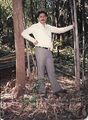
25.12.1985 को मैं एसडीओ फारेस्ट कापसी श्री एचएस पृथी के साथ भानुप्रतापपुर उत्पादन वन मंडल की कापसी बांस रेंज का बांस-कूप परतापपुर के निरिक्षण के लिए गया. यहां बांस का बहुत घना जंगल है. बांस कटाई का काम मध्य अक्टूबर से शुरू होता है. बांस कटाई के लिए मजदूर बालाघाट से लाकर उनके लिए कैंप बनाया जाता है. गर्मी शुरू होने से पहले बांस कटाई पूरी होने पर ये मजदूर वापस बालाघाट चले जाते हैं. इनका कैंप एक छोटा-मोटा गांव जैसा ही दृश्य प्रस्तुत करता है. बांस मुख्यतया पहाड़ियों की ढलान पर ज्यादा है. बांस कटाई को देखते हुए हम पहाड़ी पर चढ़ रहे थे. एक पहाड़ी पर एकदम चोटी पर नंगी चट्टान थी. हम जैसे ही उस चट्टान पर चढ़े ठीक सामने नीचे उलटी दिशा की तरफ 10 फुट की दूरी पर एक अच्छा स्वस्थ टाइगर बैठा था. हम लोगों को देखकर बिजलीसी फुर्ती से उछलकर नीचे पहाड़ी के जंगलों में चला गया. मुझे बताया गया है कि यह इस टायगर की टेरिटरी है और इस जंगल में टाइगर आमतौर पर दिखाई देता है. कैंप के मजदूर रात को उसकी आवाज प्राय: सुनते रहते हैं.
अबूझमाड़ जंगल में विशालकाय सागौन के पेड़:
26.02.1986 को मैं भानुप्रतापपुर उत्पादन वन मंडल की बांदे और परलकोट रेंजों के निरीक्षण पर गया. परलकोट रेंज के इमारती लकड़ी और बांस की कुछ पातन श्रेणियां कोटरी नदी के पार अबूझमाड़ क्षेत्र में पड़ती हैं. यहाँ बहुत घने जंगल हैं. यहाँ का सागौन बहुत उच्च गुणवत्ता का है. बांस की गुणवत्ता बहुत ही उत्तम है जिसको खरीदने के लिए व्यापारियों में जबरदस्त प्रतिस्पर्धा होती थी. यहाँ जंगल इतने घने हैं कि जमीन से आकाश दिखाई नहीं देता है. बेलों के रूप में 1-2 फुट मोटाई की कुछ प्रजातियाँ (woody climbers) पेड़ों के ऊपर छाई रहती हैं. भानुप्रतापपुर वन मंडल को कोटरी नदी अबूझमाड़ से पृथक करती है. कोटरी नदी इस दूरस्थ क्षेत्र की जीवन-रेखा है. कोटरी नदी भानुप्रतापपुर वन मंडल के पश्चिमी भाग से बहती हुई अबूझमाड़ क्षेत्र में प्रवेश करती है और महाराष्ट्र के गढ़चिरौली जिले में स्थित भामरागढ़ कस्बे के पास इंद्रावती नदी में मिल जाती है. कोटरी नदी पर कोई ब्रिज नहीं था इसलिए शेष दुनिया से अबूझमाड़ कटा रहता था. इमारती लकड़ी और बांस को वन से बाहर निकालने के लिए कोटरी नदी पर प्रतिवर्ष बांस और लकड़ी से अस्थाई पुल वन विभाग द्वारा बनाया जाता था.
लेखक (लक्ष्मण बुरड़क) द्वारा परलकोट रेंज के निरिक्षण के दौरान पाया कि परलकोट रेंज का वर्तमान में चार नंबर (1986) का इमारती लकड़ी कूप कट रहा है. जबकि पिछले दो नंबर (1985) और तीन नंबर (1984) के कूप भी अधूरे कटे हुए थे. कूप आधे-अधूरे कटे थे और उनमें वर्ष 1984 से 86 तक की कटी हुई इमारत लकड़ी यथावत पड़ी हुई थी. उनकी ना तो लोगिंग की गयी और ना रिकोर्डिंग की गयी. बताया गया कि सड़क नहीं बनने के कारण यह बहुमूल्य सागवान की इमारती लकड़ी नहीं निकाली जा सकी. गर्मी के समय कहीं-कहीं आग से नुकसान होना भी पाया गया. सागौन के पेड़ कितने मोटे थे इसकी कल्पना इससे लगाई जा सकती है कि गिरे हुए पेड़ के पीछे खड़े आदमी का केवल सर दिखाई देता था. अधिकांश पेड़ तो खड़ा होने पर छाती के बराबर दिखते थे. मुझे बड़ा दुख हुआ कि पिछले अधिकारियों ने इतनी लापरवाही क्यों की?
कूपों से इमारती लकड़ी ढुलाई का रास्ता भानुप्रतापपुर से सटे हुए क्षेत्र अबूझमाड़ होकर ही जाता था, अन्य कोई रास्ता नहीं था. कूप प्रभारी महरूराम वनपाल था जिसने कभी कल्पना नहीं की होगी कि वन मंडल अधिकारी भी यहाँ कभी अचानक निरिक्षण के लिए आ सकते हैं. कूप प्रभारी महरू राम मौके पर न तो ड्रेस में था और न ही होश में था क्योंकि वह अच्छी खासी सल्फी पिए हुए था. मैंने उसको तुरंत ही मौके पर निलंबित कर दिया. मेरे साथ SDO Forest एच एस पृथी भी थे उन्होंने सुझाव दिया कि निलंबित वनपाल को कूप में छोड़ने से हो सकता है कि गुस्से में समस्त इमारती लकड़ी को आग लगादे, इसलिए उसको कूप से दूर लाकर रास्ते में छोड़ दिया गया. रेंज अधिकारी को निर्देश दिया कि इसमें लगने वाले अतिरिक्त खर्च का एस्टीमेट बनाकर तत्काल सैंक्शन लें और किसी भी हालत में कटी हुई इमारती लकड़ी मार्च-अप्रैल तक डिपो में पहुंच जानी चाहिए.

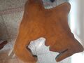
मैनें यहां पर गिरे हुए सागौन (Tectona grandis) के एक पेड़ का क्रॉस-सेक्शन निकलवाया जो मेरे पास अभी भी ड्राइंग रूम में रखा हुआ है जिसकी पेरीफेरी 15 फुट है. इसमें लगभग ढाई सौ से ऊपर रिंग हैं अर्थात यह पेड़ ढाई सौ से अधिक वर्ष उम्र का था. सागौन के वृक्ष में एक वर्ष में एक रिंग बनती है. सागौन के पेड़ की रिंग की गिनती से उसकी उम्र ज्ञात की जा सकती है. प्राकृतिक रूप से बनी इन रिंग्स के कारण ही सागौन के फर्नीचर में सुन्दरता आती है. यह पेड़ अबूझमाड़ के कोंगे गाँव के वनों में 1727 ई. में उगा था जिस वर्ष महाराजा सवाई जयसिंह ने जयपुर शहर की स्थापना की थी. यह पेड़ भारत के बहुत महत्वपूर्ण कालखंड के इतिहास का प्रत्यक्ष साक्षी रहा है.
आप सोच रहे होंगे की सागवान के तने के क्रॉस सेक्शन की शक्ल गोल नहीं होकर टेढ़ी-मेढ़ी क्यों है? यहां यह बताना उचित होगा कि सागौन और अर्जुन आदि पेड़ों में जब ये बड़े होते हैं तब जमीन के पास तने पर कुछ भाग बाहर उभरे दिखते हैं और कुछ भाग अंदर दब जाते हैं जिनको तकनीकी रूप से बट्रेस (Buttress) या फ्लूटिंग (Fluting) कहते हैं. इसलिए तने को आड़ा काटते हैं तो उसकी शक्ल गोल न कर अलग तरह की दिखती है. यह पेड़ संभवत: सालों से जंगल में पड़ा भी रहा होगा, जंगलों में गर्मी के सीजन में कभी-कभी आग भी लगती रहती है. इसलिए इसका कुछ भाग जल भी गया था. जला हुआ भाग निकाल दिया गया था. वास्तविक साइज इससे भी बड़ी रही होगी.

साथ के चित्र में जो पीले रंग का पेड़ का क्रॉस-सेक्शन दिख रहा है वह भी हल्दु पेड़ (Adina cordifolia) का क्रॉस सेक्शन है जो हमें अबूझमाड़ में मिला था इसकी गोलााई लगभग 20 फिट है. हल्दू के पेड़ की लकड़ी का रंग पीला होता है. यह भी अबूझमाड़ के भागों में हल्दु के किसी पड़े हुए पेड़ से निकाला गया था और इस क्रॉस-सेक्शन को हमारे भानुप्रतापपुर स्थित बंगले के लॉन में झूले के पास लगा दिया गया था. इसलिए हमें किसी टेबल की अतिरिक्त आवश्यकता नहीं होती थी. इतने मोटे पेड़ वनों में बहुत दुर्लभ होते हैं.
इसके बाद परलकोट रेंज का बांस कूप कोंगे देखा जिसमें कटाई चल रही थी. कोंगे वैसे अबूझमाड़ का गांव है परंतु वन क्षेत्र भानु प्रतापपुर उत्पादन वन मंडल में सम्मिलित है. लोटते में हम अबूझमाड़ के कोंगे, पंगुड और गरपा गांव से होते हुए नारायणपुर पहुंचे और नारायणपुर से भानुप्रतापपुर पहुंचे.
निलंबित वनपाल के प्रयास:
वनपाल का नशा उतरने के बाद अगले दिन उसको समझ में आया कि उसकी नौकरी तो गई. तब वह आकर पैर पड़ा, माफ़ी मांगी और उसने कहा कि यदि मैं सारा माल (इमारती लकड़ी) निकाल दूं तो क्या मुझे बहाल कर दिया जाएगा? उसको आश्वासन दिया गया कि यदि सारी इमारती लकड़ी अप्रेल तक निकाल देते हो तो बहाल कर देंगे. वनपाल वहीं रहने लगा और दिन-रात मेहनत करके सरकारी ट्रक और ठेकेदार के ट्रकों से इमारती लकड़ी तेज गति से निकलवाने लगा. हम प्रति सप्ताह उसकी प्रोग्रेस मोनिटर करते थे. वह इमारती लकड़ी ट्रक में लोड करवाता था और परिवहन कर डिपो लाकर खाली करवाता था.
निलंबित वनपाल ट्रक छोड़कर भागा:
19.03.1986 को उस निलंबित वनपाल महरूराम के साथ बड़ा अजीब वाकया हो गया. वह परलकोट रेंज के कूप क्रमांक 2, 3 और 4 से सरकारी ट्रक में लकड़ी डिपो के लिए परिवहन कर रहा था. वह अबूझमाड़ से होता हुआ आ रहा था क्योंकि परिवहन मार्ग केवल अबूझमाड होकर ही होता है. संयोग से उस दिन अबूझमाड़ में वन संरक्षक कांकेर श्री पीके मिश्रा, कलेक्टर बस्तर और जिले के समस्त अधिकारी और स्थानीय नेता अबूझमाड़ क्षेत्र में पदयात्रा पर थे. जब उन्होंने ट्रक में इमारती लकड़ी भरी हुई देखी तो ट्रक रुकवाया और पूछा अबूझमाड़ से लकड़ी क्यों ला रहे हो वहां तो कटाई प्रतिबंधित है? महरूराम वनपाल इस वीरान जंगल में अधिकारियों की विशाल भीड़ को देखकर इतना भयभीत हुआ कि वह ट्रक छोड़कर भाग गया. अब अधिकारियों का विश्वास पक्का होने लगा कि यह वनपाल चोरी-छिपे अबूझमाड़ से इमारती लकड़ी निकलवा रहा है.
मेरे लिए पुलिस थाना भानु प्रतापपुर में वायरलेस आया कि आपको सभी मानचित्रों सहित अबूझमाड़ में गरपा गांव में बुलाया गया है, आप तत्काल रवाना होकर पहुंचें. मैं सभी फारेस्ट मैनेजमेंट मैप, मार्किंग और फेलिंग रिकोर्ड तथा इमारती लकड़ी ढुलाई के डिपो से चालान आदि लेकर गरपा गाँव पहुंचा और जिला अधिकारियों को बताया कि फारेस्ट वर्किंग प्लान के अनुसार इमारती लकड़ी की कटाई हो रही है और उसी अनुसार यह परिवहन भी किया जा रहा है. इसका रास्ता केवल अबूझमाड़ होकर है इसमें कोई भी अनियमितता नहीं है. जिला अधिकारियों के साथ उस समय आईएएस प्रोबेशनर सुनील टंडन भी थे जो बाद में कलेक्टर छिंदवाडा बनकर आये और हम लोगों को वहां भी साथ-साथ काम करने का अवसर मिला. जब अधिकारियों ने पूछा कि वनपाल भाग क्यों गया तब मैंने उसके निलंबन का पूरा किस्सा समझाया तो उनके समझ में आया.
इस तरह का है अबूझमाड़ क्षेत्र! अबूझमाड़ के बारे में कुछ और विस्तार से आगे जानकारी देते हैं.
Source - Facbook Post of Laxman Burdak,30.12.2023
अबूझमाड़ का अनूठा इतिहास, भूगोल और संस्कृति

.jpg)
अबूझमाड़ भूभाग बस्तर में 1500 वर्ग मील के क्षेत्र में फैला हुआ है. अबूझमाड़ भारत के छत्तीसगढ़ राज्य के बस्तर अंचल के नारायणपुर, बीजापुर और दन्तेवाडा जिलों में स्थित है. इसका कुछ हिस्सा महाराष्ट्र तथा कुछ तेलंगाना में पड़ता है. जैसा कि नाम से ही स्पष्ट है अबूझ मतलब जिसको बूझना संभव ना हो और माड़ यानि गहरी घाटियां और पहाड़.
अबूझमाड़ नामकरण - अबूझमाड़ नामकरण के बारे में कोई ऐतिहासिक अभिलेख उपलब्ध नहीं हैं. अबूझमाड़ का नाम इसके मूल निवासी माडिया आदिवासियों ने नहीं दिया है बल्कि बाहरी लोगों द्वारा दिया गया है क्योंकि यह क्षेत्र उनके लिए एक अबूझ घने वनों वाला पर्वतीय क्षेत्र था. पहाडी-माडिया अपनी भूमि को मेटा-भूम कहते हैं जिसका अर्थ होता है- उच्च भूमि (high land).[27]
अबूझमाड़ का इतिहास - अबूझमाड़ का इतिहास अभिलेखित नहीं है. ऐतिहासिक रूप से क्षेत्र महाकाव्य रामायण में दंडकारण्य और महाभारत में कोसल साम्राज्य का हिस्सा है. बस्तर रियासत 1324 ईस्वी के आसपास स्थापित हुई थी, जब अंतिम काकतिया राजा, प्रताप रुद्र देव (1290-1325) के भाई अन्नाम देव ने वारंगल को छोड़ दिया और बस्तर में अपना शाही साम्राज्य स्थापित किया. बस्तर के मूल निवासी आदिवासी जनजातीय समूह में महापाषाण संस्कृति के अलावा विभिन्न प्रकार की संस्कृति, रीती-रिवाज़, नीति-नियम जीवन शैली, रहन-सहन और खान-पान का पालन आज भी समुदाय के द्वारा किया जाता है.
बस्तर ने कई शासक राजवंशों को अपनी पहचान को आकार देते हुए और समय के साथ परिवर्तनों को पोषित करते हुए देखा है. नल, गंग, नागवंशी और काकतीय मुख्य राजवंश थे जो बस्तर के इतिहास से निकटता से जुड़े थे. "नागवंशी " वास्तव में सिंधुघाटी के निवासी थे जिन्होंने 1500 ईसा पूर्व में सिंधुघाटी से किन्हीं कारणों से बस्तर के जंगल की ओर प्रस्थान किया.[28]
नागवंश का स्वर्णिम अध्याय 700 से 1300 ईस्वी तक का रहा है. उनके युग के दौरान प्रमुख पुरातात्विक निर्माण हुए. जिस समय दक्षिण कोसल क्षेत्र में कलचुरि वंश का शासन था, लगभग उसी समय बस्तर क्षेत्र में छिन्दक नागवंश के राजाओं का अधिकार था. ये नागवंशी चक्रकोट के राजा के नाम से विख्यात थे. प्राचीन महाकान्तर अथवा दण्डकारण्य का वह भाग इस काल में ‘चक्रकोट’ के नाम से प्रसिद्ध हुआ. कालान्तर में इसी का रूप बदलकर ‘चित्रकोट’हो गया. बस्तर के नागवंशी राजा भोगवतीपुरवरेश्वर की उपाधि धारण करते थे. ये अपने आपको कश्यप गोत्रीय एवं छिन्दक कुल का मानते थे. सम्भवतः इसीलिये इन्हें छिन्दक नाग कहा जाता है.[29]
असल में जीपीएस और गूगल मैप के इस दौर में भी अबूझमाड़ में कुल कितने गांवों में किसके पास कितनी ज़मीन है, चारागाह या सड़कें हैं या नहीं या जीवन के दूसरी ज़रूरी चीजों की उपलब्धता कैसी है, इसका कोई रिकार्ड कहीं उपलब्ध नहीं है. ये गांव कहां हैं या इनकी सरहद कहां है, यह भी पता नहीं है. इतिहास के पन्नों को पलटने से पता चलता है कि बस्तर के चार हज़ार वर्ग किलोमीटर इलाके में फैले हुए नारायणपुर ज़िले के अबूझमाड़ में पहली बार अकबर के ज़माने में राजस्व के दस्तावेज़ एकत्र करने की कोशिश की गई थी. लेकिन घने जंगलों वाले इस इलाके में सर्वे का काम अधूरा रह गया.ब्रिटिश सरकार ने 1909 में लगान वसूली के लिये इलाके का सर्वेक्षण शुरू किया लेकिन वह भी अधूरा रह गया.[30]
दुनिया से कटा हुआ - दुर्गम इलाका

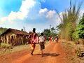
यह एक अत्यंत दुर्गम इलाका है. यह क्षेत्र छत्तीसगढ़ के चेरापूंजी (Cherrapunji) के नाम से भी जाना जाता है. यह छत्तीसगढ़ का ऐसा क्षेत्र है जहां पर सर्वाधिक वर्षा होता है. अबूझमाड़ इलाका भौगोलिक रूप से दुनिया से कटा हुआ है. यहां पर आम लोगों का जाना प्रतिबंधित है तथा प्रशासन का भी अस्तित्व यहाँ लगभग न के बराबर है.
यहां के घने वन और पहाड़ों तथा आदिम लोगों के निवास तथा इंद्रावती नदी द्वारा बस्तर को विभाजित करने के कारण यह क्षेत्र दुनिया से कटा हुआ है. ब्रिटिश शासन में भी अबूझमाड़ दुनिया से कटा हुआ रहा, यद्यपि 1873 में इसमें सर्वे किया गया था. सरकार के पास यहां के कोई राजस्व अभिलेख उपलब्ध नहीं हैं. स्थानीय आदिवासियों द्वारा शिफ्टिंग कल्टीवेशन की जाती है जिसके कारण एक स्थान पर यह स्थाई रूप से नहीं रहते हैं. टोपोशीट पर भी उनके निवास स्थान का स्थाई अस्तित्व नहीं मिलता है.
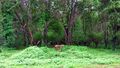
अबूझमाड़ के जंगल: यह जंगल बाघ, तेंदुए, जंगली सूअर, हिरण और बंदरों सहित जानवरों की कई प्रजातियों का घर है. यह हॉर्नबिल और मोर जैसी कई पक्षी प्रजातियों का भी घर है. यह जंगल अपनी अनूठी जनजातीय संस्कृति के लिए भी जाना जाता है. अबूझमाड़ का इलाका बिरला बसा हुआ है जिसमें मिश्रित वन हैंं, आवाजाही के साधन नहीं के बराबर हैं और अब तक भूमि का सर्वेक्षण नहीं किया गया है. लोग वन्य पशु और वनों पर निर्भर करते हैं. राजस्व, आबकारी, वन आदि के सामान्य कानून के दायरों के साए से अभी भी दूर है. बाहरी हस्तक्षेप यह लोग पसंद नहीं करते और बाहरी व्यक्ति तथा शासकीय कर्मचारियों के प्रति सशंकित रहते हैं. किंतु उनके खुद के पारिवारिक एवं सामाजिक नियम हैं, जिनसे ये लोग स्वेच्छा पूर्वक बंधे हुए हैं. इस तरह से ये आत्मनिर्भर और अनुशासित जीवन पद्धति को अपनाए हुए हैं. [31]
रियासती जमाने में इस इलाके की व्यवस्था के लिए शायद ही कोई व्यवस्था की गई हो. बताया गया कि सन 1931 में भूतपूर्व बस्तर राज्य का अंग्रेज प्रशासक मिस्टर ग्रिवसन ने इस क्षेत्र को रेवेन्यू फॉरेस्ट, एक्साईज तथा अन्य सामान्य कानून से मुक्त रखा और इस इलाके के नि:सहाय आदिवासियों को उनके भाग्य पर ही छोड़ दिया.[32]
अबूझमाड़ के गांव :
गुगल मैप के अनुसार लगभग 4000 वर्ग किलोमीटर के अबूझमाड़ इलाके में कोई सड़क नहीं है. यहां गांवों की जगह बदलती रहती है क्योंकि यहां रहने वाले माड़िया आदिवासी जगह बदल-बदल कर पेंदा पद्धती (Shifting Cultivation) से खेती करते हैं. वर्ष 1971 की जनगणना के अनुसार 209 गाँवों में से केवल 177 गाँव आबाद थे और 1 अप्रेल 1971 की स्थिति में तहसीलवार संख्या इस प्रकार थी : नारायणपुर - 164 (137), बीजापुर - 37 (32), दन्तेवाडा - 8 (8), Total = 209 (177).[33]

अबूझमाड़ के गांव की सेटिंग बहुत ही सुंदर है. हमेशा हरे-भरे रहने वाले साल के वनों, ऊंची-नीची पहाड़ियों के सपाट मैदान अथवा तलहटी पर, हरे घास के बीच, यहां-वहां बिखरी हुई झोपड़ियों का समूह ही एक गांव का रूप धारण कर लेता है. इस पहाड़ी क्षेत्र को अबूझमाड़ इसलिए कहते हैं क्योंकि आवाजाही के साधन न होने तथा जंगली जानवरों के भय से इसे अभी तक कोई पूरी तरह से बूझ यानि जान नहीं पाया है. यह अंजान इलाका रहस्यमय और कौतूहलपूर्ण है. [34]
अबूझमाड़ में शिफ्टिंग कल्टीवेशन (स्थानीय नाम: पेंदा) की पद्धति है जिसके कारण गाँव की स्थिति उपलब्ध खेती योग्य जमीन पर निर्भर करती है. लगातार कुछ वर्ष खेती करने से जब जमीन का उपजाऊपन कमजोर हो जाता है तो पूरा का पूरा गाँव स्थानांतरित हो जाता है और नई जगह गाँव बसाकर खेती शुरू की जाती है. कभी-कभी खेती के अलावा कुछ अन्य कारणों से भी गाँव स्थानांतरित हो जाते हैं जैसे प्राकृतिक आपदा या मानव-भक्षी शेर आदि का इलाके में आ जाना. इस कारण से सर्वे ऑफ़ इंडिया की टोपोशीट से गाँवों की स्थिति का मिलान नहीं हो पाता है.
अबूझमाड़ में गांव पहाड़ियों की चोटियों पर बसाए जाते हैं. कोशिश की जाती है कि तीन ओर से पर्वत हो और एक ओर से नदी. यद्यपि अब इस प्रकार की स्थिति में कुछ परिवर्तन आ रहा है. अबूझमाड़ के भौगोलिक क्षेत्र के नामकरण में गांव का महत्वपूर्ण हाथ है. साधारणत: प्रमुख गाँवों का बाहरी हिस्सा 'मड' या बाजार के काम में लाया जाता है. इन बाजारों में निश्चित ग्रामों से अबूझमाड़ी आते हैं. दूसरे शब्दों में ये 'मड' एक सुनिश्चित आर्थिक प्रभाव क्षेत्र को बतलाते हैं. [35]
इनके गांव अधिकतर नदियों के किनारे अथवा पहाड़ी ढलानों पर पाए जाते हैं. प्रत्येक घर के चारों ओर एक जाड़ी होती है. जिसमें केला, सब्जी और तम्बाकू उगाई जाती है. इनके खेत ढलवा भूमि में होते हैं जिनमें धान उगाया जाता है. जंगली क्षेत्रों को साफ करते समय यह ध्यान रखा जाता है कि क्षेत्र में बांस अधिकता से न पाए जाते हों, क्योंकि बांसों के पुन: अंकुरित होने का खतरा रहता है. [36]
अबूझमाड़ में स्थानांतरी कृषि पद्धति के अंतर्गत प्रत्येक व्यक्ति को साधारणत: अपनी आवश्यकता की भूमि प्राप्त हो जाती है. जंगलों में कृषि-भूमि का चुनाव करते समय गांव का मुखिया यह निर्णय देता है कि किस व्यक्ति को कितनी भूमि चाहिए और वह कहाँ होगी. जंगल सफाई का काम सामूहिक रूप से किया जाता है. खेतों में अलग-अलग बाड़ नहीं बनाई जाती है वरन पूरे (पेंदा) को घेर लिया जाता है, भले ही वह 200 या 300 एकड़ का हो. यह बड़ा 'बाड़ा' अत्यधिक मजबूत बनाया जाता है. यहाँ के जंगलों में केवल सुअर ही इन बांड़ों में घुसने का प्रयत्न करते है जिन से रखवाली करने के लिए मचान बनाए जोते हैं. धान के अतिरिक्त चमेली, गटका, कसरा, जोधरा इत्यादि मोटे अनाज उगाए जाते हैं, जिन्हें जंगली सुअरों से विशेष नुकसान पहुँचता है. [37]
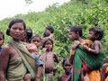
अबूझमाड़ के निवासी : अबूझमाड़िया जनजाति

माड़िया जनजाति के लोग यहाँ के मुख्य निवासी हैं. अबूझमाड़ में निवासरत माड़िया जनजाति को अबूझ माड़िया नाम से जाना जाता है. माड़िया जनजाति को मुख्यतः दो उपजातियों में बांटा गया है - अबूझ माड़िया (Abujh Maria) और बाईसन होर्न माड़िया (Bison Horn Maria). अबुझ माड़िया अबुझमाड़ के पहाड़ी क्षेत्रों में निवास करते है और बाईसन होर्न माड़िया इन्द्रावती नदी से लगे हुये मैदानी जंगलों में. बाईसन होर्न माड़िया को इस नाम से इसीलिये पुकारा जाता है, क्योंकि वे घोटूल (Ghotul) में और खास अवसरों में नाचने के दौरान बाईसन यानी की गौर के सींगो का मुकुट पहनते हैं. अबूझमाड़ का "बाइसन होर्न" नृत्य प्रसिद्ध है.
दोनों उपजातियों की संस्कृति काफ़ी हद तक मिलती जुलती है. ये दोनों ही बाहरी लोगों से मिलना-जुलना पसन्द नहीं करते लेकिन दोनों में अबूझ माड़िया ज्यादा आक्रमक हैं, वे बाहरी लोगों के अपने इलाके में आने पर तीर-कमान से हमला करना नहीं चूकते. जबकी बाईसन होर्न माड़िया बाहरी लोगों के आने पर ज्यादातर जंगलों में भाग जाना पसन्द करते हैं.

अबूझमाडिया जनजाति शहरी व ग्रामीण समाज से पृथक अबूझमाड़ क्षेत्र के गहन वन एवं पहाड़ों से परिपूर्ण प्राकृतिक परिवेश में निवास करती है. अबूझमाड़िया, अबूझमाड़ क्षेत्र को मेटाभूमि अर्थात पर्वतीय भूमि तथा स्वयं को मेटाकोईतोर अर्थात पर्वतीय भूमि के निवासी कहते हैं. सन 2015-16 में आदिम जाति अनुसंधान एवं प्रशिक्षण संस्थान रायपुर द्वारा गए कराए गए सर्वे के अनुसार अबूझमाडिया जनजाति की संख्या 23330 है.[38]

अबूझमाड़िया या हिल माड़िया बस्तर के अबूझमाड़ क्षेत्र में बसे हैं. अबूझमाड़ और इसके निवासी आज तक अपने आदिकालीन स्वरूप में हैं. चूंकि यहां रहने वाले माड़िया आदिवासी बाहरी लोगों से संपर्क रखना पसंद नहीं करते, इस कारण अभी तक यहां पायी जाने वाली पेड़ पौधों और वन्य प्राणियो की संख्या और प्रकार के बारे में सही जानकारी नहीं है और यहां के बाघों की गणना भी नहीं हुई है.
अबूझमाड़ की सीमा पर रहने वाले व्यापारी आज भी आदिवासियों से तेल और नमक का वनोपज के साथ विनिमय करते हैं. आदिवासियों से प्राप्त जानकारी के अनुसार यहाँ बाघ, वनभैंसा, गौर, सांभर चौसिंगा इत्यादि जीव प्रचुर मात्रा में हैं, लेकिन पहाड़ी इलाका होने के कारण यहां चीतलों की संख्या कम है. सबसे बडी बात यह है कि यहां कभी वनों की कटाई नहीं हुई है. यह क्षेत्र इसलिये भी महत्त्वपूर्ण हो जाता है क्योंकि यह दक्षिण भारत की अनेक नदियों का जलग्रहण क्षेत्र है.
अबूझमाड़िया जनजाति की आदिम संस्कृति

अबूझमाड़िया जनजाति की आदिम संस्कृति आज भी जीवंत है. इस संस्कृति की कई विशिष्टताएं हैं. इन्हीं में से एक है विवाह की परंपरा. इस जनजाति में दुल्हन अपनी बारात लेकर दूल्हे के घर जाती है. वधु पाने के लिए वर को उसका मूल्य चुकाना पड़ता है. समाज के लोग आपस में बैठक कर मूल्य तय करते हैं. अगर वर मूल्य अदा करने में असमर्थ रहता है तो उसे अपने ससुर के घर काम करके यह कर्ज उतारना पड़ता है. काम करवाने की यह अवधि तीन से पांच साल तक होती है. माड़िया जनजाति में विवाहित जोड़े को पहले एक साल तक आपस में संबंध बनाने की अनुमति नहीं होती. माड़िया जनजाति में युवतियों को अपना वर चुनने की पूरी आजादी होती है. यहां व्यवस्था मातृ-सत्तात्मक है. विवाह की रजामंदी होने के बाद लड़की वाले लड़के के घर जाते हैं. यहां उन्हें विवाह के आयोजन के लिए बनी विशेष झोपड़ी में ठहराया जाता है. रात के खाने-पीने में महुए की शराब, मुर्गा व सूअर का मांस अनिवार्य है. अगले दिन पूरे गांव की दावत होती है. इस अवसर पर माड़िया समूह नृत्य का आयोजन किया जाता है जिसमें दुल्हन अंतिम बार भाग लेती है. इसके बाद दुल्हन का पिता उसे दूल्हे के घर ले जाता है और कहता है कि अब वह अकेले मायके नहीं आ सकती. माड़िया जनजाति में महिला अगर अपने पति से खुश न हो तो वह बिना किसी विरोध के दूसरा पति चुन सकती है. शर्त यह होती है दूसरा पति पहले पति को विवाह के लिए खर्च की गई रकम अदा कर दे. इस जनजाति में अनैतिक संबंधों को बिल्कुल भी बर्दाश्त नहीं किया जाता. विधवा विवाह की भी अनुमति होती है. [39]
अबूझमाड़िया संस्कृति में पूर्वजों के प्रति आस्था और विश्वास का काफी गहरा नाता है. इनका पुनर्जन्म पर विश्वास है. इनके निवास (घर) में पूर्वजों के लिए अलग कक्ष होता है. इसे ये अपनी स्थानीय बोली में आनाल कोली कहते हैं. परिवार की सदस्य संख्या के आधार पर भले ही घर में पर्याप्त अथवा आवश्यकता अनुसार कक्ष की संख्या न हो लेकिन पूर्वजों का कक्ष जरूर होता है. यह जनजाति पितृपक्ष को नहीं मानती. इनके लिए पूर्वज भी देवता हैं और हर तीज त्योहार में ये सबसे पहले पूर्वजों को याद कर उनकी पूजा करते हैं. उनके नाम पर भोजन अर्पण करने के बाद ही परिवार के अन्य सदस्य भोजन ग्रहण करते हैं. केंद्रीय जनजातीय कार्य मंत्रालय की अबूझमाड़िया जनजाति के आधारभूत सर्वेक्षण से जुड़ी रिपोर्ट में पूर्वजों के प्रति इनकी आस्था और उन्हें देवतुल्य मानने का स्पष्ट उल्लेख है. [40]
इस समाज के लिए पितृपक्ष का समय विशेष मायने नहीं रखता है. हर त्योहार में पूर्वज ही देवता है. हर शुभ अवसर पर हम जो खाते हैं उसे सबसे पहले पूर्वजों के नाम पर अर्पण करते हैं. उन्होंने बताया कि हर घर में एक आनाल कोली (पूर्वजों का कक्ष) होता है. आनाल का तात्पर्य पूर्वजों की आत्मा और कोली का अर्थ कक्ष अथवा कमरा है. इस कक्ष में अड़का (घड़ा) रखा जाता है. मान्यता अनुसार पूर्वजों की आत्मा यहां निवास करती है और परिवार को हर संकट से सुरक्षित रखती है. आनाल कोली में महिलाओं का प्रवेश वर्जित है. अब धीरे-धीरे पूर्वजों के इसी कक्ष को अनाज के भंडार गृह के रूप में उपयोग किया जाने लगा है. अबूमाड़िया समाज की मान्यता है कि भरण पोषण के लिए अनाज पूर्वजों के आशीर्वाद से ही मिलता है.[41]
अबूझमाड़ की भौगोलिक स्थिति:
अबूझमाड़ बस्तर जिले का एक प्राकृतिक विभाग है जिसमें बहुत सी पर्वतीय चोटियाँ गुंथी हुई प्रतीत होती है. इनमें क्रम नहीं दिखाई पड़ता, अपितु चारों तरफ घाटियाँ और पहाड़ियों का क्रम बढ़ता नजर आता है. इन पहाड़ियों के दोनों ओर जल विभाजक मिलते हैं, जिनसे निकलने वाली सैकड़ों नदियाँ क्षेत्र की ओर भी दुर्गम बना देती हैं. पहाड़ियों की ऊँचाई धरा से 1007 मीटर तक हैं कुल मिलाकर 14 पहाड़ियों की चोटियाँ 900 मीटर से अधिक ऊँची हैं. भूगोल की भाषा में इन पहाड़ियों में अरोम प्रणाली है, किंतु यह सब छोटे पैमाने पर है. कुल क्षेत्र की प्रवाह प्रणाली तो पादपाकार ही है. [42]
बड़ी नदियों के नाम क्षेत्र के मानचित्रों में मिल जाते हैं, पर छोटी नदियाँ अनामिका हैं. अबूझमाड़ियों ने अपनी बोली में इन छोटी से छोटी नदियों को कुछ न कुछ नाम दे रखे हैं और सभी नामों के पीछे नदी सूचक शब्द मुण्डा जुड़ा रहता है, ठीक वैसे ही, जैसे चीनी भाषा में क्यांग. चीनी भाषा में चांग सी क्यांग और सी क्यांग का अर्थ चांग सी नदी और सी नदी है. कुछ ऐसी ही अबूझमाड़ में है. यहाँ कुछ छोटी नदियों के नाम हैं: कोरा मुण्डा, ओर मुण्डा, ताल्सि मुण्डा इत्यादि. इन्हें क्रमश: कोरा नदी, ओर नदी तथा तालिन नदी भी कहा जा सकता है. न केवल नदियों के लिए हिल माड़ियों की अपनी भाषा में अलग शब्द हैं, बल्कि पर्वतों को भी वे कोट, कोटि या पेप कहते हैं, जैसे धोबी कोटी, कंदर कोटी, क्या कोटी और राघोमेट. उपर्युक्त शब्दों की रचना से प्रतीत होता है कि संस्कृत का पर्वतार्थी शब्द 'कूट' हो न हो, मुड़िया भाषा की ही देन है. कंदर से कंदरा शब्द की उत्पत्तित भी प्रतीत होती है. [43]
अबूझमाड़ के भूमि के अभिलेख ठीक से उपलब्ध नहीं होने के कारण इसकी ठीक-ठीक भौगोलिक स्थिति का वर्णन किया जाना संभव नहीं है. इसका विस्तार अविभाजित बस्तर जिले के नारायणपुर, बीजापुर और दन्तेवाडा तहसीलों में था. अबूझमाड़ की भौगोलिक स्थिति लेटीट्यूड 19°N और 20°N लोंगीट्यूड 80° E और 81°E के बीच स्थित है. मोटे रूप से अबूझमाड़ घने वनों से आच्छादित वह पहाड़ी क्षेत्र है जिसके दक्षिण में इंद्रावती नदी है, उत्तर में अंतागढ़ और नारायणपुर का समतल-भूभाग स्थित है, पूर्व में जोहड़िया भूभाग और गुदरा नदी (Gudra River) की घाटी स्थित है तथा पश्चिम में परतापपुर से लेकर कोटरी नदी और इन्द्रावती नदी के संगम तक कोटरी नदी है. पश्चिम में महाराष्ट्र के गढ़चिरौली जिले तक इसका विस्तार है.[44]
एरियल सर्वे से अबूझमाड़ में गाँवों की भौगोलिक स्थिति का ज्ञान
राज्य सरकार के पास अबूझ माडिया आदिवासियों के जनसँख्या अथवा भू-अधिकार के कोई अभिलेख उपलब्ध नहीं थे इसलिए 132 वर्ष बाद वर्ष 2005 में छत्तीसगढ़ सरकार ने एरियल सर्वे का एक एक प्रोजेक्ट तैयार किया.
2007 में इस क्षेत्र को पर्यावरण और वन मंत्रालय भारत सरकार के द्वारा बायोस्फीयर रिजर्व प्रस्तावित किया गया था. वर्ष 2009 में छत्तीसगढ़ शासन द्वारा आम लोगों के प्रवेश पर रोक हटा ली गई थी, जो 1980 के प्रारंभिक वर्षों में लगाई गई थी. वर्ष 2006 से पूर्व इस क्षेत्र में प्रवेश के लिए परमिट लेना पड़ता था.
वर्ष 2009 में भारतीय अंतरिक्ष अनुसंधान संगठन (ISRO) द्वारा अबूझमाड़ में गाँवों की भौगोलिक स्थिति ज्ञात करने के लिए सैटेलाईट मैपिंग पद्धति से सर्वे किया गया है. सैटेलाईट मैपिंग पद्धति से राजस्व अभिलेखों को दुरुस्त किया जाएगा तथा नक्सली क्षेत्रों का भी मानचित्र बनाया जा सकेगा.
बस्तर में नक्सलवाद:


वर्त्तमान में अबूझमाड़ नक्सलवाद से सर्वाधिक प्रभावित क्षेत्रों में से है. अबूझमाड़ में नक्सलियों की समानांतर सरकार चलती है और जगह-जगह उनके बोर्ड दिखाई देते हैं. अबूझमाड़ में प्रवेश करने पर ओरछा परिक्षेत्र का एक बोर्ड दिखाई देता है. इसे अघोषित सरहद माना जाता है जहाँ छत्तीसगढ़ सरकार की हुकूमत समझो 'ख़त्म' हो जाती है. यहाँ से शुरू होता है जनताना सरकार का इलाका. 'जनताना सरकार', यानी 'जनता की सरकार' जिसे माओवादी अपने शासन के मॉडल के रूप में पेश करते हैं. ये सरहद हिंदुस्तान और चीन की सरहद से भी ज़्यादा संवेदनशील मानी जाती है. अंतरराष्ट्रीय सरहदों पर तो दोनों तरफ के अधिकारी मिलते-जुलते भी हैं, मगर इस 'सरहद' पर तल्ख़ी ही तल्ख़ी हैं. अब 'जनताना सरकार' के प्रतिनिधि धीरे-धीरे इस इलाक़े में भी अपना प्रभाव बढ़ाने की कोशिश में हैं. इसलिए माओवादियों के दस्ते गाहे-बगाहे ब्रहीबेड़ा आना-जाना करने लगे हैं. सोनपुर जाने वाली सड़क पर नारायणपुर प्रखंड की आखरी पंचायत है ब्रहीबेड़ा. पंचायत की हद जहाँ ख़त्म होती है, वहां से शुरू होता है अबूझमाड़ का इलाका. इससे आगे हैं पंगुड़, गर्पा, कोहकामेटा, इरकभटटी, कच्चापाल और कुतुल. [45]
अबूझमाड़ महाराष्ट्र के गढ़चिरोली जिले से लगा हुआ है. दक्षिण बस्तर वन मंडल एवं पश्चिम बस्तर वन मंडल क्रमशः तेलंगाना एवं महाराष्ट्र की सीमा से लगे हुए हैं. इन राज्यों में कई दशकों से नक्सलवादी तत्व प्रबल रहे हैं. यह नक्सलवादी तत्व 5-5, 6-6 के झुंड में हथियारों से लेस होकर जंगलों में घूमते हैं तथा आदिवासियों पर प्रभाव डालकर उनके समस्त कार्य जैसे अवैधानिक वृक्षों की कटाई, अवैधानिक आखेट एवं वन भूमि पर अतिक्रमण करने के लिए प्रोत्साहित करते हैं. वन विभाग के कर्मचारी यदि आदिवासियों की इन अवैधानिक कार्यों पर रोक लगाते हैं तो इन्हें डरा-धमकाकर आतंकित करने का प्रयास किया जाता है. अपने प्रभाव कायम करने के लिए नक्सलवादी तत्व छिपकर रात को इन क्षेत्रों में घूमते हैं तथा वन विभाग के कर्मचारियों को रात-बेरात अकेले में पाकर आतंकित करते हैं. नक्सलवादी अधिकतर आंध्र प्रदेश के तेलुगूभाषी होने से उनके बारे में तथा उनकी गतिविधियों के बारे में समाचार पाना भी काफी मुश्किल मालूम पड़ रहा है.
लेखक (लक्ष्मण बुरड़क) के भानुप्रतापपुर वन मंडल में पदस्थापना अवधि (18.06.1985 - 23.07.1988) के दौरान अबूझमाड़ में नक्सली गतिविधियां सीमित थीं. यदा-कदा सीमा के उस पार महाराष्ट्र के गढ़चिरौली के जंगलों से नक्सली भानुप्रतापपुर वन मंडल के बांदे और परलकोट वन परिक्षेत्रों में प्रवेश करते थे. हम वनों के निरीक्षण के लिए सतत भ्रमण करते रहते थे परन्तु कभी अवरोध उपस्थित नहीं हुआ. लेखक के वनक्षेत्र में भ्रमण के दौरान एक बार सूचना मिली थी कि भानुप्रतापपुर वन मंडल के बांस कटाई के कूपों के श्रमिक कैंपों में नक्सली आए थे और यहां की भुगतान व्यवस्था तथा सभी वन उपज की दरों के विस्तृत चार्ट देखकर प्रभावित हुए थे. उनकी फोटो भी वह लेकर महाराष्ट्र के वन क्षेत्र में गए थे. वहां भी उन्होंने भुगतान की इसी तरह की व्यवस्था करने के निर्देश वन कर्मचारियों को दिए थे.
बांदे और परलकोट वन परिक्षेत्रों के भ्रमण के दौरान हमें अबूझमाड़ में स्थित वन विभाग के फॉरेस्ट रेस्ट हाउस सीतरम में रुकना पड़ता था. 17-18.11.1987 को मैंने पाया कि किसी भी कमरे के अंदर की चिटकनिया नहीं लगी हुई थी. प्रभारी अधिकारी को निर्देश दिए कि आगे से सभी चिटकनियां दुरुस्त होनी चाहिए. कर्मचारियों ने हां की परंतु अगली बार भी जब सीतरम वन विश्रामगृह में रुके तो चिटकनियां नहीं थी. मेरे द्वारा कर्मचारियों को डांटने पर बताया कि यदा-कदा नक्सली इस क्षेत्र में आते हैं और वन विश्राम गृह में भी विश्राम करते हैं. पुलिस के डर के कारण यदि उनको अचानक रात में भागना पड़े तो चिटकनी लगे होने से बाधा उपस्थित हो सकती है. हमने चटकनी लगाए थी परन्तु नक्सली लोगों द्वारा दोड़दी गयी. सीतराम में प्रवास के दौरान एक बार यह भी सूचना मिली थी कि ग्राम के सरपंच की हत्या नक्सलियों द्वारा कर दी गई है. परंतु हमारे वन कर्मचारियों को कभी भी नक्सलियों द्वारा परेशान करने की कोई घटना नहीं घटी. इसका कारण संभवत: यह हो सकता है कि उनको भुगतान सम्बन्धी किसी प्रकार की अनियमितता की शिकायत नहीं मिली हो!
Source - Facebook Post of Laxman Burdak,06.01.2024
External links
See also
- Bastar
- Jat History in Bastar
- Kutumsar Cave
- Chitrakoot Falls
- Tirathgarh Falls
- Tiriya
- Gumalwada
- Kanger Valley National Park
Gallery
-
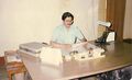
Teak Tree Cross Section From Konge, Abujhmar, Bastar, Chhattisgarh
-
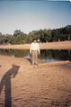
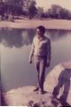
Author Laxman Burdak at Kotri River, Abujhmar, Bastar, Chhattisgarh
-
![Haldu Tree Cross Section From Abujhmar, Bastar, Chhattisgarh]](/w/thumb.php?f=Bhanupratappur-34.jpg&width=120)
Haldu Tree Cross Section From Abujhmar, Bastar, Chhattisgarh]
-
Author Laxman Burdak at Kotri River, Abujhmar, Bastar, Chhattisgarh
-
-
Author Laxman Burdak at Kotri River, Abujhmar, Bastar, Chhattisgarh
-
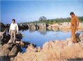
Author Laxman Burdak at Kotri River, Abujhmar, Bastar, Chhattisgarh with Range Officer RP Tewari
-
छत्तीसगढ़ का प्रतिबंधित क्षेत्र अबूझमाड़
-
अबूझमाड़ के रहस्यमय जंगल
-
अबूझमाड़ के रहस्यमय जंगल
-
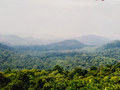
अबूझमाड़ के रहस्यमय जंगल
-
लेखक (Laxman Burdak)
-

Abujhmaria Girl
-
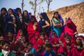
अबूझमाडिया जनजाति की महिलायें
-
अबूझमाडिया जनजाति
-
अबूझमाडिया जनजाति
-
लेखक लक्ष्मण बुरड़क द्वार बांस कटाई का निरीक्षण


References
- ↑ Tusha Mittal (12 May 2012). "Inside Abujmarh The Mythic Citadel". Tehelka. Vol. 9, no. 19. Archived from the original on 24 April 2013.
- ↑ R. R. Prasad (1996). Encyclopaedic profile of Indian tribes. 1. A - E. Discovery Publishing House. p. 349. ISBN 978-81-7141-298-3.
- ↑ "Dandakaranya". Encyclopædia Britannica Online.
- ↑ Abujhmar by DR. H. C. Jain, Tabulation Officer, Office of the Director of Census Operations, Madhya Pradesh. District Census Handbook, Bastar, Parts X(A) & X(B), Series-10, 1971,p.623
- ↑ Ramachandra Guha (28 June 2006). "Tribe Against Tribe, Village Against Village". The Telegraph. Archived from the original on 6 July 2013.
- ↑ "30 years on, curbs on entry to tribal heartland lifted". Indian Express. 10 June 2009.
- ↑ Sudhi Ranjan Sen (20 May 2005). "Defence chopper to rescue of SP, cops trapped by Naxals". Indian Express.
- ↑ B G Verghese (2010). First Draft. Westland. p. 501. ISBN 978-9380283760.
- ↑ "130 yrs later, Raman govt to map Naxal-hit Abujhmar". Indian Express. 17 January 2005.
- ↑ B G Verghese (2010). First Draft. Westland. p. 501. ISBN 978-9380283760
- ↑ B G Verghese (2010). First Draft. Westland. p. 501. ISBN 978-9380283760
- ↑ "130 yrs later, Raman govt to map Naxal-hit Abujhmar". Indian Express. 17 January 2005.
- ↑ B G Verghese (2010). First Draft. Westland. p. 501. ISBN 978-9380283760
- ↑ "Army training hub in Maoist stronghold". NDTV. 27 January 2011.
- ↑ Soumittra S Bose (24 February 2012). "Orphans being targeted by Naxals". The Times of India.
- ↑ Satarupa Bhattacharjya (1 February 2008). "Red terror". India Today.
- ↑ "130 yrs later, Raman govt to map Naxal-hit Abujhmar". Indian Express. 17 January 2005.
- ↑ "'Unlike Chhattisgarh, Jharkhand Has Multiple Maoist Outfits':The former CRPF DG, who has been given charge of the Jharkhand home department, on Maoists". Outlook. 11 March 2013.
- ↑ "30 years on, curbs on entry to tribal heartland lifted". Indian Express. 10 June 2009.
- ↑ Sudhi Ranjan Sen (20 May 2005). "Defence chopper to rescue of SP, cops trapped by Naxals". Indian Express.
- ↑ "30 years on, curbs on entry to tribal heartland lifted". Indian Express. 10 June 2009.
- ↑ "A "learning experience" for Pranab at Narayanpur". The Hindu. 8 November 2012.
- ↑ "Status of Bioshpere reserves in India" (PDF). ENVIRO NEWS, Ministry of Environment and Forests, Vol. 14. January–March 2008. p. 9. Archived from the original (PDF) on 20 January 2013.
- ↑ "Status of Bioshpere reserves in India" (PDF). ENVIRO NEWS, Ministry of Environment and Forests, Vol. 14. January–March 2008. p. 9. Archived from the original (PDF) on 20 January 2013.
- ↑ "30 years on, curbs on entry to tribal heartland lifted". Indian Express. 10 June 2009.
- ↑ "30 years on, curbs on entry to tribal heartland lifted". Indian Express. 10 June 2009.
- ↑ Abujhmar by Dr. H. C. Jain, Tabulation Officer, Office of the Director of Census Operations, Madhya Pradesh. District Census Handbook, Bastar, Parts X(A) & X(B), Series-10, 1971, p.623-24
- ↑ बस्तर का स्वर्णिम इतिहास, बस्तरिया बाबु, 08.10.2022
- ↑ बस्तर का स्वर्णिम इतिहास, बस्तरिया बाबु, 08.10.2022
- ↑ आलोक प्रकाश पुतुल, रायपुर से बीबीसी हिंदी डॉट कॉम के लिए, 3 मई 2017
- ↑ किरीट दोशी, बस्तर का अबूझमाड़, पृष्ठ क्रमांक 102, युगधर्म रायपुर, वन संपदा विशेषांक 1979, प्रधान संपादक: भगवतीधर बाजपेयी, संपादक: बबन प्रसाद मिश्र
- ↑ किरीट दोशी, बस्तर का अबूझमाड़, पृष्ठ क्रमांक 102, युगधर्म रायपुर, वन संपदा विशेषांक 1979, प्रधान संपादक: भगवतीधर बाजपेयी, संपादक: बबन प्रसाद मिश्र
- ↑ Abujhmar by DR. H. C. Jain, Tabulation Officer, Office of the Director of Census Operations, Madhya Pradesh. District Census Handbook, Bastar, Parts X(A) & X(B), Series-10, 1971, p.624
- ↑ किरीट दोशी, बस्तर का अबूझमाड़, पृष्ठ क्रमांक 102, युगधर्म रायपुर, वन संपदा विशेषांक 1979, प्रधान संपादक: भगवतीधर बाजपेयी, संपादक: बबन प्रसाद मिश्र
- ↑ Facebook Post,07.12.2016, MPPSC Preparation
- ↑ Facebook Post,07.12.2016, MPPSC Preparation
- ↑ Facebook Post,07.12.2016, MPPSC Preparation
- ↑ Tribal Research and Training Institute Government of Chhattisgarh
- ↑ By Sanjeev Tiwari, 16.04.2020, www.jagran.com
- ↑ नई दुनिया, 25.09.2021
- ↑ नई दुनिया, 25.09.2021
- ↑ Facebook Post,07.12.2016, MPPSC Preparation
- ↑ Facebook Post,07.12.2016, MPPSC Preparation
- ↑ Abujhmar by Dr. H. C. Jain, Tabulation Officer, Office of the Director of Census Operations, Madhya Pradesh. District Census Handbook, Bastar, Parts X(A) & X(B), Series-10, 1971, p.623
- ↑ सलमान रावी,बीबीसी संवाददाता, छत्तीसगढ़ से, 10 नवंबर 2013