
Chhindwara
| Author:Laxman Burdak, IFS (R) |


Chhindwara (छिंदवाड़ा) is a city and district in Madhya Pradesh.
Visit by Author
Author (Laxman Burdak) visited Chhindwara on 30-31.01.1987 and stayed at Chhindwara from 25.07.1988 to 18.07.1990, Visited on 21-23.07.1991, 26-27.01.1994,17-19.01.1996.
Origin of name
1. Chhind trees Origin (छिन्द वृक्ष): Chhindwara is believed to get name from abundance of Chhind trees (Phoenix sylvestris) in trees in the district. Chhindwara District was full of "Chhind" trees (wild date palms) in past.[1]
2. Chhindaka Naga (छिन्दक नाग): Chhindaka Naga, who was a Nagavanshi King, probably gave name to Chhindwara. The Chindaka Nagas were a dynasty that ruled over parts of modern-day Odisha and Chhattisgarh. Their kingdom was known as Chakrakota mandala and included the present-day districts of Bastar, Koraput and Kalahandi. Dr Naval Viyogi[2] writes that Vayu Puran has mentioned first king of Satavahanas was Sindhuka. The region of Bastar was once ruled by the Satwahana rulers from 72 BC to 200 AD. There is an inscription in which Chalukya king has mentioned his family name Sendrak[3]. Similarly the royal family of Chakrakot has been called Sandrak or Chhindak [4], (Chhinde or Sende which was a well known Naga family of historical period. It seems that all royal families of likewise names belonged to Indus Valley in Origin.
3. Sinhadvara (सिंहद्वार): Another story says that due to the population of lions (called "sinha" (सिंह) in Hindi), it was considered equivalent to entering the lions' den to enter this district. Hence, it was called "Sinha Dwara" (सिंहद्वार) (meaning " through the entrance of the lion"). In course of time, it became "Chhindwara". The legendary explanation also explores a term named Sinh which is the vernacular term to lion. The story has it that the place opened its indicative gateways for lions. The anglicized version of the word "Wada" is place. Hence it was called "Sinh Dwara" (means through the entrance of lion). In due course of time it became "Chhindwara".The place harbors fascinating historical lore. The history of the place is actually sunken into a bleak oblivion. None the less, the ancient inscriptions have helped the historical enthusiasts to unravel the history of the place.[5]
Location
Chhindwara district was formed on 1st November 1956. It is located on the South-West region of Satpura Range of Mountains. It is spread from 21.28 to 22.49 Deg. North (longitude) and 78.40 to 79.24 Deg. East (latitude) and spread over an area of 11,815 Sq.Km. This district is bound by the plains of Nagpur District (in Maharashtra State) on the South, Hoshangabad and Narsinghpur Districts on the North, Pandhurna District on the West and Seoni Districts on the East.[6]
Tahsils in Chhindwara District
- Amarwada (अमरवाड़ा)
- Bicchua (बिछुआ)
- Chand (चांद)
- Chhindwada (छिंदवाड़ा)
- Chaurai (चौरई)
- Harrai (हर्रई)
- Jamai (जामई)
- Mohkhed (मोहखेड़)
- Pandhurna (पांढुर्ना)
- Parasia (परासिया)
- Sausar (सौसर)
- Tamia (तामिया)
- Umreth (उमरेठ)
Villages in Chhindwara tahsil
Towns: 1 Chhindwara, 2 Lonia Karbal.
Villages :
1 Ajaniya, 2 Anghodi, 3 Atarwada, 4 Bamhni, 5 Bangaon, 6 Bhaisadand , 7 Bhaiskola, 8 Bhajipani Kalan, 9 Bhanadai, 10 Bhandi, 11 Bhula, 12 Bhutera, 13 Bijepani, 14 Bijori Khurd, 15 Bilamba, 16 Bohna, 17 Boriya, 18 Chanhia Kalan, 19 Chanhia Khurd, 20 Chargaon, 21 Chargaon Bhat, 22 Chargaon Pehlad, 23 Chausra , 24 Chhabadi, 25 Chhinda, 26 Dagawani Pipariya , 27 Dauda Raiyatwari, 28 Dewardha, 29 Dhagdiya, 30 Dhamania, 31 Dhanori Gusai, 32 Dhoulpur, 33 Dunda Seoni, 34 Dungariya, 35 Gadhmari, 36 Gangai, 37 Gangiwada, 38 Ghat Parasia, 39 Ghoghra, 40 Gondara, 41 Guraiya, 42 Imli Kheda, 43 Jaitpur Kalan, 44 Jamhodi Panda, 45 Jamuniya, 46 Jatalapur, 47 Jetama, 48 Jhajhariya Urf. Khutiya, 49 Jhanda, 50 Jhiri, 51 Jhirlinga, 52 Kabadiya, 53 Kacharia, 54 Kakai, 55 Kaparwadi, 56 Karaboh, 57 Karaghat, 58 Karbe Pipariya, 59 Keolari, 60 Khairi Bhopal, 61 Khamra, 62 Khapa Kalan, 63 Khapa Mithekhan, 64 Kheri Bhutai, 65 Kheri Laddu, 66 Kotalbarri, 67 Kudwari, 68 Kuhiya, 69 Kusmeli, 70 Lahgadua, 71 Lakdai Jamhodi, 72 Loniya Maru, 73 Madanpur, 74 Malhanwada, 75 Manegaon, 76 Marai, 77 Matkuli, 78 Mendki Tal, 79 Moadei, 80 Mohgaon, 81 Nagjhir, 82 Navegaon, 83 Ner, 84 Pakhadiya, 85 Panjra, 86 Panth, 87 Partala, 88 Pindrai Kalan, 89 Pipariya Birsa, 90 Pipariya Bistsala, 91 Pipariya Lalu, 92 Poama, 93 Pulpuldoh, 94 Raja Khoh, 95 Rajana, 96 Rangin Khapa, 97 Rohana Kalan, 98 Rohana Khurd, 99 Sahajpuri, 100 Salaiya Kalan, 101 Samarboh, 102 Sankh, 103 Saraswada, 104 Sarna, 105 Sarra, 106 Seoni Megha, 107 Shahpura, 108 Sihora, 109 Sonakhar, 110 Sonapipri, 111 Sonkhaba, 112 Sonpur, 113 Sunari Mohagaon, 114 Surgi, 115 Susarai, 116 Thaori Kalan, 117 Thawari Khurd, 118 Thawari Teka, 119 Thuniya Bhand , 120 Thuniya Udana, 121 Ubhegaon Khajari, 122 Umarhar, 123 Umariya Isra, 124 Usariya,
Source - https://www.census2011.co.in/data/subdistrict/3654-chhindwara-chhindwara-madhya-pradesh.html
Geography
Chhindwara District ranks 1st in area (11,815 Sq. Km.) in Madhya Pradesh State and occupies 3.85% of the area of the state. The District is divided into 12 Tehsils (Chhindwara, Chhindwara Nagar, Tamia, Parasia, Junnardeo, Amarwara, Chourai, Bicchua, Umreth, Mohkhed, Chand and Harrai).
There are 1948 villages in the district, out of which 1903 villages are habitated.
Chhindwara is one of the largest cities in the Satpura range and the largest district in terms of area in Madhya Pradesh. It is on a plateau, surrounded by lush green fields, rivers and by dense forest with diverse flora and fauna.
From the Geographical point of view Chhindwara district can be divided into three main regions –
- 2. The central region consists of Chhindwara, southern part of Amarwara region, Bichhua and Mohkhed region. It is a plateau region.
- 3. The northern region is in the highest part of the Satpura Range, and covers a small portion of the plains of the Narmada valley.
The altitude of the district varies from 1,550 ft (470 m) to 3,820 ft (1,160 m) above sea level with an average elevation of 2215 feet (675 m).
Rivers in Chhindwara
Following major and minor rivers flow through the Chhindwara district namely Kanhan River, Pench River, Jam River, Kulbehra River, Shakkar River, Doodhi River, Bodri River, Datpadi River, Chotti Kulbehra, Gunnor River, Dantfadu River, Sitareva River, Harad River, Sarpini River etc.
- Kanhan River flows in the Southern direction through the western parts of Chhindwara Tehsil and mixes with the Wainganga River. Kanhan River rises on the slopes of the hills at the southern edge of the Satpura range to the north of Damua and west of Junnardeo towns in Chhindwara, Madhya Pradesh, India. Flowing south from its origin, Damua is the first town it encounters. Here it intersects the town and allows for its flow to be controlled by means of a dam. It then runs along a south & southeastern direction, meandering through the countryside of Chhindwara District where it has been productively harnessed for growing Tur dal and cotton. The river comes to lie about 5 km to the south of Deogarh Fort where it humbly receives an insignificant tributary. Upon reaching the town of Ramkona it is crossed by a rail bridge as well as another road bridge which supports NH-26 B. Nearly at the end of its course in Madhya Pradesh at Razadi Borgaon, it is joined by Jam River, and for a short distance provides a natural boundary with adjoining state Maharashtra.
- Pench River originates from Satpura hills near Junnardeo in the Chhindwara district of Madhya Pradesh, passes through Parasia, Singora, Singori, Chaurai, Chand in Chhindwara district and flows across Pench National Park, forming boundary of Chhindwara and Seoni districts before entering Maharashtra. Pench River flows in the border areas of Chhindwara and Seoni Districts and mixes with the Kanhan River in Nagpur District.
- Jam River originates in the Betul District and flows through Chhindwara district, mostly through the Sausar region and joins with the Kanhan River at the end of its course in Madhya Pradesh at Razadi Borgaon.
- Kulbehra River starts at Umreth and flows through Chhindwara and Mohkhed and joins with Pench river.
- Bodri River: The Chhindwara town is built around the Bodri Stream, a tributary with the Kulbehra River[7]& is the origin source of Pench River which flows across Pench National Park which includes Pench Tiger Reserve, which is one of the reserve for the Tiger Project of India.
- Datpadi River joins Kulbehra River from right.
- Chotti Kulbehra - The Kulbehra River receives its first tributary - a small spill off from the Kanhargaon Dam- known as the Chotti Kulbehra. It then flows southeast through Chhindwara Tehsil passing just south of the town of Chhindwara it is joined by the Bodri River from the left, whereafter it turns south and then flows into Mohkhed Tehsil.[8] Its major tributary, the Umra River, joins it from the right just south of the village of Bisapur, whereafter the Kulbehra heads east where it passes just north of the village of Chand and joins with the Pench River just southeast of the village of Chand at 21°55′25″N 79°10′30″E.[9]
- Doodhi River flows in the Patalkot valley.
- Gunnor River flows in the Parasia tahsil of Chhindwara.
- Dantfadu River (दांतफाडू) flows in Sangakheda area. Dantfadu River originates near Pilhawadi in Tamia tahsil of Chhindwara and flows to north-east between Sangakheda and Jhot in Chhindwara district.
- Sitareva River merges with Shakkar River in Chhindwara.
- Harad River merges with Shakkar near Kotra village in Harrai tahsil.
- Sarpini River: A tributary of Jam River in Sausar, Chhindwara. Just before reaching the village Jam in Sausar tahsil, Jam River receives its largest tributary Sarpini River. From here the Jam river again flows southeast-ward passing the town Lodhikheda and ends its course by draining off in Kanhan River at Razadi Borgaon, Madhya Pradesh.
- Bel River - Sangam (संगम) near the confluence of the rivers Kanhan River and Bel River. Sangam (संगम) is a village in Mohkhed tahsil in Chhindwara district of Madhya Pradesh. It is mentioned as Sangamika (संगमिका) in Pandhurna Plates of 29th year of Pravarasena II[10].
Source - https://chhindwara.nic.in/en/about-district/
Inscriptions in Chhindwara District
(114) Dudia Plates of 23rd year of Pravarasena II
[p.81]: Dudia (डूडिआ), is a village 30 miles south-west of Chhindwara. The inscription is one of Maharaja Pravarasena II of the Vakataka dynasty, and does not give any more information about it than is furnished by the Chammak (No. 174) and Sewani (No. 78) grants which were issued by the same king. It is dated on the 10th day of the fourth fortnight of the rainy season in the 23rd year of the Maharaja's reign and records the grant of some land at Darbhamalaka in the Chandrapura Sangamika (confluence of rivers), and at Karmakara in the Hiranyapura bhāga (territorial division) in the province of Arammi. Arammi is apparently Arvi, a tahsil in the Wardha District, which adjoins Amraoti District. Close to Arvi lies the taluk of Chandur, which is evidently the Chandrapura of our inscription. Near it there is a confluence of 2 rivers, Chandrabhaga and Sarasvati. Hiranyapura (golden town) may be identified with Songaon near Chandur and Karmakara with Kalamgaon close to Chandur. Darbhamalaka is not traceable, and it is possible it may have been only a plot of land abounding in darbha or kusa grass so scarce in Vidarbha (the land destitute of darbha), which was the old name of Berar.
This grant, like the two others of the same king, purports to be issued from Pravarapura, which remains unidentified.
(115) Nilkanthi Stone Inscription
[p.81]: Nilkanthi (नीलकंठी) is a village 14 miles south of Chhindwara. On a pillar which appears formerly to have belonged to a temple there is a much defaced inscription, but the name of the king Krishna (III) of the Rashtrakuta line can still be made out. This king belonged to the 10th Century A. D. Another fragmentary inscription of the same king
[p.82]: was found at Nilkanthi and is now deposited in the Nagpur Museum. We know from the Multai and Tiwarkhed plates (Nos. 107 and 108) that the Rashtrakutas dominated even the Betul District, and naturally the intervening District of Chhindwara must have belonged to them.
Dudia Plates of 23rd year of Pravarasena II
These plates were in the possession of some Gonds at Dudia in the Aser pargana of the Chhindwara District of Madhya Pradesh. They have been edited before, with facsimiles, by Dr. Kielhorn in the Epigraphia Indica, Vol III, pp. 258. They are edited here from the same facsimiles.
The copper-plates are four in number, each of which measures 7-1/2" long by 3-5/8" broad. The second and third plates are inscribed on both sides, the first plate is so on one side, and the fourth is blank and merely serves to protect the writing on the second side of the third plate. The plates are quite smooth, their edges having been neither fashioned thicker nor raised into rims; but the writing, nevertheless, is in an excellent state of preservation.....The weight of the four plates is 3-1/4 lbs. ; that of the ring, the copper band and the seal is 1/2 lb.; total, 3-3/4 Ibs1.... The characters belong to the box-headed variety of the southern alphabets and resemble those of the preceding Indore plates. Like the latter, they show two forms of n and b : the curve of l encircles the letter on the left as in -lalāmasya in line 1 of the seal; the sign of the jihvāmūliya occurs in line 22 and that of the upadhmānīya in line 3 of the seal and line 16 of the plates. Inter-punctuation is shown by one or more horizontal or vertical strokes. The Language is Sanskrit, and, with the exception of the legend on the seal and one imprecatory verse in line 27-28, the whole record is in prose. As regards orthography, we find that a consonant has been reduplicated before and after r as in parākkram- , lines 4-5 and -Aptoryyām-, line 1; before as in Bhagiratthy-amala, line 5; and after anusvāra in samvvatsare, line 28.
The inscription, which opens with drishtam, is one of the Vakataka Maharaja Pravarasena II. His genealogy is given here exactly as in the Jamb plates, his maternal grandfather being called Devagupta. The object of it is to record the grant, by Pravarasena, of 25 (nivartanas) of land at Darbhamalaka (दर्भमलक) in the Chandrapura Sangamika (चंद्रपुर संगमिक), to one Yakshārya of the Kausika gotra, and of sixty (nivartanas) of land2 at the village of Karmakara (कर्मकार) in the Hiranyapura-bhoga (हिरण्यपुर-भोग) to one Kaliśarman of the Kaundinya gotra. The order is addressed to the royal officers, soldiers and policemen in the Arammi-rajya (आरम्मी राज्य) in which evidently both the aforementioned villages were situated. The charter was written by Goladasa while Namidasa was the Senapati. It was issued from Pravarapura.
1 Ep. Ind,, Vol. III, pp. 258-59.
2 The figures of land (bhumi) given here, like those in the Chammak plates, probably refer to the nivartanas. See line 22 of the Pattan plates (No. 13, below) which mention 400 nivartanas of land according to the royal measure.
[p.44]: The record is dated, in line 28, on the tenth day of the fourth fortnight of the rainy season in the twenty-third year evidently of Pravarasena IIs reign. It does not admit of verification, but probably corresponds to the tenth tithi of the bright half of the month Bhadrapada. The date is noteworthy as it is one of the two season dates known so far from Vakataka inscriptions. In all other inscriptions dates are recorded in lunar months and tithis.
The localities mentioned in the present grant have not yet been satisfactorily identified. Dr. Kielhorn suggested the identification of Chandrapura with Chandpur, 'which lies to the south of Siwani and to the west of the Wenganga riveri’1, but he could not locate the other places mentioned in the grant. Dr. Hiralal proposed to identify Arammi with Arvi, the chief town of the Arvi tahsil of the Wardha District, and Chandrapura with Chandur where there is a confluence of the two rivers Chandrabhaga and Sarasvati. Further, he suggested that Hiranyapura might be Sonegaon near Chandur and Karmakara, Kalamgaon close to the same town2.
These identifications also are not quite satisfactory. A clue to location of the places is possibly afforded by the mention of Hiranyapura (हिरण्यपुर). This town may have been situated on the river Hiranya which is mentioned in the Wadgaon plates of Pravarasena II. As shown elsewhere, this Hiranya (हिरण्या) is identical with the modern river Erai3. Chandrapura may be the modern Chanda, the chief town of the Chanda District. This old name of the town is still current. Near Chanda there is the confluence of the two rivers, Erai and Jharpat. In fact the town of Chanda is situated in the angle formed by these two rivers, so that its situation answers to the description of Chandrapura in the present grant viz. that it was a sangamika or ‘a tract of land near the confluence of two rivers’ ; but the mention of Arammi-rajya in the recently discovered Pandhurna plates4 also has raised doubts about these identifications. Since both the grants which mention Arammi-rajya come from the Chhindwara District, we must evidently look for the places situated in them in that very district. As shown elsewhere, some of the localities referred to in the Pandhurna plates can be identified in the neighbourhood of Pandhurna, which indicates that Arammi, the headquarters of that division, may be modern Amla, about 40 miles north by west of Pandhurna. None of the places mentioned in the present grant can, however, be traced in that region, unless Hiranyapura is Harankhedi, about 6 miles north of Multai.
1 Ep Ind., Vol. III, p. 260.
2 I.C.P.B., p. 93.
3 Below, p. 54.
4 No. 14, lines 26 and 29.
5 From the facsimiles facing pages 260 and 261 in Ep. Ind, Vol. III.
6 Here and in many places below, the rules of sandhi have not been observed.
7 Originally निरोत्र, changed to निरात्र.


[p.46]: Seen. From Pravarapura —
By the order of the illustrious Pravarasena (II), the Maharaja of the Vakatakas, born of Prabhavatigupta, the daughter of the Maharajadhiraja, the illustrious Devagupta, who is the son of the illustrious Rudrasena (II), the Maharaja of the Vakatakas—
(Line 13). Our officers of noble birth, who are employed by the order of the Sarvādhyaksha (General Superintendent) [and) who exercise their authority by (Our) command and (Our) soldiers and policemen in the Arammi-rajya should be directed by the following command which is well known (to them ) : —
“Be It known to you that in order to increase Our religious merit, life, power and prosperity and to obtain blessings for ourself, we have donated here at Our place of religious worship with the pouring out of water twenty-five nivartanas of land in (the village of)
[p.47]: Darbhamalaka (दर्भमलक) in the Sangamika of Chandrapura (चंद्रपुर संगमिक) to Yakshārya of the Kaushika gotra, and sixty nivartanas of land in the village of Karmakara (कर्मकार) situated in the bhoga of Hiranyapura ((हिरण्यपुर)) to Kalisarman of the Kaundinya gotra, as gifts not previously made.
(Line 25). We issue this order to the present rulers (who have been) vanquished by Our resolve, attack or valour. (And) We make this request to future (rulers) out of reverence for them.
(Line 26). And the following verse sung by Vyasa should be regarded as authoritative on this point.
(Line 28). [This charter) has been written by Goladasa (गोलदास), while Namidasa (नमिदास) is the Senapati, on the tenth day in the fourth fortnight of the twenty-third (regnal) year.
Seal
(For translation of the legend on the seal, see above, p. 27.)Wiki Editor Notes:
- Arwal (अरवाल) (Jat clan) → Arvi (आर्वी) = Arammi (आरम्मी) = Arammi-rajya (आरम्मी राज्य). Arammi-rajya (आरम्मी राज्य) is mentioned in Dudia Plates of 23rd year of Pravarasena II[11] Arvi (आर्वी) is a town and tahsil in Wardha district of Maharashtra.
- Dabaka Heti - Village in Chimur tahsil in Chandrapur district in Maharashtra.
- Darb (दर्ब) (Jat clan) → Dabaka Heti → Darbhamalaka (दर्भमलक). Dabaka Heti is a village in Chandur Railway tahsil in Amravati district of Maharashtra, India. It is mentioned as Darbhamalaka (दर्भमलक) in Dudia Plates of 23rd year of Pravarasena II[12]
- Dudi (डूडी) (Jat clan) → Dudia (डुडिया). Dudia Plates of Pravarasena II[13] were found at Dudia in the Aser pargana of the Chhindwara District of Madhya Pradesh.
- Kamal (कमल) (Jat clan) → Kalamgaon (कमलगाँव). Kalamgaon (कमलगाँव) is a village in Chandur Railway tahsil in Amravati district of Maharashtra, India. It is mentioned as Karmakara (कर्मकार) in Dudia Plates of 23rd year of Pravarasena II[14]
- Songarwal (सोंगरवाल) (Jat clan) → Songaon (सोनगाँव). It is mentioned as Hiranyapura-bhoga (हिरण्यपुर-भोग) in Dudia Plates of 23rd year of Pravarasena II[15]Songaon (सोनगाँव) is a village in Chandur Railway tahsil in Amravati district of Maharashtra, India.
Chhindwara Archeology छिंदवाड़ा पुरातत्त्व
.jpg)

(According to Centeral Provinces District Gazetteers Issue Date: 1907)
The archaeological remains are of very slight interest. The District is singularly bare of notable buildings, even important shrines being represented only by a chabutra or platform and not by a temple. The oldest buildings are probably the ruins of the Nilkanthi temples, of which nothing now remains but the entrance to the main building. These appear to be in the mediaval Brahmanic style and to belong to the period between the seventh and the twelfth centuries. A pillar standing by the roadside contains an inscription with the name of king Krishna III, of the Rashtrakuta dynasty, who flourished about the eighth century. Another fragmentary slab inscription has recently been discovered, which also mentions this king. The sculptured stones placed on the Ashburner lark at Chhindwara were brought from Nilkanthi. Two old temples exist at Mohgaon, one of these having been constructed about three centuries ago. The most interesting buildings in the District are those of Deogarh, situated on a spur of the southern range of the Satpuras, about 24 miles (38.6 km) south-west of Chhindwara. These consist of a wall enclosing the summit of an isolated hill about half a mile long and 150 to 200 yards wide with deep valleys on each side. Within are some stone tanks and buildings, the principal being the Badal Mahal or cloud palace and the Nakkar Khana or entrance gate. In the valley below are the tombs of the Gond kings. All the buildings except the arches are of brick. Local tradition ascribes the construction of the fort to Gaoli princes who preceded the Gonds, but the existing remains are in the Muhammadan style and may be attributed to Bakht Buland, who lived about 1700 and visited Delhi. The names of various hills as Haryagarh, Garjägarh and others preserve the memory of the unsettled times when they were crowned by the strongholds of Gond freebooters, but all traces of these have now vanished. A copper-plate grant of the sixth century was found at Dudhia in the Chhindwara tahsil and has been referred to in the history of the District.
पुरातात्विक अवशेष बहुत कम रुचि के हैं। छिंदवाड़ा जिला उल्लेखनीय इमारतों से रहित है, यहां तक कि महत्वपूर्ण मंदिरों का प्रतिनिधित्व केवल एक चबत्रा या मंच द्वारा किया जाता है, न कि मंदिर द्वारा। सबसे पुरानी इमारतें संभवत: नीलकंठी मंदिरों के खंडहर हैं, जिनमें से अब कुछ भी नहीं बचा है, लेकिन मुख्य भवन के प्रवेश द्वार के अलावा। ये मध्यकालीन ब्राह्मनिक शैली में हैं और सातवीं और बारहवीं शताब्दी के बीच की अवधि के हैं। सड़क के किनारे खड़े एक स्तंभ में राष्ट्रकूट वंश के राजा कृष्ण तृतीय के नाम का एक शिलालेख है, जो लगभग आठवीं शताब्दी में फला-फूला। एक और खंडित शिलालेख हाल ही में खोजा गया है, जिसमें इस राजा का भी उल्लेख है। छिंदवाड़ा में ऐशबर्नर लार्क पर रखे मूर्तिकला पत्थर नीलकंठी से लाए गए थे। दो पुराने मंदिर मोहगांव में मौजूद हैं, इनमें से एक का निर्माण लगभग तीन शताब्दी पहले किया गया था। छिंदवाड़ा जिले में सबसे दिलचस्प इमारतें देवगढ़ की हैं, जो छिंदवाड़ा से लगभग 24 मील (38.6 किमी) दक्षिण-पश्चिम में सतपुड़ा की दक्षिणी सीमा पर स्थित हैं। इनमें लगभग आधा मील लंबी और 150 से 200 गज चौड़ी एक सुनसान पहाड़ी के शिखर को बंद करने वाली एक दीवार होती है, जिसके दोनों ओर गहरी घाटियाँ होती हैं। भीतर कुछ पत्थर के टैंक (मोती टांका) और इमारतें हैं, जिनमें प्रमुख हैं बादल महल या मेघ महल और नक्कार खाना एवं प्रवेश द्वार है। नीचे घाटी में गोंड राजाओं की कब्रें हैं। मेहराब को छोड़कर सभी इमारतें ईंट की हैं। स्थानीय परंपरा में किले के निर्माण का श्रेय गोंड राजाओं से पहले के गोली राजओं को दिया जाता है लेकिन मौजूदा अवशेष मुहम्मदान शैली में हैं और इसका श्रेय बख्त बुलंद को दिया जा सकता है, जो लगभग 1700 में रहते थे और दिल्ली से आए थे। विभिन्न पहाड़ियों के नाम जैसे हरियागढ़, गरजागढ़ और अन्य अस्थिर समय की स्मृति को संरक्षित करते हैं जब उन्हें गोंड फ्रीबूटर्स के गढ़ों द्वारा ताज पहनाया गया था, लेकिन इनमें से सभी निशान अब गायब हो गए हैं। छिंदवाड़ा तहसील के दुधिया में छठी शताब्दी का एक ताम्रपत्र अनुदान मिला था और इसे जिले के इतिहास में संदर्भित किया गया है।
Source - https://www.mpchhindwara.com/2022/07/chhindwara-archeology.html
History
The early history of Chhindwara is not well-known. Based on copper-plate inscriptions found in Chhindwara and neighbouring Seoni districts, it was speculated that the Vakatakas were in power here until the 3rd century CE. By the late 7th century their power faded and the dynasty was ruled by the Gaulis. The southern part of the district, like the Nagpur plain to the south, was ruled by the Rashtrakutas for several centuries. A copper plate inscription from the 9th century CE gives a village named Mohagrama to a Kannada Brahmin, which some scholars have identified as Mohgaon in southern Chhindwara.[16]
Until the advent of the Gond dynasties in the 14th century, Chhindwara's history is scant. The western part of the district could have been part of the Kherla kingdom in nearby Betul. Deogarh on the Chhindwara plateau is believed to be the last seat of Gauli power. According to legend, founder of the Gond dynasty, Jatha slew and supplanted the Gauli chiefs Ransur and Ghamsur during a temple festival.[17] Briefly the Deogarh kingdom was the most powerful of the four Gond states, but was quickly made into a tribute-paying sarkar under the Berar subah of the Mughals. The Deogarh sarkar included parts of Chhindwara and Nagpur districts. King Bakht Bulund was most powerful in the dynasty and he has adopted Islam as his religion during the rule of Emperor Aurangzeb. By 1720, under Bakht Buland's leadership, Deogarh was largely independent from Mughal control. Bakht Buland mainly resided in Deogarh and conquered large territories from the kingdoms of Mandla and Chanda. When Aurangzeb's army was faltering, Bakht Buland took the opportunity to attack Mughal territory on both sides of the Wardha River. He and his sons encouraged the migration of many non-tribal cultivators to the Berar plains and the plateau region. After his son Chand Sultan's death, one of his illegitimate sons claimed the throne and his widow called the Marathas for aid. The Marathas conquered Deogarh and it became the territory of the Bhonsles of Nagpur.[18]
On 17 September 1803, the British East India Company had taken over this kingdom by defeating Raghoji II Bhonsle, starting the British rule. Nagpur state continued to administer the territory until in 1853 it was annexed as part of the Doctrine of Lapse. After the 1857 rebellion, Chhindwara district became part of the Nerbudda Division of the Central Provinces and Berar, which became the state of Madhya Bharat (later Madhya Pradesh) after India's independence in 1947.[19] After Independence, Nagpur was made the capital of Chhindwara District, and on 1 November 1956, when Maharashtra was formed and took Nagpur, this district was re-constituted with Chhindwara as the capital.
Ancient History

The ancient history of Chhindwara is unclear till date in the absence of any authentic historical monument or documents proving its the existence of region in those days. Yet on the basis of inscriptions found it is assumed that it was a part of the Vidarbha Kingdom. In 3-4th century BC the great Mauryan dynasty came into existence and ruled over this area.[20]
Nagavanshi History: No records are available about Nagavanshi rule in Chhindwara. The study of naming of the peoples or places in Chhindwara district of Madhya Pradesh indicates that they have phonetic similarity with Nagavanshi Jat clans or Jat Places. Such a similarity is probably due to the fact that Nagavanshi Jats had been rulers of this area in antiquity.
_tree.jpg)
Origin of the name - Chhindwara is generally believed to be derived from the Chhind tree due to its abundance in the region. Chhind is called 'wild date palm' in English and its botanical name is Phoenix sylvestris. It is native to southern Pakistan, most of India, Nepal, Bhutan, Myanmar and Bangladesh.
There was a tradition of the animal or plant Totemism among aboriginal tribes. Totem can be defined as follows: if some casters or tribes or a group of families living together accept animal or a plant as their totem, it is called the totem of that caste or tribe viz Monkey, bear, fish, serpent, dear, eagle, tortoise, pea-cock, duck and many plants etc. [21]
Acharya Chhitiji Mohan Sen [22] has defined the totem tradition: “From the most ancient time, in different countries, nations or tribes, a particular mark or insignia (animal, bird or plant) known as totem was in practice: that insignia was a subject of great respect and full faith for each and every member of the tribe or Nation. [23]
The people living in area with abundance of Chhind tree were called Chhindak. A study of Jat clans reveals that Chhindak (छिन्दक) was a Jat clan. Chhindaka Naga (छिन्दक नाग) was a Nagavanshi King. The Chindaka Nagas were a dynasty that ruled over parts of modern-day Odisha and Chhattisgarh. Their kingdom was known as Chakrakota mandala and included the present-day districts of Bastar, Koraput and Kalahandi. Probably Chhindaka Naga (छिन्दक नाग) kingdom extended up to Chhindwara (छिंदवाड़ा).
Bharshiv (भारशिव) is a Jat clan. It is a matter of research if Bharshiv (भारशिव) people have any connection with Bharia people of Patalkot. Bhar, Bhargote and Bharashiva Gotras originated from Bhar Nagavanshi Kings of the period of Mahabharata.
There is further need to research and establish above inter-connection.
Glorious past of Chhindwara:
Prior to the ingress of Maurya of 4th century BC, Nandas were the conquerors of the land of Chhindwara. Evidential prospects also signify that the place was ruled by other dynasties such as Vakatakas, Sungas, Kalachuris and Gonds. The historical lore of the place carved niche for itself during 16th century. This is the very period which marked the egress of Gond rulers in the vicinity of Chhindwara. The village Harya which is located 40 km away from Gond forms the traces of earliest recorded headquarters of Devgarh family.[24]
Ancient History of Chhindwara: The evidences found in Seoni, Chhindwara, and Ajanta region prove that fact that Vakataka Dynasty was ruling the region during 3rd Century. Going by the records of ancient manuscripts and by relying on ‘The Archeology report’ and ‘The Coins of India’ it is believed that Vakatakas kingdom was extended across the entire Vindhyachal region and their capital was today’s Bhandak town of the Chandrapur (Chanda) district. Though the fact is denied and challenged by Dr. Bullhur, who says that the names found on those manuscripts were not at all a part of those districts. One of the significant rulers of this kingdom was King Pravarasena II. It is believed that the dynasty was spread up to Godavari River in the south and Mahadev Hill Ranges in the North. The traces of this dynasty are obtained in coins, sculptures, idols and the hills of Ajanta. Moreover, Chhindwara and the nearby areas like Seoni, Balaghat, and some district places of Maharashtra like Arvi, Chanda (Chandrapur), and Ellichpur also contain evidences about the same. However the availability of traces proves the fact that this dynasty was highly glorious and powerful.[25]
The Rashtrakuta Dynasty
Following the decline of Vakataka dynasty, Chhindwara was included in the kingdom of Gond Dynasty. In ancient days, the southern part of Chhindwara used to constitute a part the Rashtrakuta Empire, the capital of which was Malkhed of Hyderabad. This empire extended from Vindhyachal and Malwa regions up to the south Kachi. The available evidences prove that this region was ruled by the King Krishna III of 940 BC. These proofs were found in Devali village of Wardha district and Multai in Amarwara district of Maharashtra. Moreover, historians could come to the conclusion on the basis of the findings of Shila Stambha in the Neelkanthi village of Chhindwara district. The findings also indicate that that King Krishna III was a descendent of Chandravansha while the other Rashtrakuta kings were either belonged to Somavansha or Yaduvansha.[26]
It is a genuine fact that Rashtrakutas were great patrons of fine art and the architectural beauty of different monuments of Maharashtra particularly that of Ellora is noteworthy. In Chhindwara, there is an entrance gate of a temple which proves that this was built by the Rashtrakuta kings. Moreover, it also proves the fact that they were ruling this region from 750 AD to the next two centuries. With the changing time, the dynasty lost its hold over the region and in 973 AD, this great dynasty fell apart.[27]
Medieval History of Chhindwara
The medieval age was an important period in the history of Chhindwara. During this period, the entire region went through many changes. Historians are of the opinion that most probably the region was under the Kherla state of Betul. As per the documentation and writings of Persian historian Farishta, the Gondwana region was under the domain of Raja Narshingh Rai of Kherla. Earlier the king was ruling the region of Gulbargha and Muslim Bahimany of Sholapur. Afterward, the region was included in the Malwa region. But, historians could not come to a conclusion whether the Malwa Region was spread up to Chhindwara or not. However the entire medieval period of Chhindwara can be divided into the following groups as per the span of ruling of the dynasties.[28]
The Gondvansh of Devgarh: As the fact is very clear to us that the proper documentation of the history of Chhindwara is not available, the historians have mostly depended upon the findings and related evidences. The same has happened in case of the information about the rulers of Devgarh. According to some of the historians, the region was dominated by the Ahirs (depending on the evidences found on that region). Later, Devgarh Empire became highly powerful and merged Mandla and Chāndā districts to their dynasty. But, nothing special is known about the rule of the Gonds in this region. Scholars have a belief that Devgarh was under the kingdom of Gaulis before the Gond started ruling the region. Later on the Gondi state was set up by a Gond Jatba defeating the Gaulis.[29]
The Period of Jatba: There are no such strong evidences available to make any firm comment about the history of Jatba kingdom. But, other minor evidences have proved the fact that during 16th century, Deogarh was under the administrative power of Jaatava kings. When Akbar was ruling the region, Jatba was under Mughal rule. Later, during the rule of Jahangir, i.e. in 1616 the region was under the influence of the great Mughal dynasty. In Jahangir’s autobiography, Tujuk-e-Jahangiri, a short reference about this dynasty is found. As per that reference , Jatbas were the followers of Hindu religion and culture. During their rule, they introduced coins imprinted with important information. In earlier days it was a dry region and most of the passengers used to be deprived of basic amenities. The force for introducing changes used to come from Burhanpur and the letters of Shahjahan. After the decline of Jaatavas, Kokshah became the ruler of Devgarh. This is how over the entire. According to historical evidences during the rule of Maratha emperor the city was developing.[30]
Modern History of Chhindwara
In 1803, British army defeated Raghuji II and made him bound to conclude the treaty of Deogaon. As a result of this he lost his power over almost one third territory. Later Raja Raghuji III became the king and the conditions worsened as Pindaries started disturbing the administrative system. Finally in 1853, Chhindwara went under the British command in full-fledged manner. Like other states of the country, the annexation of the Nagpur Kingdom fueled the discontentment prevailing amongst the collapsed Indian rulers which resulted in massive burst out in the form of historical Revolt of 1857. Following the grudge amongst the Indian, British Government decided to adjoin the Sagar-Nerbudda territories with the Nagpur Province. As a result in November 1861, the Central Province was formed among which Chhindwara was a significant district.[31]
Chhindwara also played significant role in the freedom struggle of the country. In 1917 a branch of the home Rule League at Chhindwara was established and the movement got the flow. To strengthen the movement a Political Conference was organized in 1920. The freedom fighters and common man of the city took part in the Civil Disobedience Movement as well as in Flag Satyagraha. Gandhiji came to visit the district in November 1933.The history of Chhindwara is written in golden words followed by sacrificing of their great ancestors during freedom movement. The sacrifice of Jagirdar of Harra Kota or Mahavir Singh is remembered with deep respect till date.[32]
The Gole Gunj market of the city, with its two large gateways (known today as Kamania Gate), was built by Captain Montgomery, who administrated the district as a regent of Richard Jenkins (1818–1830).
The municipality of Chhindwara was founded in 1867.
Culture
Chhindwara District has majority of tribal population. The tribal communities include Gond, Pardhan, Bharia, Korku.
Languages: Hindi, Marathi, Gondi, Urdu, Korku, Musai, Parvari etc. languages/dialects are in use in the district. Majority of the tribals speak in Gondi and Hindi mixed with Marathi.
Among the cultural functions/festivals in the district Pola, Bhujalia, Meghnath, Akhadi, Harijyoti etc. are famous ones. ‘Gotmar Mela’ of Pandhurna is unique and world renowned fair. On Shivrathri day ‘Mahadev Mela’ is celebrated each year on “Chauragarh”.
Source - https://chhindwara.nic.in/en/about-district/
Tourist attractions in and around Chhindwara
The main tourist attractions in and around Chhindwara include:

- Deogarh Fort: This famous historical fort is 39 km south of Chhindwara beyond Mohkhed. It is built on a hill which is fortified by a deep valley clothed with dense reserve forest. The fort is approachable up to its foot by motor road. The nature is beautiful here. It is believed that there was a secret underground passage connecting Devgarh to Nagpur. Here is a tank called "motitaka" and there is famous saying that the water in this tank never finishes. At present, Deogarh village is a small inhabitant's area. The ruins at this place speak of its past glory.
- Popular tradition tells of a Gaoli Kingdom preceding the Gonds. The mythical Gond hero Jatba, who founded the dynasty, was born from a virgin under a bean plant, and was protected by a cobra, who came and spread its hood over him during the heat of the day, when his mother left him to go to her work. When he grew up he became famous for his feats of strength, and entered the service of the twin Gaoli kings, Ransur and Ghansur, whom he subsequently slew with a magic sword, and taking the kingdom in their stead became the first Gond ruler. The forts of Patansaongi and Nagardhan in Nagpur District are attributed to him.In the late 17th century, Prince Bakht Buland went to Delhi, where he entered the service of the Mughal Empire Aurangzeb. He gained the emperor's favor by his military achievements, and the emperor persuaded him to become a Muslim. He returned from Delhi with a number of craftsmen and farmers, both Hindu and Muslim. He enlarged his dominions at the expense of the states of Chanda and Mandla, and established many new towns and villages, including the city of Nagpur.
- Bahkt Buland's successor, Chand Sultan, moved the capital of the kingdom from Deogarh to Nagpur. After Chand Sultan's death in 1739, struggles over his succession led to the intervention of the Maratha leader Raghoji Bhonsle, who governed neighboring Berar in the name of the Maratha Peshwa. The Gond kingdom was annexed to the Maratha empire, and ruled by Raghoji's successors. The Bhonsle kingdom was defeated the British in the Anglo-Maratha Wars, and became a princely state of British India. The Nagpur kingdom was annexed by the British in 1853 under the Doctrine of lapse, and was governed as Nagpur Province until 1861, when it became part of the Central Provinces.

- Patalkot, in the hilly block 'Tamia' of Chhindwara District, has acquired great importance because of its geographical and scenic beauty. Patalkot is a lovely landscape located at a depth of 1200–1500 feet in a valley. Because of the great depth, this place is christened as 'Patalkot' (patal means very deep, in Sanskrit). When one looks down from the top of the valley, the place looks like a horseshoe in shape. Earlier, people believed it as the entrance to 'Patal'. There is one more belief that after worshiping 'Lord Shiva' Prince Meghnath had gone to Patal-lok through this place only. People say that this place was ruled by kings in 18th and 19th centuries and that there was a long tunnel connecting this place to 'Pachmarhi' in Hoshangabad District. Because of the inaccessibility of this area, the tribals of this region were totally cut off from the civilized world. But, with the constant efforts being made by the government, tribals of this area started tasting the advantages of adopting civilized life. 'Patalkot' is attracting many tourists because of its geographical location, scenic beauty, culture of the people who live here, and the immense and rare herbal wealth. Deepak Acharya has done exceptionally good work in the field of herbal medicines and tribal life of Patalkot.

- Tamia: Tamia Hills are around 45 km from Chhindwara. The steep hills, dense forests, and big winding ghats have all combined to make Tamia a beauty spot and a tourist place. A PWD rest house is picturesquely situated on a steep hill commanding an extensive view of the deep forests and mountainous ranges of Satpura notably Mahadeo and Chaura Pahad in the background. The view from the rest house is noted for its constantly shifting natural scenery which is inspiring to visitors. The government postal bungalow in Tamia is a pleasant place as it is in hilly range at 3,765 feet (1,148 m) height above Mean Sea Level surrounded by dense forest. The sunrise and sunset scenes give a breath taking experience to the visitors. About 1.5 km from this bungalow there is a cave where in the holy 'Shivling' (the deity of Lord Shiva) of 'Chota Mahadev' exists. Just beside the cave is a small water fall. Both of these provide a feast to the eyes of the visitors.

- Gotmar Mela of Pandhurna: Gotmar literally means stone throwing ('got' = stone and 'mar' = beat). "Gotmar Mela" was celebrated every year on the second day of Bhadrapad, which is New Moon day, on the banks of the Jam River. A long tree was erected in the middle of the river with a flag at its very top. The residents of the villages of Savargaon and Pandhurna gathered on either bank of the river, and started pelting stones at the persons of the opposite village who tried to cross into the middle of the river and remove the flag on top of the tree trunk. The village whose resident succeeds in removing the flag would be considered victorious. The whole activity happened amidst the chanting of the sacred name of "Chandi Mata Ki Jay." People were often left either dead or injured, so the festival was banned in 2009 and 2011, after failed attempts in 2001 and 2002 to get the villagers to use rubber balls instead of stones.[33]

- Shri Badal Bhoi State Tribal Museum Chhindwara: The Tribal Museum started in Chhindwara on 20 April 1954 and acquired 'State Museum' status in 1975. On 8 September 1997 the Tribal Museum's name was changed to "Shri Badal Bhoi State Tribal Museum". This museum is maintained by a Museum In-charge Officer with the help of artists and peons. It comprises 14 rooms, 3 galleries and two open galleries. It depicts the tribal cultures of 45 (approx.) tribal communities living in Madhya Pradesh and Chhattisgarh states. It is the oldest and the biggest tribal museum in Madhya Pradesh. It is a treasure house, storing antique and rare collections of items related to the tribal living in the district. One can find items related to the houses, clothes, ornaments, arms, agriculture tools, art, music, dance, celebrations, the deities worshiped by them, religious activities, herbal collections, and so on. The museum throws light on the rich traditions and ancient cultures of the tribal communities. It has depicted the family living styles of the ground and Baiga, the principal tribes living in the district. Also it has shown how the Agria tribes mould iron and shows Patalkots Deha agricultural systems. These exhibits attract the tourists. The museum is a one-stop collection-cum-information centre on the tribes of this district.
- Shrashti Mata Mandir is located at Kapurda, almost 45 km north of Chhindwara. This temple is very old and famous for its cultural influence on the region. It attracts a number of tourists almost every day, but Tuesday is considered to be the best day for worship. It is believed that if Shrashti Mata is invoked with faith, she dispels disease. Some visitors come for the mundan ceremony (the first hair cutting ceremony) of their children and offer their crop of hair at the altar of goddess. Among other visitors, married couples come to invoke the blessings of the goddess for a happy married life. This temple was built by late B.L. Shrivastava in 1939. At present the temple management is taken care of by his sons L.L. Shrivastava and S.S. Shrivastava and well supported by all villagers but specially Mishra family has huge impact on that and managed all events, functions with them. The temple can be reached by local buses or taxis from Chhindwara.

- Kukadi Khapa Waterfall : The picturesque location of Kukdi Khapa waterfall is found along the Chhindwara to Nagpur narrow gauge railway line, between the stations of Umaranala and Ramakona. The waterfall is situated in the panoramic Sillevani mountain range. The height of this fall is approximately 60 feet. The location is more beautiful and picturesque immediately after a spell of good rains. While travelling in the train along the narrow gauge railway toward Nagpur one can see this beautiful picnic spot.
- Lilahi (Dhanora) waterfall:The Lilahi (Dhanora) waterfall is located in the downstream of the District's second biggest river, Kanhan River. This fall is situated on the route from Mohkhed to Pandhurna via Devgarh. It is close to the 'Narayan Ghat,' near Dhanora village on the Kanhan river. The lovely sight of the waterfall surrounded by mountain rocks and colorful nature is indeed a feast to the visitor. The waterfall will have a sufficient flow of water from July to January.

- Anhoni sulphur springs: Anhoni village is near Mahuljhir Police Station and at a distance of 2 miles (3.2 km) from the village Jhirpa on Chhindwara-Piparia road. A hill stream with hot and boiling sulphur springs flows near the village. These springs, at a further distance, assume the form of a nullah (short stream). The water is believed to be beneficial for skin diseases and for certain impurities of the blood.

- Neelkanthi: Some ruins of a temple can be seen by the side of Siphna stream which flows at some distance of Neelkanthi, a village which is 14 miles (23 km) south-east of Chhindwara town. The entrance gate to the main temple is said to date back between 7th and 10th century. It is believed that at one time an area of 264 x 132 sq ft (12.3 m2) inside the gate was surrounded by a rampart. The stone slabs of the gate are fastened together with iron hooks. An illegible inscription can be found on one of the stone pillars of the temple. There is a reference to Raja Krishna III of Rashtrakut kingdom. The design of the gate is in Bahmanic style.
- Hinglaj Mata Mandir, at Ambada (Mohan Colliery, Muari road) almost 40 km (by the Parasia road) south of Chhindwara is one of the notable temples in Chhindwara. It attracts a number of tourists almost every day, but Tuesday and Saturday are considered to be the best days for worship.
- Ram Mandir, a Hindu temple dedicated to Lord Ram, located at the heart of the city, is considered the oldest temple of the city. It was constructed with the old beam and bracket system. In front of Ram mandir there is Badi Mata Mandir, dedicated to goddess Durga.
- Jama Masjid is located at Gole Ganj area, almost at the centre of Chhindwara. It is considered as a historical place because it was constructed by famous freedom fighters, the Shaukat Ali Brothers. The Masjid is decorated by Arabic calligraphy, in Mughal and Turkish style
- Simariya Kalan- 101 feet Statue of Hanuman built by former union minister and current MLA of Chhindwara Shri Kamal Nath. This temple complex is spread over five acres of land. The temple complex is situated in such a way that it seems like the statue of Lord Hanuman is giving blessings to the devotees. Simariya Kalan village belongs to Mohkhed subdistrict of Chhindwara district of Madhya Pradesh state of India.
- Sahaja Yoga: Thousands of followers of Sahaja Yoga come every year to Chhindwara to visit the birthplace of H.H.Shri Mataji Nirmala Devi, founder of Sahaja Yoga. She was born on 21 March 1923 to a Christian family in Chhindwara, India (http://www.chhindwara.org). Her parents were Prasad Salve and Cornelia Salve, direct descendants of the royal Shalivahana dynasty. Seeing the beauty of this child who was born with a spotless brilliance, they called her Nirmala, which means 'Immaculate'. Later on, she came to be known by the multitudes by the name of H.H.Shri Mataji Nirmala Devi – the revered Mother – who was born with her complete Self Realization and knew from a very young age that she had a unique gift which had to be made available to all mankind. Her parents played a key role in India's Liberation Movement from under British rule. Her father, a close associate of Mahatma Gandhi, was a member of the Constituent Assembly of India and helped write free India's first constitution. He was a renowned scholar, master of 14 languages, and translated the Koran into Marathi. Her mother was the first woman in India to receive an Honors Degree in Mathematics.
Villages in Chhindwara after Characters of Ramayana
- Bhimkhedi is a village in Pandhurna tahsil in Chhindwara district of Madhya Pradesh. Bhimkhedi is also a village in Tamia tahsil in Chhindwara district of Madhya Pradesh.
- Ramakona - Village in Sausar tahsil in Chhindwara district (now in Pandhurna district) of Madhya Pradesh.
- Rampur - Village in Jamai tahsil in Chhindwara district of Madhya Pradesh.
- Rampuri - Village in Sausar tahsil in Chhindwara district (now in Pandhurna district) of Madhya Pradesh.
- Rawanwada (रावनवाड़ा) - Rawanwada is a village in Parasia tahsil in Chhindwara district of Madhya Pradesh.
- Sitadongri - Village in Tamia tahsil in Chhindwara district of Madhya Pradesh.
- Sitajhir - Village in Chaurai tahsil, Chhindwara
- Sitapar- Village in Chaurai tahsil, Chhindwara
- Sitapar- Village in Sausar tahsil, Chhindwara
- Vaidehi Mata Sita Cave - Damua
Jat History in Chhindwara
Presently there are no villages inhabited by Jats in Chhindwara. Some Jat family found in Chhindwara are migrated from elsewhere.
Jat Gotras in Chhindwara
Notable Jats in Chhindwara:
- Murari Mohan Singh, Retd. Dy. Collector mob. 9425128805. श्री मुरारी मोहन सिंह (गोत्र: र्तुर्र), पिता स्वर्गीय श्री बाबूलाल पटेल. जन्म तिथि 01.07.1950. स्थान ग्राम खुरपा नरसिंहपुर, शिक्षा बी एस सी , एम ए , एल एल बी. परदादा के दादा थौलपुर राजस्थान से माईग्रैट होकर नरसिंहपुर में आए थे. उच्च श्रेणी शिक्षक: 02/1972 से 1978-79 तक, पी एस सी 1979 से नायाव तहसीलदार. जून 2010 में डिप्टी कलेक्टर पद से सेवानिवृत्त. 2011 से 2015 तक लोक सेवा जिला प्रवंधक पर. वर्तमान में निशुल्क राजस्व विभाग में मागदर्शन सेवा. वर्तमान निवास छिन्दवाड़ा.
- Dr. Vijay Jat डा विजय जाट (गोत्र: दासपुरिया), आप मूलरुप से नरसिंह पुर जिले के धुबगढ़ गांव के निवासी हैं। आप सेवा निवृत्त चिकित्सा अधिकारी हैं । सेवा निवृत्ति के बाद आप छिंदवाड़ा नगर में निवासरत होकर चिकित्सा कार्य में संलग्न हैं। आपका संपर्क नंबर Mob. 8871337884 है। इनकी धर्मपत्नी श्रीमती अरुणा जाट कुशल गृहिणी है। इनका गौत्र दासपुरिया है। आपके दो पुत्र भानु विक्रम सिंह और सौरभ सिंह जाट हैं।
- S. R. Singh Sherawat, एस आर सिंह, सेवा निवृत्त वन अधिकारी । मूल रुप से आप अलीपुर गाँव, तहसील जानसठ, जिला मुज़फ्फरनगर के निवासी हैं. सेवा निवृत्ति बाद छिंदवाड़ा में बस गए हैं। संपर्क : 8989109044/7162246256
- C.K. Chaudhary सी के चौधरी, आप सोने-चांदी के आभूषणों के निर्माता और थोक विक्रेता हैं । mob. 9826094988
- Source - Santosh Thakur, Bhopal
Gallery of Jats in Chhindwara
-
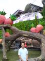
Murari Mohan Singh Turr, Retired SDM (SAS ) Chhindwara M. P.
-

CK Chaudhary, Chhindwara
-

-
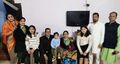
Dr Vijay Jat (Daspuria) with family


Chhindwara Jat Gotras Namesake
- See complete list here Chhindwara Jat Gotras Namesake
Chhindwara Jat Gotras Namesake is partial list of the peoples or places in Chhindwara district of Madhya Pradesh, which have phonetic similarity with Jat clans or Jat Places. There are 1948 villages in the district, out of which 1903 villages are habitated. In list below those on the left are Jat clans (or Jat Places) and on right are people or place names in Chhindwara District. Such a similarity is probably due to the fact that Nagavanshi Jats had been inhabitants and rulers of this area in antiquity. Such a phonetic similarity is found more in Jamai, Pandhurna, Parasia, Tamia tahsils.
Some of villages in Chhindwara district are based on Jat such as 1. Jatlapur (जाटलापुर) in Chhindwara tahsil, 2. Jatlapur (जाटलापुर) in Pandhurna tahsil, 3. Jatasemar (जाटासेमर) in Jamai tahsil, 4. Jatachhapar (जाटाछापर) in Parasia tahsil etc. Jat clans having phonetic similarity with villages in Chhindwara district are not major Jat Gotras but either have very rare distribution or no distribution indicating that these people in antiquity migrated elsewhere or vanished in wars.
I found interesting naming convention using 'barra' or 'barri' as suffix in some of villages like 1. Jamunbarra (जामुनबर्रा) village in Parasia tahsil in Chhindwara, 2. Chikatbarri (चिकटबर्री) village in Jamai tahsil in Chhindwara. This type of naming is found in villages in England such as Avebury (ऎवबरी), Canterbury (कँटरबरी), Ramsbury (राम्स्बरी), Salisbury (सल्ज़्बरी).
There is further need to study ancient history of these places and establish any inter-connection. This compilation does not claim any inter-connection but is to help further research.
छिंदवाड़ा का परिचय
भोपाल से छिंदवाड़ा की सड़क मार्ग से दूरी 313 किलोमीटर और वायुमार्ग से 206 किलोमीटर है. छिंदवाड़ा से नागपुर (महाराष्ट्र) की दूरी 126 कि.मी.है. छिंदवाड़ा जिला मध्य प्रदेश राज्य का एक बड़ा जिला है. पेच नेशनल पार्क, सतपुड़ा टाइगर रिजर्व, तामिया, पातालकोट, देवगढ़ किला, नीलकंठी, छोटा महादेव गुफा, नैनादेवी मंदिर तामिया, नागलवाड़ी (tah:Umreth), जुन्नारदेव, आदि यहां के दर्शनीय स्थान हैं.
छिंदवाडा़ भारत के मध्य प्रदेश प्रांत में स्थित एक प्रमुख शहर है. छिंदवाड़ा नगर, दक्षिण-मध्य मध्य प्रदेश राज्य, मध्य भारत, कुलबेहरा की धारा बोदरी के तट पर स्थित है. यह 671 मीटर की ऊँचाई पर सतपुड़ा के खुले पठार पर स्थित है और उपजाऊ कृषि भूमि से घिरा है, जिसमें बीच-बीच में आम के बाग़ हैं और इसके पश्चिमोत्तर में कम ऊँचाई वाले ऊबड़-खाबड़ पहाड़ तथा दक्षिण में नागपुर के मैदानों की ओर ढलान हैं. पठार के दक्षिणी और पूर्वी हिस्से में चौराई गेहुँ के उपजाऊ मैदान हैं. नागपुर का मैदान कपास और ज्वार की खेती का समृद्ध इलाका है और इस समूचे क्षेत्र का सबसे संपन्न और सर्वाधिक आबादी वाला हिस्सा है. वैनगंगा, पेंच और कन्हान नदियाँ इस क्षेत्र को अपवाहित करती हैं. यहाँ की मिट्टी बजरीयुक्त और जल्दी सूखने वाली है. अपेक्षाकृत कम बारिश के बावजूद यहाँ का मौसम विशेष रूप से स्वास्थ्यवर्द्धक और खुशनुमा है. शहर के हृदय स्थल में सैकड़ों वर्ष पुराना भव्य मंदिर भी स्थित है, जहाँ की रामलीला प्रसिद्ध है, स्थान छोटी माता मंदिर के नाम से जाना जाता है.
छिंदवाड़ा का नामकरण: यह माना जाता है कि इस क्षेत्र में छिन्द (ताड़) के पेड़ बहुतायत में हैं, इसीलिये इसका नाम छिंदवाड़ा पड़ा. नागवंश इतिहास के अनुसार छिंदवाड़ा का नाम संभवत: छिंदक नाग के नाम पर पडा है जो छत्तीसगढ़ और उड़ीसा प्रान्तों में शासक रहे हैं. नागवंशी राज्यों में वृक्ष अथवा प्राणी उनके राज्य-चिन्ह हुआ करते थे. छिन्द पेड़ उनका रज्य-चिन्ह था.
छिंदवाड़ा का प्राचीन इतिहास: छिंदवाडा के दक्षिण में नागपुर था जो नागवंशी शासकों की राजधानी थी. छिंदवाडा का प्रसिद्द स्थान पातालकोट का नाम भी संभवत: सिन्धु घाटी के विस्थापित शिव के उपासक और नागवंशी मूल के लोगों ने दिया है. सिकंदर महान के आक्रमण 326 ई. के समय सिंध में पाताल नामक राज्य का उल्लेख हुआ है. पुराणों में इसे ही नागवंशी लोगों के पाताललोक के रूप में वर्णित किया है. संभवत: सिकंदर महान के आक्रमण 326 ई. के परिणाम स्वरुप नागवंशी लोगों ने सिंध से विस्थापित होकर सुरक्षित क्षेत्रों में संरक्षण ली हो. सिंध प्रान्त के पाताल राज्य में तत्समय सीथियन लोग भी आबाद थे, जिनको भारत में शक कहा गया है, यही लोग शिवी थे. [34] कालांतर में ये नागवंशी और सीथियन लोग भारत में आबाद हुए और अधिकांश जाट जाति में समाहित हो गए. इसलिए भारत के विभिन्न भागों के स्थानों के नाम जाट गोत्रों के साथ समानता लिए हैं.
छिंदवाड़ा भू-भाग पर नागवंशी लोगों के शासन के कोई स्पष्ट अभिलेख नहीं मिले हैं परन्तु नागवंशी-भारशिव शासक भावनाग (290-315 ई.) का उल्लेख वाकाटक नरेश प्रवरसेन द्वितीय (c.400 - 415) के छिंदवाड़ा से लगे हुए क्षेत्रों से प्राप्त ताम्र-दानपट्ट अभिलेखों यथा सिवनी प्रशस्ति (18वां वर्ष), तिरोडी प्रशस्ति बालाघाट (23वां वर्ष), चमक प्रशस्ति अमरावती (18वां वर्ष) में मिलता है....शिव के प्रति बढ़ती हुई श्रद्धा का प्रदर्शन करने के लिए नागवंशियों ने ‘भारशिव’ नाम धारण करके जनता के समक्ष अपने आपको नवीन रूप में प्रस्तुत किया. दिलीपसिंह अहलावत[35] ने इस बारे में पर्याप्त प्रकाश डाला है. उन्होंने लिखा है कि शिवलिंग का अपने कन्धे पर भार ढोने से जिन्होंने भलीभांति शिव को सन्तुष्ट कर दिया था - जिन्होंने अपने प्राक्रम से प्राप्त की हुई भागीरथी गंगा के स्वच्छ जल से राज्याभिषेक कराया और जिन्होंने अश्वमेध करके अवभृथ-स्नान किया था, इस प्रकार के भारशिवों के महाराजा द्वारा नागवंश का पुनरुत्थान किया गया. इनके राजा शिवनन्दी ने पद्मावती का शासन करते हुए कनिष्क से पराजय पाई थी.
नागवंशी मूल: छिंदवाड़ा के मूल निवासी संभवत: नागवंशी लोग थे जिन्होंने यहाँ के स्थानों, नदियों और पर्वतों के नाम दिए. ये लोग शिव के उपासक थे. इनले मूल निवास के बारे में डॉ. नवल वियोगी [36] ने लिखा है कि सातवाहनों ने 72 BC से 200 AD तक इन वन प्रान्तों में राज्य किया. उनके प्रथम राजा का नाम सिमुक था जिसको वायुपुराण में सिन्धुक बताया है. एक शिलालेख में चालुक्य राजा ने अपना पारिवारिक नाम सेंद्रक[37] उल्लेखित किया है. इसी प्रकार चक्रकोट के शाही परिवार () को संद्रक or छिंदक [38] वंश का बताया गया है जो ज्ञात इतिहास में एक प्रतिष्टित नागवंशी परिवार था. ऐसा अनुमान है कि सिन्धुक या इससे मिलते-जुलते नाम सिन्धु-घाटी अभिगमन करने वाले नागवंशी मूल के हैं.
छत्तीसगढ़ के रायपुर जिले (वर्तमान बलोदा बाज़ार) में स्थित बिलाईगढ़ के पृथ्वीदेव द्वितीय के कलचुरी वर्ष 896 (1144 ई.) के ताम्राभिलेख में चक्रकोट के नागवंशी राजा को जटेश्वर लिखा गया है.
आदिम जाति अनुसंधान एवं विकास संस्था छिंदवाडा का संग्रहालय
आदिम जाति अनुसंधान एवं विकास संस्था छिंदवाडा का संग्रहालय - जनजाति अनुसंधान एवं विकास संस्था की स्थापना दिनांक 20.04.1954 को जिला छिंदवाड़ा मुखयालय में की गई थी, वर्ष 10 अप्रैल 1965 में संस्था का मुख्यालय भोपाल श्यामला हिल्स में तैयार किये गये नये कार्यालय में स्थानांतरित किया गया। संस्था का संग्रहालय छिंदवाड़ा के भवन में ही रखा गया जो आज श्री बादल भोई राज्य आदिवासी संग्रहालय के नाम से संस्था द्वारा संचालित किया जा रहा है। संस्था का मुख्य कार्य प्रदेश की जनजातियों का मानव शास्त्रीय शोध, जनजातीय विषयों पर अनुसंधान, विकास कार्यो का मूल्यांकन अध्ययन, प्रदेश की जनजातियों की भाषा एवं नागरिक शिक्षा, जनजातियों के संस्कृति एवं उनके सांस्कृतिक आयामों का संकलन, अभिलेखीकरण, संवर्धन एवं संरक्षण. जनजातियों की विभिन्न कलाओं पर कार्याशालाओं का आयोजन उनका छायांकन व फिल्मांकन तथा उनकी शिक्षा स्वास्थ्य व अन्य विषयों पर सेमीनार. प्रदेश के राजस्व/पुलिस एवं अन्य विभागीय अधिकारियों का पुनरध्ययन प्रशिक्षण व जनप्रतिनिधियों का जनजातियों के लिये संवैधानिक एवं संरक्षणात्मक उपायों पर प्रशिक्षण देना आदि है।
श्री बादल भोई राज्य जनजातीय संग्रहालय, छिंदवाड़ा: क्षेत्र के एक प्रसिद्ध आदिवासी स्वतंत्रता सेनानी, स्वर्गीय बादल भोई के नाम पर, संग्रहालय को मध्य प्रदेश के विविध आदिवासी लोकाचार को बढ़ावा देने और संरक्षित करने के उद्देश्य से 1954 में छिंदवाड़ा में एक राज्य जनजातीय संग्रहालय के रूप में स्थापित किया गया था। यह अविभाजित राज्य मध्य प्रदेश (अर्थात वर्तमान एमपी और छत्तीसगढ़) की अधिकांश अनुसूचित जनजातियों की जीवन शैली और संस्कृति को दर्शाता है। संग्रहालय के 11 कमरों में 2000 से अधिक आदिवासी कलाकृतियां, आदिवासी "गोत्र" के चिन्ह और मॉडल प्रदर्शित किए गए हैं। हर साल 1,00,000 से अधिक घरेलू और अंतर्राष्ट्रीय आगंतुक संग्रहालय में आते हैं।
Source - https://trdi.mp.gov.in/museum


Population
वर्ष 2011 की जनगणना के अनुसार छिंदवाड़ा शहर की जनसंख्या 138291 है जिसमें 70465 पुरुष और 67826 महिलाएं हैं ।
See also
External links
Source
- Santosh Kumar Thakur (Khenwar) 9826546968
References
- ↑ MSME-Development Institute. "Brief Industrial Profile of Chindwara District, Madhya Pradesh" (PDF). Ministry of Micro, Small and Medium Enterprises (MSME), Government of India. Archived (PDF)
- ↑ Dr Naval Viyogi: Nagas – The Ancient Rulers of India,p.301
- ↑ Vaidya C.V., "Madhya Yugin Bharat"
- ↑ MRE (1808-9) Inscriptions in Berar and C.P. no. 269,p.111
- ↑ https://www.chhindwaraonline.in/guide/history-of-chhindwara
- ↑ https://chhindwara.nic.in/en/about-district/
- ↑ Russell, R. V., ed. (1907). Chhindwara District. Volume 9, Part 1 of Central Provinces District Gazetteers. Bombay: Times Press for Gazetteer Department, Government of Maharashtra. p. 209. OCLC 733692877.
- ↑ Russell, R. V., ed. (1907). Chhindwara District. Volume 9, Part 1 of Central Provinces District Gazetteers. Bombay: Times Press for Gazetteer Department, Government of Maharashtra. p. 220.
- ↑ Russell, R. V., ed. (1907). Chhindwara District. Volume 9, Part 1 of Central Provinces District Gazetteers. Bombay: Times Press for Gazetteer Department, Government of Maharashtra. p. 220.
- ↑ Corpus Inscriptionum Indicarum Vol.5 (Inscriptions of The Vakatakas), Edited by Vasudev Vishnu Mirashi, 1963, Archaeological Survey of India, p.63-68
- ↑ Corpus Inscriptionum Indicarum Vol.5 (Inscriptions of The Vakatakas), Edited by Vasudev Vishnu Mirashi, 1963, Archaeological Survey of India, p.42-47
- ↑ Corpus Inscriptionum Indicarum Vol.5 (Inscriptions of The Vakatakas), Edited by Vasudev Vishnu Mirashi, 1963, Archaeological Survey of India, p.42-47
- ↑ Corpus Inscriptionum Indicarum Vol.5 (Inscriptions of The Vakatakas), Edited by Vasudev Vishnu Mirashi, 1963, Archaeological Survey of India, p.42-47
- ↑ Corpus Inscriptionum Indicarum Vol.5 (Inscriptions of The Vakatakas), Edited by Vasudev Vishnu Mirashi, 1963, Archaeological Survey of India, p.42-47
- ↑ Corpus Inscriptionum Indicarum Vol.5 (Inscriptions of The Vakatakas), Edited by Vasudev Vishnu Mirashi, 1963, Archaeological Survey of India, p.42-47
- ↑ "Central Provinces District Gazetteers: Chhindwara District, volume A descriptive". INDIAN CULTURE. Ministry of Culture, Government of India.
- ↑ B.H. Mehta (1984). Gonds of the Central Indian Highlands Vol II. Concept Publishing Company. p. 571.
- ↑ "Central Provinces District Gazetteers: Chhindwara District, volume A descriptive". INDIAN CULTURE. Ministry of Culture, Government of India.
- ↑ Hunter, William Wilson, Sir, et al. (1908). Imperial Gazetteer of India, Volume 6. 1908-1931; Clarendon Press, Oxford
- ↑ https://www.chhindwaraonline.in/guide/history-of-chhindwara
- ↑ Dr Naval Viyogi: Nagas the Ancient Rulers of India, p.226
- ↑ Bharat mien jati bhed, pp.111-112
- ↑ Dr Naval Viyogi: Nagas the Ancient Rulers of India, p.227
- ↑ https://www.chhindwaraonline.in/guide/history-of-chhindwara
- ↑ https://www.chhindwaraonline.in/guide/history-of-chhindwara
- ↑ https://www.chhindwaraonline.in/guide/history-of-chhindwara
- ↑ https://www.chhindwaraonline.in/guide/history-of-chhindwara
- ↑ https://www.chhindwaraonline.in/guide/history-of-chhindwara
- ↑ https://www.chhindwaraonline.in/guide/history-of-chhindwara
- ↑ https://www.chhindwaraonline.in/guide/history-of-chhindwara
- ↑ https://www.chhindwaraonline.in/guide/history-of-chhindwara
- ↑ https://www.chhindwaraonline.in/guide/history-of-chhindwara
- ↑ https://chhindwara.nic.in/en/festival/gotmar-mela/
- ↑ 1911 Encyclopedia Britannica
- ↑ Jat History Dalip Singh Ahlawat/Chapter V (Page 488-490)
- ↑ Dr Naval Viyogi: Nagas – The Ancient Rulers of India,p.301
- ↑ Vaidya C.V., "Madhya Yugin Bharat"
- ↑ MRE (1808-9) Inscriptions in Berar and C.P. no. 269,p.111